

ALPHA
General Cargo

Current Trip
| Time Travelled | 6 days |
|---|---|
| Remaining Time | --- |
| Distance Travelled | 660.92 nm |
| Remaining Distance | --- |
| AVG Speed | 6.6 Knop |
| MAX Speed | 8.3 Knop |
| AVG Wind | 9.3 knots |
| MAX Wind | 21 knots |
| MIN Temp | 4.8°C / 40.64°F |
| MAX Temp | 15.1°C / 59.18°F |
| Djupgående | 3.8 m |
| Position mottagen | 1 h, 18 m sen |
Current Position
| Longitud | --- |
|---|---|
| Latitude | --- |
| Status | At anchor |
| Fart | |
| Kurs | 11° |
| Område | Aegean Sea |
| Station | T-AIS |
| Position mottagen | 1 h, 18 m sen |
Information
The current position of ALPHA is in Aegean Sea with coordinates 39.90104° / 26.14014° as reported on 2025-02-19 02:34 by AIS to our vessel tracker app. The vessel's current speed is 0 Knop
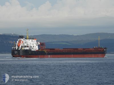
The vessel ALPHA (IMO: 9391804, MMSI: 518998399) is a General Cargo that was built in 2008 ( 17 År gammal ). It's sailing under the flag of [CK] Cook Is.
In this page you can find informations about the vessels current position, last detected port calls, and current voyage information. If the vessels is not in coverage by AIS you will find the latest position.
The current position of ALPHA is detected by our AIS receivers and we are not responsible for the reliability of the data. The last position was recorded while the vessel was in Coverage by the Ais receivers of our vessel tracking app.
The current draught of ALPHA as reported by AIS is 3.8 meters
Weather
| Temperature | 4.9°C / 40.82°F |
|---|---|
| Wind Speed | 12 knots |
| Direction | 39° NE |
| Pressure | 1022.2 hPa |
| Humidity | 81.9 % |
| Cloud Coverage | 26 % |


Featured Company
Last Trips
| Origin | Departure | Destination | Arrival | Distance | |
|---|---|---|---|---|---|
| 2025-02-06 23:33 | 2025-02-09 17:07 | 488.33 nm | |||
| 2025-02-01 16:25 | 2025-02-05 19:08 | 102.89 nm | |||
| 2025-01-30 18:42 | 2025-02-01 06:22 | 238.73 nm | |||
| 2024-12-13 06:44 | 2025-01-27 15:43 | 2954.14 nm | |||
| 2024-10-25 06:40 | 2024-12-09 08:07 | 2474.10 nm |
Events
| Tid | Event | Detaljer | Position / Dest | Information |
|---|---|---|---|---|
| 2025-02-19 02:43 | Status ändrad | Default At anchor |
39.90104 / 26.14004
TR AKC
|
Fart: Kurs: 11° |
| 2025-02-19 02:34 | Status ändrad | At anchor Default |
39.90104 / 26.14014
TR AKC
|
Fart: Kurs: 17° |
| 2025-02-19 02:34 | UTANFÖR täckningsområde |
39.90104 / 26.14014
Aegean Sea
TR AKC
|
Fart: Kurs: 265.6° |
|
| 2025-02-19 01:58 | Status ändrad | Default At anchor |
39.90107 / 26.13995
TR AKC
|
Fart: Kurs: 22° |
| 2025-02-19 01:22 | Status ändrad | At anchor Default |
39.90109 / 26.13987
TR AKC
|
Fart: Kurs: 24° |
| 2025-02-19 01:16 | Status ändrad | Default At anchor |
39.90113 / 26.13980
TR AKC
|
Fart: Kurs: 24° |
| 2025-02-19 01:10 | Status ändrad | At anchor Default |
39.90111 / 26.13975
TR AKC
|
Fart: Kurs: 24° |
| 2025-02-19 00:25 | Status ändrad | Default At anchor |
39.90122 / 26.13953
TR AKC
|
Fart: Kurs: 40° |
| 2025-02-19 00:01 | Status ändrad | At anchor Default |
39.90126 / 26.13954
TR AKC
|
Fart: 0.1 kn Kurs: 38° |
| 2025-02-18 23:37 | STOPPAR förflyttning | 1.38 nm, North West of AKCANSA |
39.90123 / 26.13984
TR AKC
|
Fart: 0.1 kn Kurs: 36° |