

ALK
Cargo

Current Trip
DINTELOORD
| Time Travelled | 4 days |
|---|---|
| Remaining Time | --- |
| Distance Travelled | 83.89 nm |
| Remaining Distance | --- |
| AVG Speed | 5.1 Knop |
| MAX Speed | 7.2 Knop |
| AVG Wind | 5.8 knots |
| MAX Wind | 8 knots |
| MIN Temp | 3.4°C / 38.12°F |
| MAX Temp | 14.3°C / 57.74°F |
| Djupgående | 0.4 m |
| Position mottagen | 10 h, 47 m sen |
Current Position
| Longitud | --- |
|---|---|
| Latitude | --- |
| Status | Under way using engine |
| Fart | 3.4 Knop |
| Kurs | 142.4° |
| Område | North Sea |
| Station | T-AIS |
| Position mottagen | 10 h, 47 m sen |
Information
The current position of ALK is in North Sea with coordinates 51.54711° / 6.07801° as reported on 2025-03-05 18:36 by AIS to our vessel tracker app. The vessel's current speed is 3.4 Knop
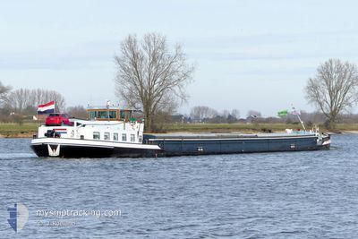
The vessel ALK (MMSI: 244750358) is a Cargo It's sailing under the flag of [NL] Netherlands.
In this page you can find informations about the vessels current position, last detected port calls, and current voyage information. If the vessels is not in coverage by AIS you will find the latest position.
The current position of ALK is detected by our AIS receivers and we are not responsible for the reliability of the data. The last position was recorded while the vessel was in Coverage by the Ais receivers of our vessel tracking app.
The current draught of ALK as reported by AIS is 0.4 meters
Weather
| Temperature | 10.1°C / 50.18°F |
|---|---|
| Wind Speed | 5 knots |
| Direction | 211° SSW |
| Pressure | 1022 hPa |
| Humidity | 58.5 % |
| Cloud Coverage | --- |


Featured Company
Last Port Calls
| Port | Arrival | Departure | Time In Port |
|---|---|---|---|
| 2025-03-01 08:40 | 2025-03-01 08:53 | 12 m | |
| 2025-02-26 16:32 | 2025-02-27 13:32 | 21 h | |
| 2025-02-24 00:18 | 2025-02-24 12:34 | 12 h | |
| 2025-02-20 08:45 | 2025-02-20 08:56 | 10 m | |
| 2025-02-17 11:35 | 2025-02-17 12:06 | 30 m | |
| 2025-02-15 12:19 | 2025-02-17 09:58 | 1 d | |
| 2025-02-15 09:51 | 2025-02-15 10:13 | 21 m | |
| 2025-02-14 22:16 | 2025-02-14 22:40 | 23 m | |
| 2025-02-14 13:41 | 2025-02-14 17:13 | 3 h | |
| 2025-02-13 15:43 | 2025-02-14 11:26 | 19 h |
Last Trips
| Origin | Departure | Destination | Arrival | Distance | |
|---|---|---|---|---|---|
| 2025-02-27 14:32 | 2025-03-01 09:40 | 120.83 nm | |||
| 2025-02-24 13:34 | 2025-02-26 17:32 | 132.60 nm | |||
| 2025-02-20 09:56 | 2025-02-24 01:18 | 65.29 nm | |||
| 2025-02-17 13:06 | 2025-02-20 09:45 | 173.24 nm | |||
| 2025-02-17 10:58 | 2025-02-17 12:35 | 5.68 nm | |||
| 2025-02-15 11:13 | 2025-02-15 13:19 | 7.29 nm | |||
| 2025-02-14 23:40 | 2025-02-15 10:51 | 20.42 nm | |||
| 2025-02-14 18:13 | 2025-02-14 23:16 | 36.50 nm | |||
| 2025-02-14 12:26 | 2025-02-14 14:41 | 10.65 nm | |||
| 2025-02-13 14:59 | 2025-02-13 16:43 | 9.74 nm |
Events
| Tid | Event | Detaljer | Position / Dest | Information |
|---|---|---|---|---|
| 2025-03-05 18:36 | UTANFÖR täckningsområde |
51.54711 / 6.07801
North Sea
|
Fart: 3.4 kn Kurs: 142.4° |
|
| 2025-03-05 18:19 | Status ändrad | Under way using engine Default |
51.55988 / 6.04511
DINTELOORD
|
Fart: 5.3 kn Kurs: 193° |
| 2025-03-05 18:07 | Status ändrad | Default Under way using engine |
51.57582 / 6.03785
DINTELOORD
|
Fart: 5.4 kn Kurs: 184.3° |
| 2025-03-05 17:20 | STARTAR förflyttning | 2.45 nm, South East of BOXMEER |
51.63596 / 5.99587
DINTELOORD
|
Fart: 4.8 kn Kurs: 102.8° |
| 2025-03-05 17:17 | Status ändrad | Under way using engine Moored |
51.63670 / 5.99101
DINTELOORD
|
Fart: Kurs: 511° |
| 2025-03-05 16:32 | I täckningsområde |
51.63645 / 5.99159
North Sea
|
Fart: Kurs: 100.5° |
|
| 2025-03-05 13:38 | UTANFÖR täckningsområde |
51.63822 / 5.98897
North Sea
|
Fart: 3.5 kn Kurs: 139° |
|
| 2025-03-05 10:28 | STARTAR förflyttning | 0.51 nm, North of GRAVE |
51.76764 / 5.74025
DINTELOORD
|
Fart: 4.4 kn Kurs: 150.3° |
| 2025-03-05 10:12 | STOPPAR förflyttning | 0.6 nm, North of GRAVE |
51.76926 / 5.73839
DINTELOORD
|
Fart: 0.3 kn Kurs: 511° |
| 2025-03-05 07:37 | STARTAR förflyttning | 0.76 nm, North West of LITHOIJEN |
51.80873 / 5.45590
DINTELOORD
|
Fart: 4.3 kn Kurs: 77.6° |