
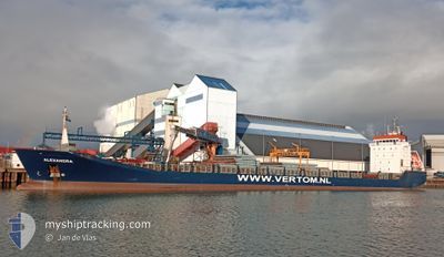
ALEXANDRA
General Cargo
Current Trip
| Time Travelled | --- |
|---|---|
| Remaining Time | --- |
| Distance Travelled | --- |
| Remaining Distance | --- |
| AVG Speed | --- |
| MAX Speed | --- |
| AVG Wind | --- |
| MAX Wind | --- |
| MIN Temp | --- |
| MAX Temp | --- |
| Djupgående | 7.8 m |
| Position mottagen | 15 h, 2 m sen |
Current Position
| Longitud | -9.63590° |
|---|---|
| Latitude | 43.39148° |
| Status | Under way using engine |
| Fart | 10.2 Knop |
| Kurs | 12.1° |
| Område | North Atlantic Ocean |
| Station | T-AIS |
| Position mottagen | 15 h, 2 m sen |
Info
Information
The current position of ALEXANDRA is in North Atlantic Ocean with coordinates 43.39148° / -9.63590° as reported on 2024-05-02 17:49 by AIS to our vessel tracker app. The vessel's current speed is 10.2 Knop and is heading at the port of GREENORE. The estimated time of arrival as calculated by MyShipTracking vessel tracking app is 2024-05-05 10:00 LT
The vessel ALEXANDRA (IMO: 9196163, MMSI: 314512000) is a General Cargo that was built in 2000 ( 24 År gammal ). It's sailing under the flag of [BB] Barbados.
In this page you can find informations about the vessels current position, last detected port calls, and current voyage information. If the vessels is not in coverage by AIS you will find the latest position.
The current position of ALEXANDRA is detected by our AIS receivers and we are not responsible for the reliability of the data. The last position was recorded while the vessel was in Coverage by the Ais receivers of our vessel tracking app.
The current draught of ALEXANDRA as reported by AIS is 7.8 meters
Weather
| Temperature | 12°C / 53.6°F |
|---|---|
| Wind Speed | 9 knots |
| Direction | 240° WSW |
| Pressure | 1012.7 hPa |
| Humidity | 72.4 % |
| Cloud Coverage | --- |
Featured Company
Last Port Calls
| Port | Arrival | Departure | Time In Port |
|---|---|---|---|
| 2024-04-16 09:08 | |||
| 2024-03-29 04:49 | 2024-04-02 14:09 | 4 d | |
| 2024-03-12 12:44 | 2024-03-16 04:36 | 3 d | |
| 2024-03-12 12:08 | 2024-03-12 12:25 | 17 m | |
| 2024-03-06 21:08 | 2024-03-06 23:29 | 2 h | |
| 2024-03-06 11:40 | 2024-03-06 12:32 | 51 m | |
| 2024-03-05 15:38 |
Last Trips
| Origin | Departure | Destination | Arrival | Distance | |
|---|---|---|---|---|---|
| 2024-04-02 17:09 | 2024-04-16 11:08 | 698.63 nm | |||
| 2024-03-16 05:36 | 2024-03-29 06:49 | 3063.12 nm | |||
| 2024-03-12 13:25 | 2024-03-12 13:44 | 1.57 nm | |||
| 2024-03-07 00:29 | 2024-03-12 13:08 | 326.10 nm | |||
| 2024-03-06 13:32 | 2024-03-06 22:08 | 50.21 nm | |||
| 2024-03-05 16:38 | 2024-03-06 12:40 | 225.42 nm |
Events
| Tid | Event | Detaljer | Position / Dest | Information |
|---|---|---|---|---|
| 2024-05-02 17:49 | UTANFÖR täckningsområde |
43.39148 / -9.63590
North Atlantic Ocean
IEGRN
|
Fart: 10.2 kn Kurs: 12.1° |
|
| 2024-05-02 17:49 | Upptäckt i hav | Spanish part of the North Atlantic Ocean |
43.39148 / -9.63590
North Atlantic Ocean
IEGRN
|
Fart: 10.2 kn Kurs: 12.1° |
| 2024-05-02 17:49 | Status ändrad | Under way using engine Default |
43.39148 / -9.63590
IEGRN
|
Fart: 9.6 kn Kurs: 27° |
| 2024-05-02 17:49 | I täckningsområde |
43.39148 / -9.63590
North Atlantic Ocean
IEGRN
|
Fart: 10.2 kn Kurs: 12.1° |
|
| 2024-05-02 02:15 | UTANFÖR täckningsområde |
40.93196 / -9.80606
North Atlantic Ocean
IEGRN
|
Fart: 9.1 kn Kurs: 356.5° |
|
| 2024-05-01 21:14 | Status ändrad | Under way using engine Default |
40.19269 / -9.81490
IEGRN
|
Fart: 8.7 kn Kurs: 359° |
| 2024-05-01 21:05 | Status ändrad | Default Under way using engine |
40.19993 / -9.81502
IEGRN
|
Fart: 8.9 kn Kurs: 1.5° |
| 2024-05-01 20:38 | Status ändrad | Under way using engine Default |
40.12378 / -9.81635
IEGRN
|
Fart: 8.7 kn Kurs: 2° |
| 2024-05-01 20:20 | I täckningsområde |
40.12378 / -9.81635
North Atlantic Ocean
IEGRN
|
Fart: 8.9 kn Kurs: 1° |
|
| 2024-05-01 18:02 | UTANFÖR täckningsområde |
39.74327 / -9.82180
North Atlantic Ocean
IEGRN
|
Fart: 8.9 kn Kurs: 353.4° |