
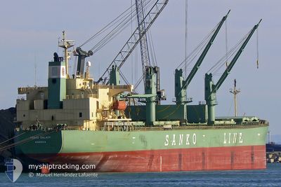
ALESSANDRA M
Bulk Carrier
Current Trip
| Time Travelled | 6 days |
|---|---|
| Remaining Time | --- |
| Distance Travelled | 1096.38 nm |
| Remaining Distance | --- |
| AVG Speed | 10.3 Knop |
| MAX Speed | 14.1 Knop |
| AVG Wind | 9.5 knots |
| MAX Wind | 29.8 knots |
| MIN Temp | 14°C / 57.2°F |
| MAX Temp | 30.7°C / 87.26°F |
| Djupgående | 10.3 m |
| Position mottagen | 4 d sen |
Current Position
| Longitud | 128.98037° |
|---|---|
| Latitude | 34.62503° |
| Status | Under way using engine |
| Fart | 11.3 Knop |
| Kurs | 225° |
| Område | Japan Sea |
| Station | T-AIS |
| Position mottagen | 4 d sen |
Info
Information
The current position of ALESSANDRA M is in Japan Sea with coordinates 34.62503° / 128.98037° as reported on 2024-06-21 04:23 by AIS to our vessel tracker app. The vessel's current speed is 11.3 Knop and is heading at the port of TAICANG. The estimated time of arrival as calculated by MyShipTracking vessel tracking app is 2024-06-22 12:40 LT
The vessel ALESSANDRA M (IMO: 9284518, MMSI: 215554000) is a Bulk Carrier that was built in 2005 ( 19 År gammal ). It's sailing under the flag of [MT] Malta.
In this page you can find informations about the vessels current position, last detected port calls, and current voyage information. If the vessels is not in coverage by AIS you will find the latest position.
The current position of ALESSANDRA M is detected by our AIS receivers and we are not responsible for the reliability of the data. The last position was recorded while the vessel was in Coverage by the Ais receivers of our vessel tracking app.
The current draught of ALESSANDRA M as reported by AIS is 10.3 meters
Weather
| Temperature | 25.5°C / 77.9°F |
|---|---|
| Wind Speed | 6 knots |
| Direction | 175° S |
| Pressure | 1010.1 hPa |
| Humidity | 78.9 % |
| Cloud Coverage | 100 % |
Featured Company
Last Port Calls
| Port | Arrival | Departure | Time In Port |
|---|---|---|---|
| 2024-06-16 08:45 | 2024-06-19 03:04 | 2 d | |
| 2024-06-09 04:39 | 2024-06-11 02:17 | 1 d | |
| 2024-06-01 09:35 | 2024-06-04 05:59 | 2 d | |
| 2024-05-27 00:31 | 2024-05-28 11:09 | 1 d | |
| 2024-05-18 23:51 | 2024-05-24 07:22 | 5 d | |
| 2024-05-09 01:30 | 2024-05-11 03:15 | 2 d | |
| 2024-05-03 06:51 | 2024-05-06 17:10 | 3 d | |
| 2024-04-25 23:36 | 2024-04-29 02:32 | 3 d | |
| 2024-04-18 15:43 | 2024-04-20 14:39 | 1 d | |
| 2024-04-06 01:49 | 2024-04-08 01:21 | 1 d |
Most Visited Ports (Last year)
| Port | Arrivals | |
|---|---|---|
| 10 | ||
| 9 | ||
| 6 | ||
| 4 | ||
| 3 | ||
| 3 |
Last Trips
| Origin | Departure | Destination | Arrival | Distance | |
|---|---|---|---|---|---|
| 2024-06-11 10:17 | 2024-06-16 18:45 | 1322.85 nm | |||
| 2024-06-04 15:59 | 2024-06-09 12:39 | 1318.01 nm | |||
| 2024-05-28 19:09 | 2024-06-01 19:35 | 1225.16 nm | |||
| 2024-05-24 16:22 | 2024-05-27 08:31 | 787.47 nm | |||
| 2024-05-11 12:15 | 2024-05-19 08:51 | 1885.95 nm | |||
| 2024-05-07 03:10 | 2024-05-09 10:30 | 482.22 nm | |||
| 2024-04-29 10:32 | 2024-05-03 16:51 | 1200.84 nm | |||
| 2024-04-21 00:39 | 2024-04-26 07:36 | 1229.04 nm | |||
| 2024-04-08 09:21 | 2024-04-19 01:43 | 1321.91 nm | |||
| 2024-04-01 01:06 | 2024-04-06 09:49 | 1296.41 nm |
Events
| Tid | Event | Detaljer | Position / Dest | Information |
|---|---|---|---|---|
| 2024-06-24 09:29 | STOPPAR förflyttning | 3.55 nm, North West of ZHANGJIAGANG |
32.00213 / 120.34975
CJK
|
Fart: 0.2 kn Kurs: 233° |
| 2024-06-24 01:48 | STARTAR förflyttning | 1.58 nm, East of TAICANG |
31.65748 / 121.22568
CJK
|
Fart: 4.2 kn Kurs: 299° |
| 2024-06-23 11:27 | STOPPAR förflyttning | 2.35 nm, East of TAICANG |
31.65203 / 121.23962
CJK
|
Fart: 0.1 kn Kurs: 295° |
| 2024-06-23 01:20 | STARTAR förflyttning |
31.19730 / 122.65345
CJK
|
Fart: 3.6 kn Kurs: 269° |
|
| 2024-06-22 15:33 | STOPPAR förflyttning |
31.20322 / 122.65633
CJK
|
Fart: Kurs: 144° |
|
| 2024-06-21 04:28 | Status ändrad | Default Under way using engine |
34.61377 / 128.96661
CJK
|
Fart: 11.3 kn Kurs: 225° |
| 2024-06-21 04:23 | Status ändrad | Under way using engine Default |
34.62503 / 128.98037
CJK
|
Fart: 11.3 kn Kurs: 223° |
| 2024-06-21 04:23 | UTANFÖR täckningsområde |
34.62503 / 128.98037
Japan Sea
CJK
|
Fart: 11.3 kn Kurs: 225° |
|
| 2024-06-21 04:09 | Status ändrad | Default Under way using engine |
34.65655 / 129.01860
CJK
|
Fart: 11 kn Kurs: 224° |
| 2024-06-21 03:35 | Byter havsområde | South Korean part of the Japan Sea Japanese part of the Japan Sea |
34.72872 / 129.10640
Japan Sea
CJK
|
Fart: 10.6 kn Kurs: 223° |