
ALESSANDRA M
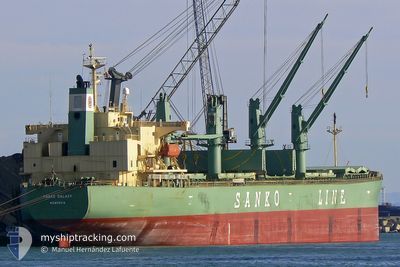
Bulk Carrier
Current Trip
| Trip Time | 3 days |
|---|---|
| Trip Distance | 504.26 nm |
| AVG Speed | 10.9 Knopen |
| MAX Speed | 13 Knopen |
| Diepgang | 7.8 M |
| AVG Wind | 11.3 knots |
| MAX Wind | 19.8 knots |
| MIN Temp | 15.2°C / 59.36°F |
| MAX Temp | 25.3°C / 77.54°F |
| Positie ontvangen | 3 d geleden |
Current Position
| Lengtegraad | --- |
|---|---|
| Breedtegraat | --- |
| Status | Under way using engine |
| Snelheid | 11.5 Knopen |
| Koers | 202° |
| Gebied | Japan Sea |
| Station | T-AIS |
| Positie ontvangen | 3 d geleden |
Info
Information
The current position of ALESSANDRA M is in Japan Sea with coordinates 41.22482° / 132.34692° as reported on 2024-09-24 20:43 by AIS to our vessel tracker app. The vessel's current speed is 11.5 Knopen and is currently inside the port of ULSAN.
The vessel ALESSANDRA M (IMO: 9284518, MMSI: 215554000) is a Bulk Carrier that was built in 2005 ( 19 Jaar oud ). It's sailing under the flag of [MT] Malta.
In this page you can find informations about the vessels current position, last detected port calls, and current voyage information. If the vessels is not in coverage by AIS you will find the latest position.
The current position of ALESSANDRA M is detected by our AIS receivers and we are not responsible for the reliability of the data. The last position was recorded while the vessel was in Coverage by the Ais receivers of our vessel tracking app.
The current draught of ALESSANDRA M as reported by AIS is 7.8 meters
Weather
| Temperature | 24°C / 75.2°F |
|---|---|
| Wind Speed | 20 knots |
| Direction | 50° NE |
| Pressure | 1019.2 hPa |
| Humidity | 67.2 % |
| Cloud Coverage | 74 % |
Featured Company
Last Port Calls
| Port | Arrival | Departure | Time In Port |
|---|---|---|---|
| 2024-09-28 03:52 | |||
| 2024-09-20 23:57 | 2024-09-24 12:16 | 3 d | |
| 2024-09-17 07:48 | 2024-09-19 06:36 | 1 d | |
| 2024-08-23 05:10 | 2024-08-25 22:31 | 2 d | |
| 2024-08-06 03:01 | 2024-08-08 23:17 | 2 d | |
| 2024-07-27 06:25 | 2024-07-29 00:23 | 1 d | |
| 2024-07-21 02:59 | 2024-07-24 05:25 | 3 d | |
| 2024-07-15 04:34 | 2024-07-17 01:18 | 1 d | |
| 2024-07-08 08:19 | 2024-07-09 21:17 | 1 d | |
| 2024-07-05 01:07 | 2024-07-06 22:08 | 1 d |
Most Visited Ports (Last year)
| Port | Arrivals | |
|---|---|---|
| 12 | ||
| 9 | ||
| 6 | ||
| 4 | ||
| 3 | ||
| 3 |
Last Trips
| Origin | Departure | Destination | Arrival | Distance | |
|---|---|---|---|---|---|
| 2024-09-24 22:16 | 2024-09-28 12:52 | 504.26 nm | |||
| 2024-09-19 15:36 | 2024-09-21 09:57 | 477.59 nm | |||
| 2024-08-26 07:31 | 2024-09-17 16:48 | 1683.63 nm | |||
| 2024-08-09 08:17 | 2024-08-23 14:10 | 1896.60 nm | |||
| 2024-07-29 09:23 | 2024-08-06 12:01 | 1881.35 nm | |||
| 2024-07-24 15:25 | 2024-07-27 15:25 | 444.20 nm | |||
| 2024-07-17 09:18 | 2024-07-21 12:59 | 1304.02 nm | |||
| 2024-07-10 07:17 | 2024-07-15 12:34 | 1300.26 nm | |||
| 2024-07-07 07:08 | 2024-07-08 18:19 | 443.87 nm | |||
| 2024-06-19 13:04 | 2024-07-05 10:07 | 3621.98 nm |
Events
| Tijd | Evenement | Details | Positie / Bestemming | Info |
|---|---|---|---|---|
| 2024-09-28 03:52 | Stop beweging |
35.52658 / 129.37825
[KR] ULSAN
|
Snelheid: Koers: 315° |
|
| 2024-09-28 03:52 | Aankomsthaven |
|
35.52658 / 129.37825
[KR] ULSAN
|
Snelheid: 2.3 kn Koers: 321° |
| 2024-09-28 02:51 | Start beweging | 2.55 nm, East of ONSAN |
35.43065 / 129.42857
KR USN
|
Snelheid: 3.9 kn Koers: 230° |
| 2024-09-27 02:36 | Stop beweging | 2.75 nm, East of ONSAN |
35.43562 / 129.43312
KR USN
|
Snelheid: 0.2 kn Koers: 255° |
| 2024-09-26 21:57 | Start beweging |
36.01432 / 129.91365
KR USN
|
Snelheid: 3.8 kn Koers: 192° |
|
| 2024-09-26 03:11 | Stop beweging |
35.92138 / 129.85838
KR USN
|
Snelheid: 0.1 kn Koers: 313° |
|
| 2024-09-24 20:48 | Status Changed | Default Under way using engine |
41.20933 / 132.33870
KR USN
|
Snelheid: 11.5 kn Koers: 202° |
| 2024-09-24 20:43 | Buitenbereik |
41.22482 / 132.34692
Japan Sea
KR USN
|
Snelheid: 11.5 kn Koers: 202° |
|
| 2024-09-24 20:33 | Draught Changed | 7.8 6.8 |
41.27922 / 132.37672
KR USN
|
Snelheid: 11.5 kn Koers: 202° |
| 2024-09-24 20:11 | Status Changed | Under way using engine Default |
41.31977 / 132.39968
KR USN
|
Snelheid: 11.3 kn Koers: 201° |