
ALAND
General Cargo
Current Trip
| Time Travelled | 1 day |
|---|---|
| Remaining Time | 47 mins |
| Distance Travelled | 356.12 nm |
| Remaining Distance | 10.59 nm |
| AVG Speed | 11.2 Knop |
| MAX Speed | 12.8 Knop |
| AVG Wind | 10.3 knots |
| MAX Wind | 14.9 knots |
| MIN Temp | 5.6°C / 42.08°F |
| MAX Temp | 14.1°C / 57.38°F |
| Djupgående | 4.5 m |
| Position mottagen | Nu |
Current Position
| Longitud | 24.35759° |
|---|---|
| Latitude | 58.24251° |
| Status | Under way using engine |
| Fart | 10.3 Knop |
| Kurs | 25.5° |
| Område | Gulf of Riga |
| Station | T-AIS |
| Position mottagen | Nu |
Info
Information
The current position of ALAND is in Gulf of Riga with coordinates 58.24251° / 24.35759° as reported on 2024-05-21 19:08 by AIS to our vessel tracker app. The vessel's current speed is 10.3 Knop and is heading at the port of PARNU. The estimated time of arrival as calculated by MyShipTracking vessel tracking app is 2024-05-21 19:55 LT
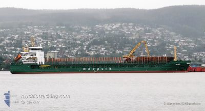
The vessel ALAND (IMO: 9350783, MMSI: 255802540) is a General Cargo that was built in 2007 ( 17 År gammal ). It's sailing under the flag of [PT] Portugal.
In this page you can find informations about the vessels current position, last detected port calls, and current voyage information. If the vessels is not in coverage by AIS you will find the latest position.
The current position of ALAND is detected by our AIS receivers and we are not responsible for the reliability of the data. The last position was recorded while the vessel was in Coverage by the Ais receivers of our vessel tracking app.
The current draught of ALAND as reported by AIS is 4.5 meters
Weather
| Temperature | 12.7°C / 54.86°F |
|---|---|
| Wind Speed | 13 knots |
| Direction | 59° ENE |
| Pressure | 1022.1 hPa |
| Humidity | 61.3 % |
| Cloud Coverage | --- |
Featured Company
Last Port Calls
| Port | Arrival | Departure | Time In Port |
|---|---|---|---|
| 2024-05-19 12:24 | 2024-05-20 11:11 | 22 h | |
| 2024-05-16 23:01 | 2024-05-18 03:12 | 1 d | |
| 2024-05-15 13:20 | 2024-05-16 15:56 | 1 d | |
| 2024-05-14 04:13 | 2024-05-15 05:10 | 1 d | |
| 2024-05-12 11:48 | 2024-05-13 20:44 | 1 d | |
| 2024-05-10 06:47 | 2024-05-11 03:23 | 20 h | |
| 2024-05-04 09:08 | 2024-05-05 21:53 | 1 d | |
| 2024-05-02 05:24 | 2024-05-02 22:47 | 17 h | |
| 2024-04-29 08:32 | 2024-04-30 17:08 | 1 d | |
| 2024-04-26 08:44 | 2024-04-28 11:16 | 2 d |
Most Visited Ports (Last year)
| Port | Arrivals | |
|---|---|---|
| 9 | ||
| 7 | ||
| 4 | ||
| 4 | ||
| 4 | ||
| 4 |
Last Trips
| Origin | Departure | Destination | Arrival | Distance | |
|---|---|---|---|---|---|
| 2024-05-18 06:12 | 2024-05-19 15:24 | 345.13 nm | |||
| 2024-05-16 18:56 | 2024-05-17 02:01 | 77.98 nm | |||
| 2024-05-15 08:10 | 2024-05-15 16:20 | 78.21 nm | |||
| 2024-05-13 23:44 | 2024-05-14 07:13 | 78.44 nm | |||
| 2024-05-11 06:23 | 2024-05-12 14:48 | 338.88 nm | |||
| 2024-05-06 00:53 | 2024-05-10 09:47 | 650.04 nm | |||
| 2024-05-03 01:47 | 2024-05-04 12:08 | 331.98 nm | |||
| 2024-04-30 20:08 | 2024-05-02 08:24 | 332.58 nm | |||
| 2024-04-28 13:16 | 2024-04-29 11:32 | 228.13 nm | |||
| 2024-04-22 11:18 | 2024-04-26 10:44 | 122.05 nm |
Events
| Tid | Event | Detaljer | Position / Dest | Information |
|---|---|---|---|---|
| 2024-05-21 16:41 | Upptäckt i hav | Estonian part of the Gulf of Riga |
57.97951 / 23.72001
Gulf of Riga
PARNU
|
Fart: 11 kn Kurs: 75.4° |
| 2024-05-21 16:40 | Status ändrad | Under way using engine Default |
57.97886 / 23.71537
PARNU
|
Fart: 10 kn Kurs: 76° |
| 2024-05-21 16:40 | I täckningsområde |
57.97951 / 23.72001
Gulf of Riga
PARNU
|
Fart: 11 kn Kurs: 75.4° |
|
| 2024-05-21 09:21 | Status ändrad | Default Under way using engine |
58.08047 / 21.52659
PARNU
|
Fart: 11.1 kn Kurs: 150.6° |
| 2024-05-21 09:13 | UTANFÖR täckningsområde |
58.10082 / 21.50495
Baltic Sea
PARNU
|
Fart: 11.1 kn Kurs: 150.6° |
|
| 2024-05-21 04:11 | Byter havsområde | Estonian part of the Baltic Sea Finnish part of the Baltic Sea |
58.92788 / 20.66630
Baltic Sea
PARNU
|
Fart: 11.1 kn Kurs: 152° |
| 2024-05-21 01:08 | Upptäckt i hav | Finnish part of the Baltic Sea |
59.43132 / 20.16195
Baltic Sea
PARNU
|
Fart: 11.1 kn Kurs: 152.3° |
| 2024-05-21 00:59 | Byter havsområde | Swedish part of the Baltic Sea Finnish part of the Baltic Sea |
59.45610 / 20.13646
Baltic Sea
PARNU
|
Fart: 11.1 kn Kurs: 152.3° |
| 2024-05-20 22:41 | Byter havsområde | Finnish part of the Baltic Sea Finnish part of the Gulf of Bothnia |
59.79757 / 19.65342
Baltic Sea
PARNU
|
Fart: 11.1 kn Kurs: 141.3° |
| 2024-05-20 22:35 | Upptäckt i hav | Finnish part of the Gulf of Bothnia |
59.81206 / 19.63011
Gulf of Bothnia
PARNU
|
Fart: 11.1 kn Kurs: 140.8° |