
ALAND
General Cargo
Current Trip
| Time Travelled | 15 h, 26 mins |
|---|---|
| Remaining Time | --- |
| Distance Travelled | 148.82 nm |
| Remaining Distance | --- |
| AVG Speed | 9.6 Knopen |
| MAX Speed | 11.5 Knopen |
| AVG Wind | 3.9 knots |
| MAX Wind | 7.2 knots |
| MIN Temp | 4.9°C / 40.82°F |
| MAX Temp | 7.7°C / 45.86°F |
| Diepgang | 4.3 M |
| Positie ontvangen | 1 m geleden |
Current Position
| Lengtegraad | 20.05710° |
|---|---|
| Breedtegraat | 59.54693° |
| Status | Under way using engine |
| Snelheid | 9.2 Knopen |
| Koers | 172.9° |
| Gebied | Baltic Sea |
| Station | T-AIS |
| Positie ontvangen | 1 m geleden |
Info
Information
The current position of ALAND is in Baltic Sea with coordinates 59.54693° / 20.05710° as reported on 2024-05-03 14:12 by AIS to our vessel tracker app. The vessel's current speed is 9.2 Knopen and is heading at the port of MERSRAGS. The estimated time of arrival as calculated by MyShipTracking vessel tracking app is 2024-05-04 13:00 LT
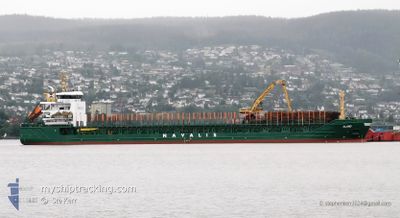
The vessel ALAND (IMO: 9350783, MMSI: 255802540) is a General Cargo that was built in 2007 ( 17 Jaar oud ). It's sailing under the flag of [PT] Portugal.
In this page you can find informations about the vessels current position, last detected port calls, and current voyage information. If the vessels is not in coverage by AIS you will find the latest position.
The current position of ALAND is detected by our AIS receivers and we are not responsible for the reliability of the data. The last position was recorded while the vessel was in Coverage by the Ais receivers of our vessel tracking app.
The current draught of ALAND as reported by AIS is 4.3 meters
Weather
| Temperature | 6.5°C / 43.7°F |
|---|---|
| Wind Speed | 5 knots |
| Direction | 139° SE |
| Pressure | 1020.5 hPa |
| Humidity | 79 % |
| Cloud Coverage | 42 % |
Featured Company
Last Port Calls
| Port | Arrival | Departure | Time In Port |
|---|---|---|---|
| 2024-05-02 05:24 | 2024-05-02 22:47 | 17 h | |
| 2024-04-29 08:32 | 2024-04-30 17:08 | 1 d | |
| 2024-04-26 08:44 | 2024-04-28 11:16 | 2 d | |
| 2024-04-21 00:07 | 2024-04-22 08:18 | 1 d | |
| 2024-04-20 16:00 | |||
| 2024-04-16 06:11 | 2024-04-17 05:47 | 23 h | |
| 2024-04-08 17:34 | 2024-04-10 02:57 | 1 d | |
| 2024-04-05 17:29 | 2024-04-07 18:24 | 2 d | |
| 2024-03-31 15:37 | 2024-04-04 00:57 | 3 d | |
| 2024-03-28 21:14 | 2024-03-30 12:49 | 1 d |
Most Visited Ports (Last year)
| Port | Arrivals | |
|---|---|---|
| 9 | ||
| 8 | ||
| 4 | ||
| 4 | ||
| 4 | ||
| 4 |
Last Trips
| Origin | Departure | Destination | Arrival | Distance | |
|---|---|---|---|---|---|
| 2024-04-30 20:08 | 2024-05-02 08:24 | 332.58 nm | |||
| 2024-04-28 13:16 | 2024-04-29 11:32 | 228.13 nm | |||
| 2024-04-22 11:18 | 2024-04-26 10:44 | 122.05 nm | |||
| 2024-04-20 18:00 | 2024-04-21 03:07 | 90.46 nm | |||
| 2024-04-10 05:57 | 2024-04-16 09:11 | 747.46 nm | |||
| 2024-04-07 20:24 | 2024-04-08 20:34 | 231.72 nm | |||
| 2024-04-04 03:57 | 2024-04-05 19:29 | 432.24 nm | |||
| 2024-03-30 13:49 | 2024-03-31 18:37 | 262.20 nm | |||
| 2024-03-28 11:49 | 2024-03-28 22:14 | 112.57 nm | |||
| 2024-03-24 22:33 | 2024-03-26 10:28 | 378.98 nm |
Events
| Tijd | Evenement | Details | Positie / Bestemming | Info |
|---|---|---|---|---|
| 2024-05-03 14:02 | Status Changed | Under way using engine Default |
59.57177 / 20.04951
MERSRAGS
|
Snelheid: 9.1 kn Koers: 137° |
| 2024-05-03 13:52 | Status Changed | Default Under way using engine |
59.58890 / 20.01715
MERSRAGS
|
Snelheid: 9.1 kn Koers: 135.3° |
| 2024-05-03 12:17 | Wijzig zee gebeid | Finnish part of the Baltic Sea Swedish part of the Baltic Sea |
59.77156 / 19.68803
Baltic Sea
MERSRAGS
|
Snelheid: 9.1 kn Koers: 140° |
| 2024-05-03 12:02 | Gevonden in zee | Swedish part of the Baltic Sea |
59.80226 / 19.63927
Baltic Sea
MERSRAGS
|
Snelheid: 9.5 kn Koers: 141.4° |
| 2024-05-03 07:28 | Gevonden in zee | Swedish part of the Gulf of Bothnia |
60.39525 / 19.09621
Gulf of Bothnia
MERSRAGS
|
Snelheid: 9.8 kn Koers: 220.6° |
| 2024-05-03 07:28 | Status Changed | Under way using engine Default |
60.39561 / 19.09688
MERSRAGS
|
Snelheid: 9.8 kn Koers: 221° |
| 2024-05-03 07:24 | Binnenbereik |
60.39525 / 19.09621
Gulf of Bothnia
MERSRAGS
|
Snelheid: 9.8 kn Koers: 220.6° |
|
| 2024-05-03 01:00 | Status Changed | Default Under way using engine |
61.07865 / 20.86362
MERSRAGS
|
Snelheid: 10.2 kn Koers: 233.3° |
| 2024-05-03 00:53 | Buitenbereik |
61.09170 / 20.90060
Gulf of Bothnia
MERSRAGS
|
Snelheid: 10.2 kn Koers: 233.3° |
|
| 2024-05-02 23:16 | Start beweging | 1.12 nm, South West of RAUMA |
61.11430 / 21.41052
MERSRAGS
|
Snelheid: 3.1 kn Koers: 255° |