
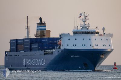
AKRANES
Vehicles Carrier
Current Trip
TORLAKSHOFN
| Time Travelled | 51 mins |
|---|---|
| Remaining Time | --- |
| Distance Travelled | 7.92 nm |
| Remaining Distance | --- |
| AVG Speed | 17 Knop |
| MAX Speed | 17 Knop |
| AVG Wind | 15.2 knots |
| MAX Wind | 15.5 knots |
| MIN Temp | 7.8°C / 46.04°F |
| MAX Temp | 7.9°C / 46.22°F |
| Djupgående | 5.6 m |
| Position mottagen | 2 d sen |
Current Position
| Longitud | -4.32707° |
|---|---|
| Latitude | 59.17891° |
| Status | Under way using engine |
| Fart | 12.9 Knop |
| Kurs | 310.4° |
| Område | North Atlantic Ocean |
| Station | T-AIS |
| Position mottagen | 2 d sen |
Info
Information
The current position of AKRANES is in North Atlantic Ocean with coordinates 59.17891° / -4.32707° as reported on 2024-05-13 10:45 by AIS to our vessel tracker app. The vessel's current speed is 12.9 Knop
The vessel AKRANES (IMO: 9160774, MMSI: 231852000) is a Vehicles Carrier that was built in 1998 ( 26 År gammal ). It's sailing under the flag of [FO] Faroe Is.
In this page you can find informations about the vessels current position, last detected port calls, and current voyage information. If the vessels is not in coverage by AIS you will find the latest position.
The current position of AKRANES is detected by our AIS receivers and we are not responsible for the reliability of the data. The last position was recorded while the vessel was in Coverage by the Ais receivers of our vessel tracking app.
The current draught of AKRANES as reported by AIS is 5.6 meters
Weather
| Temperature | 7.9°C / 46.22°F |
|---|---|
| Wind Speed | 15 knots |
| Direction | 144° SE |
| Pressure | 1012.1 hPa |
| Humidity | 79.8 % |
| Cloud Coverage | 100 % |
Featured Company
Last Port Calls
| Port | Arrival | Departure | Time In Port |
|---|---|---|---|
| 2024-05-15 07:52 | 2024-05-15 18:38 | 10 h | |
| 2024-05-11 22:35 | 2024-05-11 23:15 | 40 m | |
| 2024-05-11 16:18 | 2024-05-11 22:34 | 6 h | |
| 2024-05-11 15:15 | 2024-05-11 16:08 | 52 m | |
| 2024-05-09 20:12 | 2024-05-09 22:25 | 2 h | |
| 2024-05-08 07:56 | 2024-05-08 18:41 | 10 h | |
| 2024-05-04 23:24 | 2024-05-05 00:07 | 43 m | |
| 2024-05-04 16:27 | 2024-05-04 23:24 | 6 h | |
| 2024-05-04 15:42 | 2024-05-04 16:20 | 38 m | |
| 2024-05-02 14:48 | 2024-05-02 21:42 | 6 h |
Last Trips
| Origin | Departure | Destination | Arrival | Distance | |
|---|---|---|---|---|---|
| 2024-05-12 01:15 | 2024-05-15 07:52 | 1095.52 nm | |||
| 2024-05-12 00:34 | 2024-05-12 00:35 | 0.40 nm | |||
| 2024-05-11 18:08 | 2024-05-11 18:18 | 0.40 nm | |||
| 2024-05-09 23:25 | 2024-05-11 17:15 | 714.32 nm | |||
| 2024-05-08 18:41 | 2024-05-09 21:12 | 429.89 nm | |||
| 2024-05-05 02:07 | 2024-05-08 07:56 | 1099.34 nm | |||
| 2024-05-05 01:24 | 2024-05-05 01:24 | 0.05 nm | |||
| 2024-05-04 18:20 | 2024-05-04 18:27 | 0.37 nm | |||
| 2024-05-02 22:42 | 2024-05-04 17:42 | 716.05 nm | |||
| 2024-05-01 13:53 | 2024-05-02 15:48 | 427.09 nm |
Events
| Tid | Event | Detaljer | Position / Dest | Information |
|---|---|---|---|---|
| 2024-05-15 18:38 | AVGÅTT HAMN |
|
63.86104 / -21.36152
TORLAKSHOFN
|
Fart: 1 kn Kurs: -1° |
| 2024-05-15 07:52 | ANLÄNDER HAMN |
|
63.85984 / -21.37124
[IS] HERJOLFUR
|
Fart: Kurs: -1° |
| 2024-05-15 07:41 | STOPPAR förflyttning | 0.2 nm, South of HERJOLFUR |
63.85667 / -21.36833
TORLAKSHOFN
|
Fart: Kurs: -1° |
| 2024-05-13 10:50 | Status ändrad | Default Under way using engine |
59.19119 / -4.35638
TORLAKSHOFN
|
Fart: 12.9 kn Kurs: 310.4° |
| 2024-05-13 10:45 | UTANFÖR täckningsområde |
59.17891 / -4.32707
North Atlantic Ocean
TORLAKSHOFN
|
Fart: 12.9 kn Kurs: 310.4° |
|
| 2024-05-13 10:44 | Status ändrad | Under way using engine Default |
59.17690 / -4.32243
TORLAKSHOFN
|
Fart: 12.8 kn Kurs: 310° |
| 2024-05-13 10:42 | Status ändrad | Default Under way using engine |
59.17313 / -4.31351
TORLAKSHOFN
|
Fart: 12.8 kn Kurs: 310.5° |
| 2024-05-13 10:42 | Status ändrad | Under way using engine Default |
59.17278 / -4.31271
TORLAKSHOFN
|
Fart: 12.7 kn Kurs: 310° |
| 2024-05-13 10:39 | Status ändrad | Default Under way using engine |
59.16451 / -4.29327
TORLAKSHOFN
|
Fart: 12.9 kn Kurs: 309.7° |
| 2024-05-13 07:59 | Byter havsområde | United Kingdom part of the North Atlantic Ocean United Kingdom part of the North Sea |
58.80461 / -3.42617
North Atlantic Ocean
TORLAKSHOFN
|
Fart: 12.4 kn Kurs: 309.4° |