
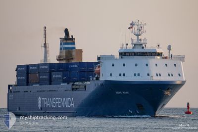
AKRANES
Vehicles Carrier
Current Trip
TORLAKSHOFN
| Time Travelled | 18 h, 58 mins |
|---|---|
| Remaining Time | --- |
| Distance Travelled | 283.20 nm |
| Remaining Distance | --- |
| AVG Speed | 18.1 Noeuds |
| MAX Speed | 19.6 Noeuds |
| AVG Wind | 15.8 knots |
| MAX Wind | 26 knots |
| MIN Temp | 8.4°C / 47.12°F |
| MAX Temp | 11.7°C / 53.06°F |
| Tirant d eau | 5.8 m |
| Position reçue | 3 d depuis |
Current Position
| Longitude | -4.41708° |
|---|---|
| Latitude | 59.19683° |
| Etat | Under way using engine |
| Vitesse | 13.6 Noeuds |
| Parcours | 308.1° |
| Zone | North Atlantic Ocean |
| Station | T-AIS |
| Position reçue | 3 d depuis |
Info
Information
The current position of AKRANES is in North Atlantic Ocean with coordinates 59.19683° / -4.41708° as reported on 2024-07-01 13:07 by AIS to our vessel tracker app. The vessel's current speed is 13.6 Noeuds
The vessel AKRANES (IMO: 9160774, MMSI: 231852000) is a Vehicles Carrier that was built in 1998 ( 26 Age ). It's sailing under the flag of [FO] Faroe Is.
In this page you can find informations about the vessels current position, last detected port calls, and current voyage information. If the vessels is not in coverage by AIS you will find the latest position.
The current position of AKRANES is detected by our AIS receivers and we are not responsible for the reliability of the data. The last position was recorded while the vessel was in Coverage by the Ais receivers of our vessel tracking app.
The current draught of AKRANES as reported by AIS is 5.8 meters
Weather
| Temperature | 10.2°C / 50.36°F |
|---|---|
| Wind Speed | 15 knots |
| Direction | 49° NE |
| Pressure | 992.7 hPa |
| Humidity | 85.1 % |
| Cloud Coverage | 100 % |
Featured Company
Last Port Calls
| Port | Arrival | Departure | Time In Port |
|---|---|---|---|
| 2024-07-03 07:49 | 2024-07-03 18:58 | 11 h | |
| 2024-06-29 23:57 | 2024-06-30 00:39 | 42 m | |
| 2024-06-29 16:41 | 2024-06-29 23:56 | 7 h | |
| 2024-06-29 15:39 | 2024-06-29 16:32 | 53 m | |
| 2024-06-27 19:09 | 2024-06-27 22:44 | 3 h | |
| 2024-06-26 07:52 | 2024-06-26 19:52 | 11 h | |
| 2024-06-22 16:52 | 2024-06-22 23:21 | 6 h | |
| 2024-06-22 15:51 | 2024-06-22 16:49 | 58 m | |
| 2024-06-20 18:28 | 2024-06-20 22:32 | 4 h | |
| 2024-06-19 06:42 | 2024-06-19 19:32 | 12 h |
Last Trips
| Origin | Departure | Destination | Arrival | Distance | |
|---|---|---|---|---|---|
| 2024-06-30 02:39 | 2024-07-03 07:49 | 1096.14 nm | |||
| 2024-06-30 01:56 | 2024-06-30 01:57 | 0.24 nm | |||
| 2024-06-29 18:32 | 2024-06-29 18:41 | 0.32 nm | |||
| 2024-06-27 23:44 | 2024-06-29 17:39 | 713.78 nm | |||
| 2024-06-26 19:52 | 2024-06-27 20:09 | 415.13 nm | |||
| 2024-06-23 01:21 | 2024-06-26 07:52 | 1099.84 nm | |||
| 2024-06-22 18:49 | 2024-06-22 18:52 | 0.23 nm | |||
| 2024-06-20 23:32 | 2024-06-22 17:51 | 719.62 nm | |||
| 2024-06-19 19:32 | 2024-06-20 19:28 | 424.10 nm | |||
| 2024-06-16 03:18 | 2024-06-19 06:42 | 1094.93 nm |
Events
| Heure | Evenement | Détails | Position/ Destination | Info |
|---|---|---|---|---|
| 2024-07-03 19:02 | Démarrage | 1 nm, East of HERJOLFUR |
63.85651 / -21.33204
TORLAKSHOFN
|
Vitesse: 14.9 kn Parcours: 132° |
| 2024-07-03 18:58 | PORT DE DEPART |
|
63.85651 / -21.33204
TORLAKSHOFN
|
Vitesse: Parcours: 104° |
| 2024-07-03 08:29 | Arret |
63.85979 / -21.37146
[IS] HERJOLFUR
|
Vitesse: Parcours: 103° |
|
| 2024-07-03 07:49 | Port d'arrivée |
|
63.85826 / -21.36816
[IS] HERJOLFUR
|
Vitesse: 7.6 kn Parcours: 296° |
| 2024-07-01 13:16 | Etat Changé | Default Under way using engine |
59.21513 / -4.46570
TORLAKSHOFN
|
Vitesse: 13.6 kn Parcours: 308.1° |
| 2024-07-01 13:07 | Hors de la zone couverte |
59.19683 / -4.41708
North Atlantic Ocean
TORLAKSHOFN
|
Vitesse: 13.6 kn Parcours: 308.1° |
|
| 2024-07-01 13:05 | Etat Changé | Under way using engine Default |
59.19134 / -4.40317
TORLAKSHOFN
|
Vitesse: 13.7 kn Parcours: 310° |
| 2024-07-01 13:04 | Etat Changé | Default Under way using engine |
59.18876 / -4.39690
TORLAKSHOFN
|
Vitesse: 13.8 kn Parcours: 309.7° |
| 2024-07-01 10:10 | Changement de zone | United Kingdom part of the North Atlantic Ocean United Kingdom part of the North Sea |
58.78747 / -3.42421
North Atlantic Ocean
TORLAKSHOFN
|
Vitesse: 13.6 kn Parcours: 314.8° |
| 2024-07-01 07:47 | Etat Changé | Under way using engine Default |
58.34230 / -2.57687
TORLAKSHOFN
|
Vitesse: 13.9 kn Parcours: 324° |