
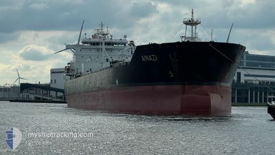
AINAZI
Oil/Chemical Tanker
Current Trip
| Time Travelled | 3 days |
|---|---|
| Remaining Time | 9 days |
| Distance Travelled | 927.38 nm |
| Remaining Distance | 2874.90 nm |
| AVG Speed | 12.1 Knop |
| MAX Speed | 13.2 Knop |
| AVG Wind | 9.8 knots |
| MAX Wind | 23.2 knots |
| MIN Temp | 14.1°C / 57.38°F |
| MAX Temp | 19.8°C / 67.64°F |
| Djupgående | 10.5 m |
| Position mottagen | 10 m sen |
Current Position
| Longitud | --- |
|---|---|
| Latitude | --- |
| Status | Under way using engine |
| Fart | 12.8 Knop |
| Kurs | 210.3° |
| Område | North Atlantic Ocean |
| Station | T-AIS |
| Position mottagen | 10 m sen |
Info
Information
The current position of AINAZI is in North Atlantic Ocean with coordinates 28.13546° / -15.00106° as reported on 2025-12-11 07:23 by AIS to our vessel tracker app. The vessel's current speed is 12.8 Knop and is heading at the port of ARATU. The estimated time of arrival as calculated by MyShipTracking vessel tracking app is 2025-12-20 13:07 LT
The vessel AINAZI (IMO: 9323405, MMSI: 538002779) is a Oil/Chemical Tanker that was built in 2008 ( 17 År gammal ). It's sailing under the flag of [MH] Marshall Is.
In this page you can find informations about the vessels current position, last detected port calls, and current voyage information. If the vessels is not in coverage by AIS you will find the latest position.
The current position of AINAZI is detected by our AIS receivers and we are not responsible for the reliability of the data. The last position was recorded while the vessel was in Coverage by the Ais receivers of our vessel tracking app.
The current draught of AINAZI as reported by AIS is 10.5 meters
Weather
| Temperature | 19°C / 66.2°F |
|---|---|
| Wind Speed | 12 knots |
| Direction | 34° NE |
| Pressure | 1022.5 hPa |
| Humidity | 63.5 % |
| Cloud Coverage | --- |
Featured Company
Last Port Calls
| Port | Arrival | Departure | Time In Port |
|---|---|---|---|
| 2025-12-05 03:58 | 2025-12-08 02:47 | 2 d | |
| 2025-11-28 08:20 | 2025-12-01 22:14 | 3 d | |
| 2025-11-16 09:16 | 2025-11-16 19:14 | 9 h | |
| 2025-11-12 00:40 | 2025-11-13 13:44 | 1 d | |
| 2025-11-04 18:13 | 2025-11-04 18:25 | 12 m | |
| 2025-11-04 00:56 | 2025-11-04 18:12 | 17 h | |
| 2025-10-24 02:46 | 2025-10-26 06:14 | 2 d | |
| 2025-10-10 07:59 |
Most Visited Ports (Last year)
| Port | Arrivals | |
|---|---|---|
| 3 | ||
| 2 | ||
| 2 | ||
| 2 | ||
| 1 | ||
| 1 |
Last Trips
| Origin | Departure | Destination | Arrival | Distance | |
|---|---|---|---|---|---|
| 2025-12-01 22:14 | 2025-12-05 03:58 | 588.70 nm | |||
| 2025-11-13 13:44 | 2025-11-28 08:20 | 2801.64 nm | |||
| 2025-11-13 13:44 | 2025-11-16 09:16 | 507.86 nm | |||
| 2025-10-26 06:14 | 2025-11-12 00:40 | 2554.87 nm | |||
| 2025-10-26 06:14 | 2025-11-04 18:13 | 1852.80 nm | |||
| 2025-10-26 06:14 | 2025-11-04 00:56 | 1768.71 nm | |||
| 2025-10-10 07:59 | 2025-10-24 02:46 | 1727.05 nm |
Events
| Tid | Event | Detaljer | Position / Dest | Information |
|---|---|---|---|---|
| 2025-12-11 07:30 | Status ändrad | Default Under way using engine |
28.11094 / -15.01125
BRARB
|
Fart: 12.8 kn Kurs: 210.3° |
| 2025-12-11 07:23 | Upptäckt i hav | Spanish (Canary Islands) part of the North Atlantic Ocean |
28.13546 / -15.00106
North Atlantic Ocean
BRARB
|
Fart: 12.8 kn Kurs: 210.3° |
| 2025-12-11 07:23 | Status ändrad | Under way using engine Default |
28.13546 / -15.00106
BRARB
|
Fart: 12.5 kn Kurs: 202° |
| 2025-12-11 07:18 | I täckningsområde |
28.13546 / -15.00106
North Atlantic Ocean
BRARB
|
Fart: 12.8 kn Kurs: 210.3° |
|
| 2025-12-10 00:46 | Status ändrad | Default Under way using engine |
32.82834 / -10.27333
BRARB
|
Fart: 11.1 kn Kurs: 233.6° |
| 2025-12-10 00:41 | Status ändrad | Under way using engine Default |
32.83775 / -10.26164
BRARB
|
Fart: 12 kn Kurs: 211° |
| 2025-12-10 00:41 | UTANFÖR täckningsområde |
32.83775 / -10.26164
North Atlantic Ocean
BRARB
|
Fart: 11.1 kn Kurs: 233.6° |
|
| 2025-12-10 00:22 | I täckningsområde |
32.83775 / -10.26164
North Atlantic Ocean
BRARB
|
Fart: 11.1 kn Kurs: 233.6° |
|
| 2025-12-09 15:15 | Status ändrad | Default Under way using engine |
34.09219 / -8.69461
BRARB
|
Fart: 11 kn Kurs: 229° |
| 2025-12-09 15:07 | UTANFÖR täckningsområde |
34.10949 / -8.67206
North Atlantic Ocean
BRARB
|
Fart: 11 kn Kurs: 229° |