
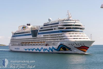
AIDAMAR
Passengers Ship
Current Trip
ESACE
| Time Travelled | 10 h, 24 mins |
|---|---|
| Remaining Time | --- |
| Distance Travelled | 106.45 nm |
| Remaining Distance | --- |
| AVG Speed | 15.4 Knop |
| MAX Speed | 15.8 Knop |
| AVG Wind | 6.1 knots |
| MAX Wind | 8.8 knots |
| MIN Temp | 22.2°C / 71.96°F |
| MAX Temp | 23°C / 73.4°F |
| Djupgående | 7.3 m |
| Position mottagen | 9 h, 52 m sen |
Current Position
| Longitud | --- |
|---|---|
| Latitude | --- |
| Status | Under way using engine |
| Fart | 15 Knop |
| Kurs | 38.8° |
| Område | North Atlantic Ocean |
| Station | T-AIS |
| Position mottagen | 9 h, 52 m sen |
Info
Information
The current position of AIDAMAR is in North Atlantic Ocean with coordinates 29.01121° / -13.40964° as reported on 2024-11-30 17:46 by AIS to our vessel tracker app. The vessel's current speed is 15 Knop
The vessel AIDAMAR (IMO: 9490052, MMSI: 247312900) is a Passengers Ship that was built in 2012 ( 12 År gammal ). It's sailing under the flag of [IT] Italy.
In this page you can find informations about the vessels current position, last detected port calls, and current voyage information. If the vessels is not in coverage by AIS you will find the latest position.
The current position of AIDAMAR is detected by our AIS receivers and we are not responsible for the reliability of the data. The last position was recorded while the vessel was in Coverage by the Ais receivers of our vessel tracking app.
The current draught of AIDAMAR as reported by AIS is 7.3 meters
Weather
| Temperature | 21.7°C / 71.06°F |
|---|---|
| Wind Speed | 13 knots |
| Direction | 155° SSE |
| Pressure | 1020.5 hPa |
| Humidity | 70.4 % |
| Cloud Coverage | 42 % |
Featured Company
Last Port Calls
| Port | Arrival | Departure | Time In Port |
|---|---|---|---|
| 2024-11-30 06:26 | 2024-11-30 17:15 | 10 h | |
| 2024-11-29 07:15 | 2024-11-29 18:23 | 11 h | |
| 2024-11-28 07:38 | 2024-11-28 20:02 | 12 h | |
| 2024-11-27 07:17 | 2024-11-27 21:54 | 14 h | |
| 2024-11-25 20:37 | 2024-11-26 20:30 | 23 h | |
| 2024-11-22 06:26 | 2024-11-22 17:11 | 10 h | |
| 2024-11-20 18:27 | 2024-11-21 19:13 | 1 d | |
| 2024-11-17 02:11 | 2024-11-17 17:34 | 15 h | |
| 2024-11-15 06:26 | 2024-11-15 18:49 | 12 h | |
| 2024-11-14 02:31 | 2024-11-14 18:53 | 16 h |
Last Trips
| Origin | Departure | Destination | Arrival | Distance | |
|---|---|---|---|---|---|
| 2024-11-29 18:23 | 2024-11-30 06:26 | 159.09 nm | |||
| 2024-11-28 20:02 | 2024-11-29 07:15 | 106.06 nm | |||
| 2024-11-27 21:54 | 2024-11-28 07:38 | 60.47 nm | |||
| 2024-11-26 20:30 | 2024-11-27 07:17 | 148.62 nm | |||
| 2024-11-22 18:11 | 2024-11-25 20:37 | 931.71 nm | |||
| 2024-11-21 20:13 | 2024-11-22 07:26 | 137.60 nm | |||
| 2024-11-17 18:34 | 2024-11-20 19:27 | 1075.93 nm | |||
| 2024-11-15 19:49 | 2024-11-17 03:11 | 418.40 nm | |||
| 2024-11-14 19:53 | 2024-11-15 07:26 | 167.00 nm | |||
| 2024-11-12 00:22 | 2024-11-14 03:31 | 755.36 nm |
Events
| Tid | Event | Detaljer | Position / Dest | Information |
|---|---|---|---|---|
| 2024-11-30 17:55 | Status ändrad | Default Under way using engine |
29.03949 / -13.38420
ESACE
|
Fart: 15 kn Kurs: 38.8° |
| 2024-11-30 17:46 | UTANFÖR täckningsområde |
29.01121 / -13.40964
North Atlantic Ocean
|
Fart: 15 kn Kurs: 38.8° |
|
| 2024-11-30 17:45 | Status ändrad | Under way using engine Default |
29.00641 / -13.41416
ESACE
|
Fart: 15.8 kn Kurs: 55° |
| 2024-11-30 17:34 | Status ändrad | Default Under way using engine |
28.97968 / -13.45639
ESACE
|
Fart: 15.8 kn Kurs: 54.3° |
| 2024-11-30 17:24 | Status ändrad | Under way using engine Default |
28.95505 / -13.49703
ESACE
|
Fart: 14 kn Kurs: 78° |
| 2024-11-30 17:23 | Status ändrad | Default Under way using engine |
28.95301 / -13.50387
ESACE
|
Fart: 10.6 kn Kurs: 90.9° |
| 2024-11-30 17:15 | AVGÅTT HAMN |
|
28.95388 / -13.53086
ESACE
|
Fart: 8.9 kn Kurs: 161° |
| 2024-11-30 17:10 | STARTAR förflyttning |
28.96337 / -13.53114
[ES] ARRECIFE
|
Fart: 4 kn Kurs: 200° |
|
| 2024-11-30 16:57 | Status ändrad | Under way using engine Moored |
28.96922 / -13.52738
[ES] ARRECIFE
|
Fart: Kurs: 16° |
| 2024-11-30 15:51 | Status ändrad | Moored Default |
28.96917 / -13.52718
[ES] ARRECIFE
|
Fart: Kurs: 16° |