
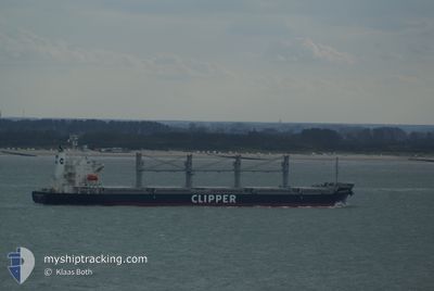
AGIA FILOTHEI
Bulk Carrier
Current Trip
| Trip Time | 55 days |
|---|---|
| Trip Distance | 6502.02 nm |
| AVG Speed | 9.4 Knop |
| MAX Speed | 16.3 Knop |
| Djupgående | 5.7 m |
| AVG Wind | 11.4 knots |
| MAX Wind | 34 knots |
| MIN Temp | -12.6°C / 9.32°F |
| MAX Temp | 29.3°C / 84.74°F |
| Position mottagen | 13 d sen |
Current Position
| Longitud | --- |
|---|---|
| Latitude | --- |
| Status | Under way using engine |
| Fart | 8 Knop |
| Kurs | 25.4° |
| Område | Gulf of St-Lawrence |
| Station | T-AIS |
| Position mottagen | 13 d sen |
Info
Information
The current position of AGIA FILOTHEI is in Gulf of St-Lawrence with coordinates 47.37592° / -70.46626° as reported on 2024-12-03 10:21 by AIS to our vessel tracker app. The vessel's current speed is 8 Knop and is currently inside the port of GRANDE ANSE.
The vessel AGIA FILOTHEI (IMO: 9605102, MMSI: 538009866) is a Bulk Carrier that was built in 2012 ( 12 År gammal ). It's sailing under the flag of [MH] Marshall Is.
In this page you can find informations about the vessels current position, last detected port calls, and current voyage information. If the vessels is not in coverage by AIS you will find the latest position.
The current position of AGIA FILOTHEI is detected by our AIS receivers and we are not responsible for the reliability of the data. The last position was recorded while the vessel was in Coverage by the Ais receivers of our vessel tracking app.
The current draught of AGIA FILOTHEI as reported by AIS is 5.7 meters
Weather
| Temperature | -0.9°C / 30.38°F |
|---|---|
| Wind Speed | 5 knots |
| Direction | 107° ESE |
| Pressure | 1019.9 hPa |
| Humidity | 90.2 % |
| Cloud Coverage | 100 % |
Featured Company
Last Port Calls
| Port | Arrival | Departure | Time In Port |
|---|---|---|---|
| 2024-12-14 02:53 | |||
| 2024-10-17 04:18 | 2024-10-19 03:39 | 1 d | |
| 2024-10-06 04:52 | 2024-10-09 05:00 | 3 d | |
| 2024-10-03 06:32 | 2024-10-06 04:32 | 2 d |
Last Trips
| Origin | Departure | Destination | Arrival | Distance | |
|---|---|---|---|---|---|
| 2024-10-19 06:39 | 2024-12-13 21:53 | 6502.02 nm | |||
| 2024-10-09 08:00 | 2024-10-17 07:18 | 1615.97 nm | |||
| 2024-10-06 07:32 | 2024-10-06 07:52 | 0.54 nm | |||
| 2024-08-31 07:33 | 2024-10-03 09:32 | 6612.10 nm |
Events
| Tid | Event | Detaljer | Position / Dest | Information |
|---|---|---|---|---|
| 2024-12-14 03:03 | STOPPAR förflyttning |
48.40196 / -70.83157
[CA] GRANDE ANSE
|
Fart: 0.1 kn Kurs: 92° |
|
| 2024-12-14 02:53 | ANLÄNDER HAMN |
|
48.40258 / -70.82945
[CA] GRANDE ANSE
|
Fart: 2.7 kn Kurs: 265° |
| 2024-12-13 18:06 | STARTAR förflyttning | 7.95 nm, North of TROIS-PISTOLES |
48.26844 / -69.19046
ESCOUMINS
|
Fart: 5 kn Kurs: 313° |
| 2024-12-13 02:44 | STOPPAR förflyttning | 7.89 nm, North of TROIS-PISTOLES |
48.26731 / -69.17898
ESCOUMINS
|
Fart: 0.3 kn Kurs: 254° |
| 2024-12-12 13:01 | STARTAR förflyttning | 9.71 nm, North of TROIS-PISTOLES |
48.29385 / -69.13444
ESCOUMINS
|
Fart: 3.6 kn Kurs: 226° |