
AC-D
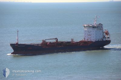
Oil/Chemical Tanker
Current Trip
| Time Travelled | 18 h, 19 mins |
|---|---|
| Remaining Time | --- |
| Distance Travelled | 208.56 nm |
| Remaining Distance | --- |
| AVG Speed | 10.9 Knop |
| MAX Speed | 14.1 Knop |
| AVG Wind | 13 knots |
| MAX Wind | 23.5 knots |
| MIN Temp | 11.4°C / 52.52°F |
| MAX Temp | 15.2°C / 59.36°F |
| Djupgående | 7.4 m |
| Position mottagen | Nu |
Current Position
| Longitud | -0.37418° |
|---|---|
| Latitude | 50.42198° |
| Status | Under way using engine |
| Fart | 11.1 Knop |
| Kurs | 256° |
| Område | English Channel |
| Station | T-AIS |
| Position mottagen | Nu |
Info
Information
The current position of AC-D is in English Channel with coordinates 50.42198° / -0.37418° as reported on 2024-06-05 08:58 by AIS to our vessel tracker app. The vessel's current speed is 11.1 Knop and is heading at the port of PORT LA NOUVELLE. The estimated time of arrival as calculated by MyShipTracking vessel tracking app is 2024-06-11 12:00 LT
The vessel AC-D (IMO: 9428437, MMSI: 256934000) is a Oil/Chemical Tanker that was built in 2008 ( 16 År gammal ). It's sailing under the flag of [MT] Malta.
In this page you can find informations about the vessels current position, last detected port calls, and current voyage information. If the vessels is not in coverage by AIS you will find the latest position.
The current position of AC-D is detected by our AIS receivers and we are not responsible for the reliability of the data. The last position was recorded while the vessel was in Coverage by the Ais receivers of our vessel tracking app.
The current draught of AC-D as reported by AIS is 7.4 meters
Weather
| Temperature | 12°C / 53.6°F |
|---|---|
| Wind Speed | 7 knots |
| Direction | 351° N |
| Pressure | 1014.8 hPa |
| Humidity | 71.7 % |
| Cloud Coverage | 10 % |
Featured Company
Last Port Calls
| Port | Arrival | Departure | Time In Port |
|---|---|---|---|
| 2024-06-03 02:09 | 2024-06-04 16:40 | 1 d | |
| 2024-05-28 10:42 | 2024-05-30 09:20 | 1 d | |
| 2024-05-09 16:52 | 2024-05-11 19:04 | 2 d | |
| 2024-04-21 17:35 | 2024-04-21 22:07 | 4 h | |
| 2024-04-08 23:05 | 2024-04-13 16:50 | 4 d | |
| 2024-04-03 17:10 | 2024-04-05 17:49 | 2 d | |
| 2024-04-01 13:02 |
Most Visited Ports (Last year)
| Port | Arrivals | |
|---|---|---|
| 4 | ||
| 3 | ||
| 3 | ||
| 2 | ||
| 2 | ||
| 2 |
Last Trips
| Origin | Departure | Destination | Arrival | Distance | |
|---|---|---|---|---|---|
| 2024-05-30 09:20 | 2024-06-03 02:09 | 237.17 nm | |||
| 2024-05-11 19:04 | 2024-05-28 10:42 | 3849.60 nm | |||
| 2024-04-21 22:07 | 2024-05-09 16:52 | 2520.07 nm | |||
| 2024-04-13 16:50 | 2024-04-21 17:35 | 2376.78 nm | |||
| 2024-04-05 17:49 | 2024-04-08 23:05 | 856.32 nm | |||
| 2024-04-01 13:02 | 2024-04-03 17:10 | 343.07 nm |
Events
| Tid | Event | Detaljer | Position / Dest | Information |
|---|---|---|---|---|
| 2024-06-05 02:59 | Byter havsområde | United Kingdom part of the English Channel French part of the English Channel |
50.89599 / 1.27733
English Channel
FR NOU
|
Fart: 13.1 kn Kurs: 236° |
| 2024-06-05 02:47 | Byter havsområde | French part of the English Channel United Kingdom part of the English Channel |
50.92667 / 1.32583
English Channel
FR NOU
|
Fart: 13.2 kn Kurs: 217° |
| 2024-06-05 01:58 | Byter havsområde | United Kingdom part of the English Channel United Kingdom part of the North Sea |
51.05467 / 1.49850
English Channel
FR NOU
|
Fart: 11.6 kn Kurs: 224° |
| 2024-06-04 22:53 | Destination ändrad | FR NOU FR NVL |
51.48392 / 1.98886
FR NOU
|
Fart: 11.2 kn Kurs: 224° |
| 2024-06-04 20:31 | Byter havsområde | United Kingdom part of the North Sea Belgian part of the North Sea |
51.80317 / 2.47650
North Sea
FR NVL
|
Fart: 12.2 kn Kurs: 223° |
| 2024-06-04 20:10 | Byter havsområde | Belgian part of the North Sea Dutch part of the North Sea |
51.85452 / 2.55644
North Sea
FR NVL
|
Fart: 12.4 kn Kurs: 227° |
| 2024-06-04 15:55 | Djupgående ändrat | 7.4 5.2 |
52.04250 / 3.81600
FR NVL
|
Fart: 11.8 kn Kurs: 278° |
| 2024-06-04 15:55 | ETA ändrat | 2024/06/11 10:00 2025/05/27 01:00 |
52.04250 / 3.81600
FR NVL
|
Fart: 11.8 kn Kurs: 278° |
| 2024-06-04 15:52 | Status ändrad | Under way using engine Moored |
52.04150 / 3.82817
FR NVL
|
Fart: 11.9 kn Kurs: 279° |
| 2024-06-04 15:01 | Destination ändrad | FR NVL NL RTM |
51.99083 / 4.04067
FR NVL
|
Fart: 10.2 kn Kurs: 307° |