
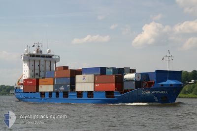
ABANOZ
Container Ship
Current Trip
| Time Travelled | 4 days |
|---|---|
| Remaining Time | 2 days |
| Distance Travelled | 903.93 nm |
| Remaining Distance | 462.58 nm |
| AVG Speed | 9.5 Knop |
| MAX Speed | 11 Knop |
| AVG Wind | 8.1 knots |
| MAX Wind | 28.3 knots |
| MIN Temp | 6.4°C / 43.52°F |
| MAX Temp | 17.5°C / 63.5°F |
| Djupgående | 7 m |
| Position mottagen | 1 m sen |
Current Position
| Longitud | --- |
|---|---|
| Latitude | --- |
| Status | Under way using engine |
| Fart | 4.3 Knop |
| Kurs | 321° |
| Område | Sea of Marmara |
| Station | T-AIS |
| Position mottagen | 1 m sen |
Information
The current position of ABANOZ is in Sea of Marmara with coordinates 40.95437° / 28.94131° as reported on 2025-03-23 07:32 by AIS to our vessel tracker app. The vessel's current speed is 4.3 Knop and is heading at the port of NOVOROSSIYSK. The estimated time of arrival as calculated by MyShipTracking vessel tracking app is 2025-03-25 21:56 LT
The vessel ABANOZ (IMO: 9121857, MMSI: 372162000) is a Container Ship that was built in 1997 ( 28 År gammal ). It's sailing under the flag of [PA] Panama.
In this page you can find informations about the vessels current position, last detected port calls, and current voyage information. If the vessels is not in coverage by AIS you will find the latest position.
The current position of ABANOZ is detected by our AIS receivers and we are not responsible for the reliability of the data. The last position was recorded while the vessel was in Coverage by the Ais receivers of our vessel tracking app.
The current draught of ABANOZ as reported by AIS is 7 meters
Weather
| Temperature | 10.9°C / 51.62°F |
|---|---|
| Wind Speed | 4 knots |
| Direction | 129° SE |
| Pressure | 1023.8 hPa |
| Humidity | 48.5 % |
| Cloud Coverage | 100 % |
Featured Company
Last Port Calls
| Port | Arrival | Departure | Time In Port |
|---|---|---|---|
| 2025-03-17 19:44 | 2025-03-19 00:15 | 1 d | |
| 2025-03-08 16:47 | 2025-03-09 07:20 | 14 h | |
| 2025-03-01 05:43 | 2025-03-01 19:25 | 13 h | |
| 2025-02-25 15:53 | 2025-02-26 08:57 | 17 h | |
| 2025-02-07 11:02 | 2025-02-09 18:46 | 2 d | |
| 2025-02-05 13:01 | 2025-02-07 10:40 | 1 d | |
| 2025-02-02 17:49 | 2025-02-04 05:41 | 1 d | |
| 2025-01-31 02:32 | 2025-01-31 04:41 | 2 h | |
| 2025-01-31 01:04 | 2025-01-31 01:43 | 39 m | |
| 2025-01-28 10:16 | 2025-01-28 19:19 | 9 h |
Most Visited Ports (Last year)
| Port | Arrivals | |
|---|---|---|
| 26 | ||
| 15 | ||
| 9 | ||
| 2 | ||
| 1 |
Last Trips
| Origin | Departure | Destination | Arrival | Distance | |
|---|---|---|---|---|---|
| 2025-03-09 10:20 | 2025-03-17 21:44 | 1342.06 nm | |||
| 2025-03-01 21:25 | 2025-03-08 19:47 | 1514.00 nm | |||
| 2025-02-26 10:57 | 2025-03-01 07:43 | 27.78 nm | |||
| 2025-02-09 21:46 | 2025-02-25 17:53 | 1401.89 nm | |||
| 2025-02-07 13:40 | 2025-02-07 14:02 | 10.62 nm | |||
| 2025-02-04 08:41 | 2025-02-05 16:01 | 221.97 nm | |||
| 2025-01-31 07:41 | 2025-02-02 20:49 | 222.43 nm | |||
| 2025-01-31 04:43 | 2025-01-31 05:32 | 10.07 nm | |||
| 2025-01-28 22:19 | 2025-01-31 04:04 | 12.76 nm | |||
| 2025-01-27 13:00 | 2025-01-28 13:16 | 7.61 nm |
Events
| Tid | Event | Detaljer | Position / Dest | Information |
|---|---|---|---|---|
| 2025-03-22 22:53 | Status ändrad | Under way using engine Default |
40.59120 / 27.25131
RUNVS
|
Fart: 9.8 kn Kurs: 64° |
| 2025-03-22 22:41 | Status ändrad | Default Under way using engine |
40.57679 / 27.21483
RUNVS
|
Fart: 9.9 kn Kurs: 64.9° |
| 2025-03-22 22:37 | Status ändrad | Under way using engine Default |
40.57165 / 27.20085
RUNVS
|
Fart: 9.7 kn Kurs: 68° |
| 2025-03-22 22:26 | Status ändrad | Default Under way using engine |
40.55998 / 27.16559
RUNVS
|
Fart: 9.8 kn Kurs: 67.2° |
| 2025-03-22 22:12 | Status ändrad | Under way using engine Default |
40.54508 / 27.11774
RUNVS
|
Fart: 10.2 kn Kurs: 65° |
| 2025-03-22 22:12 | I täckningsområde |
40.54610 / 27.12115
Sea of Marmara
RUNVS
|
Fart: 9.9 kn Kurs: 69.3° |
|
| 2025-03-22 19:09 | Status ändrad | Default Under way using engine |
40.28217 / 26.56499
RUNVS
|
Fart: 9.7 kn Kurs: 46.7° |
| 2025-03-22 19:01 | UTANFÖR täckningsområde |
40.26655 / 26.54377
Sea of Marmara
RUNVS
|
Fart: 9.7 kn Kurs: 46.7° |
|
| 2025-03-22 16:26 | Upptäckt i hav | Turkish part of the Sea of Marmara |
40.02003 / 26.20357
Sea of Marmara
RUNVS
|
Fart: 9 kn Kurs: 79.5° |
| 2025-03-22 16:26 | Status ändrad | Under way using engine Default |
40.02003 / 26.20357
RUNVS
|
Fart: 9 kn Kurs: 74° |