
ABANOZ
Container Ship
Current Trip
| Time Travelled | 2 days |
|---|---|
| Remaining Time | --- |
| Distance Travelled | 639.35 nm |
| Remaining Distance | --- |
| AVG Speed | 11.1 Noeuds |
| MAX Speed | 13.2 Noeuds |
| AVG Wind | 22.8 knots |
| MAX Wind | 31.3 knots |
| MIN Temp | 14.7°C / 58.46°F |
| MAX Temp | 19.2°C / 66.56°F |
| Tirant d eau | 7.2 m |
| Position reçue | 1 h, 53 m depuis |
Current Position
| Longitude | --- |
|---|---|
| Latitude | --- |
| Etat | Under way using engine |
| Vitesse | 10.1 Noeuds |
| Parcours | 45.5° |
| Zone | Sea of Marmara |
| Station | T-AIS |
| Position reçue | 1 h, 53 m depuis |
Info
Information
The current position of ABANOZ is in Sea of Marmara with coordinates 40.31725° / 26.61650° as reported on 2026-01-07 15:47 by AIS to our vessel tracker app. The vessel's current speed is 10.1 Noeuds and is heading at the port of NOVOROSSIYSK. The estimated time of arrival as calculated by MyShipTracking vessel tracking app is 2026-01-09 23:00 LT
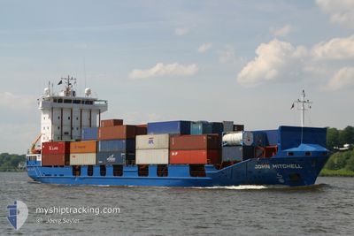
The vessel ABANOZ (IMO: 9121857, MMSI: 372162000) is a Container Ship that was built in 1997 ( 29 Age ). It's sailing under the flag of [PA] Panama.
In this page you can find informations about the vessels current position, last detected port calls, and current voyage information. If the vessels is not in coverage by AIS you will find the latest position.
The current position of ABANOZ is detected by our AIS receivers and we are not responsible for the reliability of the data. The last position was recorded while the vessel was in Coverage by the Ais receivers of our vessel tracking app.
The current draught of ABANOZ as reported by AIS is 7.2 meters
Weather
| Temperature | 15.7°C / 60.26°F |
|---|---|
| Wind Speed | 11 knots |
| Direction | 189° S |
| Pressure | 1008.9 hPa |
| Humidity | 72.9 % |
| Cloud Coverage | 14 % |
Featured Company
Last Port Calls
| Port | Arrival | Departure | Time In Port |
|---|---|---|---|
| 2026-01-04 21:14 | 2026-01-05 07:53 | 10 h | |
| 2026-01-02 12:07 | 2026-01-02 18:41 | 6 h | |
| 2025-12-30 22:26 | 2025-12-31 19:04 | 20 h | |
| 2025-12-23 18:58 | 2025-12-23 23:05 | 4 h | |
| 2025-12-17 23:16 | 2025-12-18 10:38 | 11 h | |
| 2025-12-12 08:44 | 2025-12-12 18:17 | 9 h | |
| 2025-12-09 23:44 | |||
| 2025-12-09 23:36 | |||
| 2025-12-09 20:56 | 2025-12-09 21:24 | 27 m | |
| 2025-12-09 09:04 | 2025-12-09 19:56 | 10 h |
Most Visited Ports (Last year)
| Port | Arrivals | |
|---|---|---|
| 63 | ||
| 11 | ||
| 11 | ||
| 9 | ||
| 4 | ||
| 3 |
Last Trips
| Origin | Departure | Destination | Arrival | Distance | |
|---|---|---|---|---|---|
| 2026-01-02 18:41 | 2026-01-04 21:14 | 372.48 nm | |||
| 2025-12-31 19:04 | 2026-01-02 12:07 | 204.62 nm | |||
| 2025-12-23 23:05 | 2025-12-30 22:26 | 1344.40 nm | |||
| 2025-12-18 10:38 | 2025-12-23 18:58 | 1241.76 nm | |||
| 2025-12-12 18:17 | 2025-12-17 23:16 | 814.82 nm | |||
| 2025-12-09 23:36 | 2025-12-12 08:44 | 518.71 nm | |||
| 2025-12-09 21:24 | 2025-12-09 23:44 | 11.25 nm | |||
| 2025-12-09 19:56 | 2025-12-09 20:56 | 15.99 nm | |||
| 2025-12-09 08:44 | 2025-12-09 09:04 | 6.35 nm | |||
| 2025-12-09 04:26 | 2025-12-09 07:25 | 6.36 nm |
Events
| Heure | Evenement | Détails | Position/ Destination | Info |
|---|---|---|---|---|
| 2026-01-07 15:52 | Etat Changé | Default Under way using engine |
40.32574 / 26.62793
RUNVS
|
Vitesse: 10.1 kn Parcours: 45.5° |
| 2026-01-07 15:47 | Etat Changé | Under way using engine Default |
40.31725 / 26.61650
RUNVS
|
Vitesse: 10.7 kn Parcours: 51° |
| 2026-01-07 15:47 | Hors de la zone couverte |
40.31725 / 26.61650
Sea of Marmara
RUNVS
|
Vitesse: 10.1 kn Parcours: 45.5° |
|
| 2026-01-07 15:24 | Etat Changé | Default Under way using engine |
40.27176 / 26.54867
RUNVS
|
Vitesse: 10.9 kn Parcours: 48.2° |
| 2026-01-07 13:13 | Changement de zone | Turkish part of the Sea of Marmara Turkish part of the Aegean Sea |
40.02210 / 26.19557
Sea of Marmara
RUNVS
|
Vitesse: 8.4 kn Parcours: 79.6° |
| 2026-01-07 12:28 | Etat Changé | Under way using engine Default |
39.98028 / 26.03225
RUNVS
|
Vitesse: 9.7 kn Parcours: 40° |
| 2026-01-07 11:53 | Etat Changé | Default Under way using engine |
39.92138 / 25.95329
RUNVS
|
Vitesse: 9.5 kn Parcours: 42.6° |
| 2026-01-07 11:29 | Changement de zone | Turkish part of the Aegean Sea Greek part of the Aegean Sea |
39.87230 / 25.89457
Aegean Sea
RUNVS
|
Vitesse: 11.4 kn Parcours: 44.1° |
| 2026-01-07 11:29 | Etat Changé | Under way using engine Default |
39.87230 / 25.89457
RUNVS
|
Vitesse: 11.5 kn Parcours: 37° |
| 2026-01-07 11:15 | Etat Changé | Default Under way using engine |
39.83986 / 25.85468
RUNVS
|
Vitesse: 10.6 kn Parcours: 40.6° |