
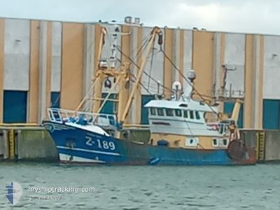
Z189 CORNELIS GERRIT
Fishing
Current Trip
VISSEN
| Time Travelled | 7 days |
|---|---|
| Remaining Time | --- |
| Distance Travelled | 789.01 морская миля |
| Remaining Distance | --- |
| AVG Speed | 5.3 Узлы |
| MAX Speed | 12.4 Узлы |
| AVG Wind | 13.4 knots |
| MAX Wind | 23 knots |
| MIN Temp | 3.8°C / 38.84°F |
| MAX Temp | 11.8°C / 53.24°F |
| Осадка | 3.5 м |
| Позиция Получена | 3 d тому назад |
Current Position
| Долгота | --- |
|---|---|
| Широта | --- |
| Статус | Engaged in Fishing |
| Скорость | 4.6 Узлы |
| Курс | 113° |
| Район | Celtic Sea |
| Станция | T-AIS |
| Позиция Получена | 3 d тому назад |
Info
Information
The current position of Z189 CORNELIS GERRIT is in Celtic Sea with coordinates 50.49435° / -5.41167° as reported on 2025-03-07 18:33 by AIS to our vessel tracker app. The vessel's current speed is 4.6 Узлы
The vessel Z189 CORNELIS GERRIT (IMO: 8745462, MMSI: 205690000) is a Fishing It's sailing under the flag of [BE] Belgium.
In this page you can find informations about the vessels current position, last detected port calls, and current voyage information. If the vessels is not in coverage by AIS you will find the latest position.
The current position of Z189 CORNELIS GERRIT is detected by our AIS receivers and we are not responsible for the reliability of the data. The last position was recorded while the vessel was in Coverage by the Ais receivers of our vessel tracking app.
The current draught of Z189 CORNELIS GERRIT as reported by AIS is 3.5 meters
Weather
| Temperature | 9.1°C / 48.38°F |
|---|---|
| Wind Speed | 19 knots |
| Direction | 68° ENE |
| Pressure | 1006.5 hPa |
| Humidity | 85 % |
| Cloud Coverage | 100 % |
Featured Company
Last Port Calls
| Port | Arrival | Departure | Time In Port |
|---|---|---|---|
| 2025-02-27 20:10 | 2025-03-03 07:28 | 3 d | |
| 2025-02-06 19:32 | 2025-02-17 03:25 | 10 d | |
| 2025-02-01 20:57 | 2025-02-02 23:08 | 1 d | |
| 2025-01-23 19:10 | 2025-01-29 21:06 | 6 d | |
| 2025-01-17 17:40 | 2025-01-20 16:29 | 2 d | |
| 2025-01-13 21:12 | 2025-01-15 18:48 | 1 d | |
| 2025-01-10 22:23 | 2025-01-13 11:02 | 2 d | |
| 2025-01-08 01:19 | 2025-01-08 02:48 | 1 h | |
| 2025-01-06 23:40 |
Most Visited Ports (Last year)
| Port | Arrivals | |
|---|---|---|
| 15 | ||
| 15 | ||
| 3 | ||
| 2 | ||
| 1 | ||
| 1 |
Last Trips
| Origin | Departure | Destination | Arrival | Distance | |
|---|---|---|---|---|---|
| 2025-02-17 04:25 | 2025-02-27 21:10 | 1200.95 морская миля | |||
| 2025-02-03 00:08 | 2025-02-06 20:32 | 412.44 морская миля | |||
| 2025-01-29 22:06 | 2025-02-01 21:57 | 214.54 морская миля | |||
| 2025-01-20 17:29 | 2025-01-23 20:10 | 338.45 морская миля | |||
| 2025-01-15 19:48 | 2025-01-17 18:40 | 306.47 морская миля | |||
| 2025-01-13 12:02 | 2025-01-13 22:12 | 96.38 морская миля | |||
| 2025-01-08 03:48 | 2025-01-10 23:23 | 319.59 морская миля | |||
| 2025-01-07 00:40 | 2025-01-08 02:19 | 116.32 морская миля |
Events
| Время | Событие | Детали | Позиция / Направление | Информация |
|---|---|---|---|---|
| 2025-03-10 15:23 | Начало движения | 12.17 nm, North West of PORTREATH |
50.44374 / -5.43896
VISSEN
|
Скорость: 4 kn Курс: 177° |
| 2025-03-10 15:19 | Окончание движения | 12.34 nm, North West of PORTREATH |
50.44635 / -5.44045
VISSEN
|
Скорость: 0.2 kn Курс: 154° |
| 2025-03-09 22:44 | Начало движения | 11.34 nm, North of PORTREATH |
50.45265 / -5.30494
VISSEN
|
Скорость: 5.6 kn Курс: 314° |
| 2025-03-08 21:15 | Окончание движения | 11.13 nm, North of PORTREATH |
50.44920 / -5.29918
VISSEN
|
Скорость: 0.3 kn Курс: 3° |
| 2025-03-08 08:59 | Начало движения | 12.85 nm, North of PORTREATH |
50.47341 / -5.36056
VISSEN
|
Скорость: 4.7 kn Курс: 224° |
| 2025-03-08 07:38 | Окончание движения | 14.21 nm, North of PORTREATH |
50.49535 / -5.36943
VISSEN
|
Скорость: 0.2 kn Курс: 289° |
| 2025-03-07 18:38 | Статус изменился | Default Engaged in Fishing |
50.49119 / -5.40207
VISSEN
|
Скорость: 4.6 kn Курс: 113° |
| 2025-03-07 18:33 | Изменение морского района | United Kingdom part of the Celtic Sea United Kingdom part of the English Channel |
50.49435 / -5.41167
Celtic Sea
|
Скорость: 4.6 kn Курс: 114° |
| 2025-03-07 18:33 | Статус изменился | Engaged in Fishing Default |
50.49435 / -5.41167
VISSEN
|
Скорость: 4.7 kn Курс: 141° |
| 2025-03-07 18:33 | Вне покрытия |
50.49435 / -5.41167
Celtic Sea
|
Скорость: 4.6 kn Курс: 114° |