
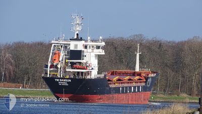
YM SAMSUN
General Cargo
Current Trip
| Time Travelled | 3 days |
|---|---|
| Remaining Time | --- |
| Distance Travelled | 692.20 морская миля |
| Remaining Distance | --- |
| AVG Speed | 10.6 Узлы |
| MAX Speed | 13.4 Узлы |
| AVG Wind | 9.5 knots |
| MAX Wind | 20 knots |
| MIN Temp | 11.4°C / 52.52°F |
| MAX Temp | 20.1°C / 68.18°F |
| Осадка | 8 м |
| Позиция Получена | 1 h, 32 m тому назад |
Current Position
| Долгота | 18.49627° |
|---|---|
| Широта | 36.48027° |
| Статус | Under way using engine |
| Скорость | 10.2 Узлы |
| Курс | 275.4° |
| Район | Mediterranean Sea - Eastern Basin |
| Станция | T-AIS |
| Позиция Получена | 1 h, 32 m тому назад |
Info
Information
The current position of YM SAMSUN is in Mediterranean Sea - Eastern Basin with coordinates 36.48027° / 18.49627° as reported on 2024-05-15 15:28 by AIS to our vessel tracker app. The vessel's current speed is 10.2 Узлы and is heading at the port of LIVERPOOL. The estimated time of arrival as calculated by MyShipTracking vessel tracking app is 2024-05-25 09:00 LT
The vessel YM SAMSUN (IMO: 9584982, MMSI: 271048988) is a General Cargo that was built in 2011 ( 13 лет ). It's sailing under the flag of [TR] Turkey.
In this page you can find informations about the vessels current position, last detected port calls, and current voyage information. If the vessels is not in coverage by AIS you will find the latest position.
The current position of YM SAMSUN is detected by our AIS receivers and we are not responsible for the reliability of the data. The last position was recorded while the vessel was in Coverage by the Ais receivers of our vessel tracking app.
The current draught of YM SAMSUN as reported by AIS is 8 meters
Weather
| Temperature | 20.1°C / 68.18°F |
|---|---|
| Wind Speed | 8 knots |
| Direction | 91° E |
| Pressure | 1011 hPa |
| Humidity | 87.5 % |
| Cloud Coverage | 100 % |
Featured Company
Last Port Calls
| Port | Arrival | Departure | Time In Port |
|---|---|---|---|
| 2024-05-11 20:29 | 2024-05-12 12:56 | 16 h | |
| 2024-04-16 14:53 | 2024-05-10 09:31 | 23 d | |
| 2024-04-15 09:53 | 2024-04-15 11:04 | 1 h | |
| 2024-04-08 00:59 | 2024-04-08 23:11 | 22 h | |
| 2024-03-30 13:21 | 2024-03-31 14:27 | 1 d | |
| 2024-03-26 14:09 | 2024-03-28 05:45 | 1 d | |
| 2024-03-20 17:43 | 2024-03-22 21:46 | 2 d | |
| 2024-03-11 09:33 | 2024-03-15 11:54 | 4 d | |
| 2024-03-08 09:40 | 2024-03-09 15:11 | 1 d | |
| 2024-03-02 09:58 | 2024-03-03 21:27 | 1 d |
Last Trips
| Origin | Departure | Destination | Arrival | Distance | |
|---|---|---|---|---|---|
| 2024-05-10 12:31 | 2024-05-11 23:29 | 64.16 морская миля | |||
| 2024-04-15 14:04 | 2024-04-16 17:53 | 25.55 морская миля | |||
| 2024-04-09 02:11 | 2024-04-15 12:53 | 817.27 морская миля | |||
| 2024-03-31 17:27 | 2024-04-08 03:59 | 872.12 морская миля | |||
| 2024-03-28 08:45 | 2024-03-30 16:21 | 430.77 морская миля | |||
| 2024-03-23 00:46 | 2024-03-26 17:09 | 439.72 морская миля | |||
| 2024-03-15 12:54 | 2024-03-20 20:43 | 1351.80 морская миля | |||
| 2024-03-09 16:11 | 2024-03-11 10:33 | 430.76 морская миля | |||
| 2024-03-04 00:27 | 2024-03-08 10:40 | 1036.67 морская миля | |||
| 2024-02-28 09:08 | 2024-03-02 12:58 | 404.11 морская миля |
Events
| Время | Событие | Детали | Позиция / Направление | Информация |
|---|---|---|---|---|
| 2024-05-15 15:34 | Статус изменился | Default Under way using engine |
36.48117 / 18.47517
GBLIV
|
Скорость: 10.2 kn Курс: 275.4° |
| 2024-05-15 15:28 | Вне покрытия |
36.48027 / 18.49627
Mediterranean Sea - Eastern Basin
GBLIV
|
Скорость: 10.2 kn Курс: 275.4° |
|
| 2024-05-15 13:12 | Статус изменился | Under way using engine Default |
36.47192 / 18.98766
GBLIV
|
Скорость: 10.5 kn Курс: 272° |
| 2024-05-15 12:40 | Статус изменился | Default Under way using engine |
36.46700 / 19.10583
GBLIV
|
Скорость: 10.8 kn Курс: 271.2° |
| 2024-05-15 12:00 | Статус изменился | Under way using engine Default |
36.46167 / 19.25503
GBLIV
|
Скорость: 10.9 kn Курс: 272° |
| 2024-05-15 11:13 | Статус изменился | Default Under way using engine |
36.45535 / 19.43395
GBLIV
|
Скорость: 10.8 kn Курс: 271.9° |
| 2024-05-15 11:09 | Статус изменился | Under way using engine Default |
36.45474 / 19.44824
GBLIV
|
Скорость: 10.8 kn Курс: 273° |
| 2024-05-15 10:54 | В покрытии |
36.45474 / 19.44824
Mediterranean Sea - Eastern Basin
GBLIV
|
Скорость: 10.8 kn Курс: 271.9° |
|
| 2024-05-15 08:52 | Статус изменился | Default Under way using engine |
36.44297 / 19.95368
GBLIV
|
Скорость: 10.6 kn Курс: 271.1° |
| 2024-05-15 08:49 | Вне покрытия |
36.44250 / 19.96583
Mediterranean Sea - Eastern Basin
GBLIV
|
Скорость: 10.6 kn Курс: 271.1° |