
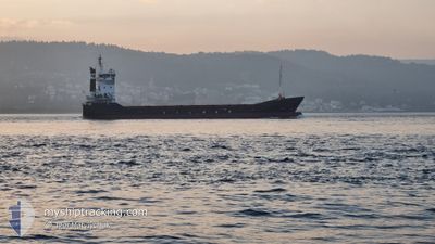
YM ARAL
General Cargo
Current Trip
| Time Travelled | 4 h, 14 mins |
|---|---|
| Remaining Time | 2 h, 56 mins |
| Distance Travelled | 47.69 морская миля |
| Remaining Distance | 34.78 морская миля |
| AVG Speed | 11.4 Узлы |
| MAX Speed | 11.9 Узлы |
| AVG Wind | 8.7 knots |
| MAX Wind | 12 knots |
| MIN Temp | 10.7°C / 51.26°F |
| MAX Temp | 12.6°C / 54.68°F |
| Осадка | 3 м |
| Позиция Получена | 1 m тому назад |
Current Position
| Долгота | --- |
|---|---|
| Широта | --- |
| Статус | Under way using engine |
| Скорость | 11.4 Узлы |
| Курс | 99.3° |
| Район | Sea of Marmara |
| Станция | T-AIS |
| Позиция Получена | 1 m тому назад |
Information
The current position of YM ARAL is in Sea of Marmara with coordinates 40.64548° / 28.46668° as reported on 2025-03-28 03:10 by AIS to our vessel tracker app. The vessel's current speed is 11.4 Узлы and is heading at the port of GEMLIK. The estimated time of arrival as calculated by MyShipTracking vessel tracking app is 2025-03-28 06:08 LT
The vessel YM ARAL (IMO: 9103805, MMSI: 271044022) is a General Cargo that was built in 1996 ( 29 лет ). It's sailing under the flag of [TR] Turkey.
In this page you can find informations about the vessels current position, last detected port calls, and current voyage information. If the vessels is not in coverage by AIS you will find the latest position.
The current position of YM ARAL is detected by our AIS receivers and we are not responsible for the reliability of the data. The last position was recorded while the vessel was in Coverage by the Ais receivers of our vessel tracking app.
The current draught of YM ARAL as reported by AIS is 3 meters
Weather
| Temperature | 10.7°C / 51.26°F |
|---|---|
| Wind Speed | 7 knots |
| Direction | 8° N |
| Pressure | 1003.7 hPa |
| Humidity | 86.8 % |
| Cloud Coverage | 100 % |
Featured Company
Last Port Calls
| Port | Arrival | Departure | Time In Port |
|---|---|---|---|
| 2025-03-27 06:08 | 2025-03-27 22:58 | 16 h | |
| 2025-03-26 05:17 | 2025-03-26 22:08 | 16 h | |
| 2025-03-17 16:08 | 2025-03-18 10:41 | 18 h | |
| 2025-03-16 13:32 | 2025-03-17 08:08 | 18 h | |
| 2025-03-12 05:39 | 2025-03-12 23:44 | 18 h | |
| 2025-03-10 05:40 | 2025-03-10 19:42 | 14 h | |
| 2025-03-08 10:52 | 2025-03-09 00:55 | 14 h | |
| 2025-03-05 08:13 | 2025-03-06 06:41 | 22 h | |
| 2025-03-02 23:21 | 2025-03-04 02:20 | 1 d | |
| 2025-02-26 05:45 | 2025-02-28 05:25 | 1 d |
Last Trips
| Origin | Departure | Destination | Arrival | Distance | |
|---|---|---|---|---|---|
| 2025-03-27 01:08 | 2025-03-27 09:08 | 82.60 морская миля | |||
| 2025-03-18 13:41 | 2025-03-26 08:17 | 968.84 морская миля | |||
| 2025-03-17 11:08 | 2025-03-17 19:08 | 84.90 морская миля | |||
| 2025-03-13 02:44 | 2025-03-16 16:32 | 814.14 морская миля | |||
| 2025-03-10 22:42 | 2025-03-12 08:39 | 248.29 морская миля | |||
| 2025-03-09 03:55 | 2025-03-10 08:40 | 244.99 морская миля | |||
| 2025-03-06 09:41 | 2025-03-08 13:52 | 300.91 морская миля | |||
| 2025-03-04 05:20 | 2025-03-05 11:13 | 247.17 морская миля | |||
| 2025-02-28 08:25 | 2025-03-03 02:21 | 605.52 морская миля | |||
| 2025-02-20 15:16 | 2025-02-26 08:45 | 610.03 морская миля |
Events
| Время | Событие | Детали | Позиция / Направление | Информация |
|---|---|---|---|---|
| 2025-03-28 00:53 | Статус изменился | Under way using engine Default |
40.73645 / 27.91482
TRGEM
|
Скорость: 11.7 kn Курс: 105° |
| 2025-03-28 00:43 | Статус изменился | Default Under way using engine |
40.74414 / 27.87480
TRGEM
|
Скорость: 11.5 kn Курс: 107.2° |
| 2025-03-28 00:30 | Статус изменился | Under way using engine Default |
40.75574 / 27.82102
TRGEM
|
Скорость: 11.4 kn Курс: 109° |
| 2025-03-28 00:24 | Статус изменился | Default Under way using engine |
40.76235 / 27.79576
TRGEM
|
Скорость: 11.5 kn Курс: 122.6° |
| 2025-03-28 00:14 | Осадка изменилась | 3 5 |
40.77532 / 27.75718
TRGEM
|
Скорость: 11.5 kn Курс: 122.5° |
| 2025-03-28 00:14 | Пункт назначения изменился | TRGEM TRTEK |
40.77532 / 27.75718
TRGEM
|
Скорость: 11.5 kn Курс: 122.5° |
| 2025-03-28 00:14 | ETA изменился | 2025/03/28 06:00 2025/03/27 06:00 |
40.77532 / 27.75718
TRGEM
|
Скорость: 11.5 kn Курс: 122.5° |
| 2025-03-28 00:12 | Статус изменился | Under way using engine Default |
40.77849 / 27.75055
TRTEK
|
Скорость: 11.5 kn Курс: 142° |
| 2025-03-27 23:16 | Статус изменился | Default Under way using engine |
40.87009 / 27.55126
TRTEK
|
Скорость: 11.9 kn Курс: 108° |
| 2025-03-27 23:15 | Статус изменился | Under way using engine Default |
40.87009 / 27.55126
TRTEK
|
Скорость: 12.1 kn Курс: 110° |