
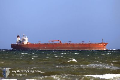
VOLTA RIVER
Crude Oil Tanker
Current Trip
| Time Travelled | 16 days |
|---|---|
| Remaining Time | 4 days |
| Distance Travelled | 4016.01 морская миля |
| Remaining Distance | 1170.63 морская миля |
| AVG Speed | 11.3 Узлы |
| MAX Speed | 14.3 Узлы |
| AVG Wind | 9.4 knots |
| MAX Wind | 15.1 knots |
| MIN Temp | 23.5°C / 74.3°F |
| MAX Temp | 29.5°C / 85.1°F |
| Осадка | 8 м |
| Позиция Получена | 8 d тому назад |
Current Position
| Долгота | --- |
|---|---|
| Широта | --- |
| Статус | Under way using engine |
| Скорость | 8.7 Узлы |
| Курс | 267° |
| Район | Laccadive Sea |
| Станция | T-AIS |
| Позиция Получена | 8 d тому назад |
Info
Information
The current position of VOLTA RIVER is in Laccadive Sea with coordinates 5.89113° / 80.18336° as reported on 2025-02-22 17:57 by AIS to our vessel tracker app. The vessel's current speed is 8.7 Узлы and is heading at the port of SUEZ CANAL. The estimated time of arrival as calculated by MyShipTracking vessel tracking app is 2025-03-06 20:49 LT
The vessel VOLTA RIVER (IMO: 9336414, MMSI: 352002521) is a Crude Oil Tanker that was built in 2007 ( 18 лет ). It's sailing under the flag of [PA] Panama.
In this page you can find informations about the vessels current position, last detected port calls, and current voyage information. If the vessels is not in coverage by AIS you will find the latest position.
The current position of VOLTA RIVER is detected by our AIS receivers and we are not responsible for the reliability of the data. The last position was recorded while the vessel was in Coverage by the Ais receivers of our vessel tracking app.
The current draught of VOLTA RIVER as reported by AIS is 8 meters
Weather
| Temperature | 25.4°C / 77.72°F |
|---|---|
| Wind Speed | 5 knots |
| Direction | 114° ESE |
| Pressure | 1012 hPa |
| Humidity | 82.5 % |
| Cloud Coverage | 23 % |
Featured Company
Last Port Calls
| Port | Arrival | Departure | Time In Port |
|---|---|---|---|
| 2025-02-13 02:49 | 2025-02-14 14:04 | 1 d | |
| 2025-01-21 02:41 | 2025-01-21 12:19 | 9 h |
Most Visited Ports (Last year)
| Port | Arrivals | |
|---|---|---|
| 7 | ||
| 4 | ||
| 3 | ||
| 2 | ||
| 2 | ||
| 1 |
Last Trips
| Origin | Departure | Destination | Arrival | Distance | |
|---|---|---|---|---|---|
| 2024-12-15 01:33 | 2025-02-13 10:49 | 6627.04 морская миля | |||
| 2024-12-15 01:33 | 2025-01-21 04:41 | 5760.35 морская миля |
Events
| Время | Событие | Детали | Позиция / Направление | Информация |
|---|---|---|---|---|
| 2025-02-22 18:01 | Статус изменился | Default Under way using engine |
5.88862 / 80.17065
SUEZ EGYPT
|
Скорость: 8.7 kn Курс: 267° |
| 2025-02-22 17:57 | Вне покрытия |
5.89113 / 80.18336
Laccadive Sea
SUEZ EGYPT
|
Скорость: 8.7 kn Курс: 267° |
|
| 2025-02-22 16:26 | Изменение морского района | Sri Lankan part of the Laccadive Sea Sri Lankan part of the Indian Ocean |
5.81871 / 80.40929
Laccadive Sea
SUEZ EGYPT
|
Скорость: 13.7 kn Курс: 274.8° |
| 2025-02-22 16:24 | Статус изменился | Under way using engine Default |
5.81820 / 80.41639
SUEZ EGYPT
|
Скорость: 13.6 kn Курс: 274° |
| 2025-02-22 16:19 | В покрытии |
5.81871 / 80.40929
Laccadive Sea
SUEZ EGYPT
|
Скорость: 13.7 kn Курс: 274.8° |
|
| 2025-02-22 09:27 | Статус изменился | Default Under way using engine |
5.86444 / 81.97862
SUEZ EGYPT
|
Скорость: 13 kn Курс: 265.5° |
| 2025-02-22 09:26 | Вне покрытия |
5.86471 / 81.98171
Indian Ocean
SUEZ EGYPT
|
Скорость: 13 kn Курс: 265.5° |
|
| 2025-02-22 08:34 | Изменение морского района | Sri Lankan part of the Indian Ocean Sri Lankan part of the Bay of Bengal |
5.87993 / 82.17288
Indian Ocean
SUEZ EGYPT
|
Скорость: 12.9 kn Курс: 264.9° |
| 2025-02-22 04:40 | Статус изменился | Under way using engine Default |
5.90332 / 83.05660
SUEZ EGYPT
|
Скорость: 13.7 kn Курс: 269° |
| 2025-02-22 04:30 | Статус изменился | Default Under way using engine |
5.90361 / 83.09319
SUEZ EGYPT
|
Скорость: 13.8 kn Курс: 269° |