
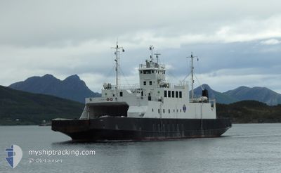
VIRAK
Ro-Ro/Passenger Ship
Current Trip
AAGSKARDET
| Time Travelled | 2 days |
|---|---|
| Remaining Time | --- |
| Distance Travelled | 112.34 морская миля |
| Remaining Distance | --- |
| AVG Speed | 9.7 Узлы |
| MAX Speed | 11.5 Узлы |
| AVG Wind | 6.8 knots |
| MAX Wind | 15 knots |
| MIN Temp | 6°C / 42.8°F |
| MAX Temp | 9.3°C / 48.74°F |
| Осадка | 3.1 м |
| Позиция Получена | Сейчас |
Current Position
| Долгота | 13.50375° |
|---|---|
| Широта | 66.73374° |
| Статус | Moored |
| Скорость | 10.6 Узлы |
| Курс | 47.7° |
| Район | Norwegian Sea |
| Станция | T-AIS |
| Позиция Получена | Сейчас |
Info
Information
The current position of VIRAK is in Norwegian Sea with coordinates 66.73374° / 13.50375° as reported on 2024-05-03 16:36 by AIS to our vessel tracker app. The vessel's current speed is 10.6 Узлы
The vessel VIRAK (IMO: 7805162, MMSI: 257377500) is a Ro-Ro/Passenger Ship that was built in 1979 ( 45 лет ). It's sailing under the flag of [NO] Norway.
In this page you can find informations about the vessels current position, last detected port calls, and current voyage information. If the vessels is not in coverage by AIS you will find the latest position.
The current position of VIRAK is detected by our AIS receivers and we are not responsible for the reliability of the data. The last position was recorded while the vessel was in Coverage by the Ais receivers of our vessel tracking app.
The current draught of VIRAK as reported by AIS is 3.1 meters
Weather
| Temperature | 6.2°C / 43.16°F |
|---|---|
| Wind Speed | 6 knots |
| Direction | 359° N |
| Pressure | 1020.4 hPa |
| Humidity | 92.1 % |
| Cloud Coverage | 90 % |
Featured Company
Last Port Calls
| Port | Arrival | Departure | Time In Port |
|---|---|---|---|
| 2024-05-01 06:45 | 2024-05-01 06:58 | 12 m | |
| 2024-04-30 12:20 | 2024-05-01 06:39 | 18 h | |
| 2024-04-12 11:19 | 2024-04-30 11:19 | 18 d | |
| 2024-04-09 17:51 | 2024-04-12 11:09 | 2 d | |
| 2024-04-09 07:53 |
Last Trips
| Origin | Departure | Destination | Arrival | Distance | |
|---|---|---|---|---|---|
| 2024-05-01 08:39 | 2024-05-01 08:45 | 0.66 морская миля | |||
| 2024-04-30 13:19 | 2024-04-30 14:20 | 7.96 морская миля | |||
| 2024-04-12 13:09 | 2024-04-12 13:19 | 0.36 морская миля | |||
| 2024-04-09 09:53 | 2024-04-09 19:51 | 92.13 морская миля |
Events
| Время | Событие | Детали | Позиция / Направление | Информация |
|---|---|---|---|---|
| 2024-05-03 16:32 | Начало движения | 7.73 nm, North East of JEKTVIK |
66.72546 / 13.48234
AAGSKARDET
|
Скорость: 10.2 kn Курс: 40.5° |
| 2024-05-03 16:26 | Окончание движения | 7.4 nm, North East of JEKTVIK |
66.72048 / 13.47598
AAGSKARDET
|
Скорость: 0.3 kn Курс: 157° |
| 2024-05-03 16:18 | Начало движения | 8.41 nm, North East of JEKTVIK |
66.73355 / 13.50243
AAGSKARDET
|
Скорость: 9.9 kn Курс: 221.2° |
| 2024-05-03 16:12 | Окончание движения | 8.79 nm, North East of JEKTVIK |
66.73833 / 13.51310
AAGSKARDET
|
Скорость: Курс: 52° |
| 2024-05-03 16:02 | Начало движения | 7.59 nm, North East of JEKTVIK |
66.72373 / 13.47846
AAGSKARDET
|
Скорость: 9.2 kn Курс: 40.9° |
| 2024-05-03 15:22 | Окончание движения | 7.4 nm, North East of JEKTVIK |
66.72048 / 13.47597
AAGSKARDET
|
Скорость: Курс: 158° |
| 2024-05-03 15:12 | Начало движения | 8.67 nm, North East of JEKTVIK |
66.73669 / 13.50958
AAGSKARDET
|
Скорость: 8.3 kn Курс: 221.6° |
| 2024-05-03 15:01 | Окончание движения | 8.79 nm, North East of JEKTVIK |
66.73833 / 13.51312
AAGSKARDET
|
Скорость: 0.1 kn Курс: 231° |
| 2024-05-03 14:53 | Начало движения | 7.78 nm, North East of JEKTVIK |
66.72578 / 13.48456
AAGSKARDET
|
Скорость: 10.6 kn Курс: 43° |
| 2024-05-03 14:27 | Окончание движения | 7.4 nm, North East of JEKTVIK |
66.72048 / 13.47597
AAGSKARDET
|
Скорость: Курс: 157° |