
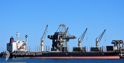
VENUS HARMONY
Cargo
Current Trip
| Time Travelled | 5 days |
|---|---|
| Remaining Time | 3 h, 14 mins |
| Distance Travelled | 1352.05 морская миля |
| Remaining Distance | 34.34 морская миля |
| AVG Speed | 10.8 Узлы |
| MAX Speed | 12.7 Узлы |
| AVG Wind | 12.6 knots |
| MAX Wind | 21 knots |
| MIN Temp | 21.6°C / 70.88°F |
| MAX Temp | 30.8°C / 87.44°F |
| Осадка | 12.5 м |
| Позиция Получена | 1 h, 42 m тому назад |
Current Position
| Долгота | --- |
|---|---|
| Широта | --- |
| Статус | Under way using engine |
| Скорость | 10.2 Узлы |
| Курс | 157.6° |
| Район | Coral Sea |
| Станция | T-AIS |
| Позиция Получена | 1 h, 42 m тому назад |
Info
Information
The current position of VENUS HARMONY is in Coral Sea with coordinates -23.19322° / 151.28178° as reported on 2024-10-02 01:30 by AIS to our vessel tracker app. The vessel's current speed is 10.2 Узлы and is heading at the port of GLADSTONE. The estimated time of arrival as calculated by MyShipTracking vessel tracking app is 2024-10-02 06:27 LT
The vessel VENUS HARMONY (IMO: 9667332, MMSI: 210322000) is a Cargo It's sailing under the flag of [CY] Cyprus.
In this page you can find informations about the vessels current position, last detected port calls, and current voyage information. If the vessels is not in coverage by AIS you will find the latest position.
The current position of VENUS HARMONY is detected by our AIS receivers and we are not responsible for the reliability of the data. The last position was recorded while the vessel was in Coverage by the Ais receivers of our vessel tracking app.
The current draught of VENUS HARMONY as reported by AIS is 12.5 meters
Weather
| Temperature | 21.6°C / 70.88°F |
|---|---|
| Wind Speed | 19 knots |
| Direction | 126° SE |
| Pressure | 1020.9 hPa |
| Humidity | 67 % |
| Cloud Coverage | --- |
Featured Company
Last Port Calls
| Port | Arrival | Departure | Time In Port |
|---|---|---|---|
| 2024-09-23 04:34 | 2024-09-27 01:00 | 3 d | |
| 2024-08-21 19:05 | 2024-08-23 20:26 | 2 d | |
| 2024-08-15 08:11 | 2024-08-17 18:47 | 2 d | |
| 2024-08-02 18:10 |
Events
| Время | Событие | Детали | Позиция / Направление | Информация |
|---|---|---|---|---|
| 2024-10-02 01:36 | Статус изменился | Default Under way using engine |
-23.20908 / 151.28839
AU GLT
|
Скорость: 10.2 kn Курс: 157.6° |
| 2024-10-02 01:30 | Вне покрытия |
-23.19322 / 151.28178
Coral Sea
AU GLT
|
Скорость: 10.2 kn Курс: 157.6° |
|
| 2024-10-02 01:12 | Статус изменился | Under way using engine Default |
-23.14513 / 151.26155
AU GLT
|
Скорость: 10 kn Курс: 158° |
| 2024-10-02 01:00 | Статус изменился | Default Under way using engine |
-23.11496 / 151.24887
AU GLT
|
Скорость: 9.9 kn Курс: 157.3° |
| 2024-10-02 00:52 | ETA изменился | 2024/10/02 07:00 2024/10/02 04:00 |
-23.09357 / 151.23987
AU GLT
|
Скорость: 9.9 kn Курс: 161.1° |
| 2024-10-02 00:46 | Статус изменился | Under way using engine Default |
-23.07899 / 151.23389
AU GLT
|
Скорость: 9.8 kn Курс: 158° |
| 2024-10-02 00:44 | Статус изменился | Default Under way using engine |
-23.07390 / 151.23184
AU GLT
|
Скорость: 9.8 kn Курс: 157.4° |
| 2024-10-02 00:41 | Статус изменился | Under way using engine Default |
-23.06622 / 151.22861
AU GLT
|
Скорость: 9.8 kn Курс: 156° |
| 2024-10-02 00:40 | Статус изменился | Default Under way using engine |
-23.06374 / 151.22752
AU GLT
|
Скорость: 9.8 kn Курс: 156° |
| 2024-10-02 00:37 | Статус изменился | Under way using engine Default |
-23.05617 / 151.22410
AU GLT
|
Скорость: 9.7 kn Курс: 158° |