
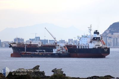
UOG SYROS
Oil/Chemical Tanker
Current Trip
| Time Travelled | 7 days |
|---|---|
| Remaining Time | --- |
| Distance Travelled | 1184.79 морская миля |
| Remaining Distance | --- |
| AVG Speed | 12.3 Узлы |
| MAX Speed | 15.2 Узлы |
| AVG Wind | 10.9 knots |
| MAX Wind | 17 knots |
| MIN Temp | 16.1°C / 60.98°F |
| MAX Temp | 25.8°C / 78.44°F |
| Осадка | 9.9 м |
| Позиция Получена | 7 d тому назад |
Current Position
| Долгота | --- |
|---|---|
| Широта | --- |
| Статус | Under way using engine |
| Скорость | 11.3 Узлы |
| Курс | 142.9° |
| Район | Gulf of Mexico |
| Станция | T-AIS |
| Позиция Получена | 7 d тому назад |
Info
Information
The current position of UOG SYROS is in Gulf of Mexico with coordinates 29.11689° / -94.42422° as reported on 2025-02-09 19:10 by AIS to our vessel tracker app. The vessel's current speed is 11.3 Узлы
The vessel UOG SYROS (IMO: 9472751, MMSI: 538006161) is a Oil/Chemical Tanker that was built in 2010 ( 15 лет ). It's sailing under the flag of [MH] Marshall Is.
In this page you can find informations about the vessels current position, last detected port calls, and current voyage information. If the vessels is not in coverage by AIS you will find the latest position.
The current position of UOG SYROS is detected by our AIS receivers and we are not responsible for the reliability of the data. The last position was recorded while the vessel was in Coverage by the Ais receivers of our vessel tracking app.
The current draught of UOG SYROS as reported by AIS is 9.9 meters
Weather
| Temperature | 23°C / 73.4°F |
|---|---|
| Wind Speed | 16 knots |
| Direction | 353° N |
| Pressure | 1017.3 hPa |
| Humidity | 84.8 % |
| Cloud Coverage | 100 % |
Featured Company
Most Visited Ports (Last year)
| Port | Arrivals | |
|---|---|---|
| 3 | ||
| 3 | ||
| 3 | ||
| 3 | ||
| 3 | ||
| 2 |
Events
| Время | Событие | Детали | Позиция / Направление | Информация |
|---|---|---|---|---|
| 2025-02-14 00:55 | Окончание движения | 1.15 nm, South of FREEPORT (BS) |
26.50390 / -78.77527
BS FPO
|
Скорость: 0.3 kn Курс: 311° |
| 2025-02-09 19:15 | Статус изменился | Default Under way using engine |
29.10083 / -94.42269
BS FPO
|
Скорость: 11.3 kn Курс: 142.9° |
| 2025-02-09 19:10 | Статус изменился | Under way using engine Default |
29.11689 / -94.42422
BS FPO
|
Скорость: 11.6 kn Курс: 133° |
| 2025-02-09 19:10 | Вне покрытия |
29.11689 / -94.42422
Gulf of Mexico
BS FPO
|
Скорость: 11.3 kn Курс: 142.9° |
|
| 2025-02-09 19:07 | В покрытии |
29.11689 / -94.42422
Gulf of Mexico
BS FPO
|
Скорость: 11.3 kn Курс: 142.9° |
|
| 2025-02-09 17:31 | Статус изменился | Default Under way using engine |
29.32853 / -94.66621
BS FPO
|
Скорость: 11.2 kn Курс: 101.7° |
| 2025-02-09 17:23 | Вне покрытия |
29.34037 / -94.69245
Gulf of Mexico
BS FPO
|
Скорость: 11.2 kn Курс: 101.7° |
|
| 2025-02-09 17:23 | Статус изменился | Under way using engine Default |
29.34060 / -94.69367
BS FPO
|
Скорость: 10.8 kn Курс: 102° |
| 2025-02-09 17:19 | Статус изменился | Default Under way using engine |
29.34277 / -94.70452
BS FPO
|
Скорость: 10.9 kn Курс: 85° |
| 2025-02-09 15:26 | ПОРТ ОТПРАВЛЕНИЯ |
|
29.59030 / -94.93999
BS FPO
|
Скорость: 10.2 kn Курс: 144° |