
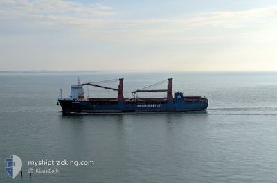
UHL FINESSE
Cargo
Current Trip
| Time Travelled | 26 days |
|---|---|
| Remaining Time | --- |
| Distance Travelled | 8057.13 морская миля |
| Remaining Distance | --- |
| AVG Speed | 13.3 Узлы |
| MAX Speed | 16.5 Узлы |
| AVG Wind | 10.9 knots |
| MAX Wind | 24.5 knots |
| MIN Temp | 9.7°C / 49.46°F |
| MAX Temp | 27.4°C / 81.32°F |
| Осадка | 6.1 м |
| Позиция Получена | 3 d тому назад |
Current Position
| Долгота | --- |
|---|---|
| Широта | --- |
| Статус | Under way using engine |
| Скорость | 11.4 Узлы |
| Курс | 122.5° |
| Район | South Atlantic Ocean |
| Станция | T-AIS |
| Позиция Получена | 3 d тому назад |
Info
Information
The current position of UHL FINESSE is in South Atlantic Ocean with coordinates -34.47648° / 18.31517° as reported on 2026-01-02 22:09 by AIS to our vessel tracker app. The vessel's current speed is 11.4 Узлы and is heading at the port of BUSAN. The estimated time of arrival as calculated by MyShipTracking vessel tracking app is 2026-01-27 09:00 LT
The vessel UHL FINESSE (IMO: 9892511, MMSI: 255806357) is a Cargo It's sailing under the flag of [PT] Portugal.
In this page you can find informations about the vessels current position, last detected port calls, and current voyage information. If the vessels is not in coverage by AIS you will find the latest position.
The current position of UHL FINESSE is detected by our AIS receivers and we are not responsible for the reliability of the data. The last position was recorded while the vessel was in Coverage by the Ais receivers of our vessel tracking app.
The current draught of UHL FINESSE as reported by AIS is 6.1 meters
Weather
| Temperature | 22.9°C / 73.22°F |
|---|---|
| Wind Speed | 7 knots |
| Direction | 284° WNW |
| Pressure | 1008.6 hPa |
| Humidity | 75.1 % |
| Cloud Coverage | 100 % |
Featured Company
Last Trips
| Origin | Departure | Destination | Arrival | Distance | |
|---|---|---|---|---|---|
| 2025-11-22 17:08 | 2025-12-08 10:06 | 1156.63 морская миля | |||
| 2025-11-16 13:05 | 2025-11-17 01:33 | 86.90 морская миля | |||
| 2025-11-15 20:17 | 2025-11-16 11:57 | 180.49 морская миля | |||
| 2025-09-20 10:16 | 2025-11-14 09:23 | 14157.33 морская миля |
Events
| Время | Событие | Детали | Позиция / Направление | Информация |
|---|---|---|---|---|
| 2026-01-02 22:15 | Статус изменился | Default Under way using engine |
-34.48773 / 18.33577
KRPUS
|
Скорость: 11.4 kn Курс: 122.5° |
| 2026-01-02 22:09 | Вне покрытия |
-34.47648 / 18.31517
South Atlantic Ocean
KRPUS
|
Скорость: 11.4 kn Курс: 122.5° |
|
| 2026-01-02 22:08 | Статус изменился | Under way using engine Default |
-34.47451 / 18.31152
KRPUS
|
Скорость: 11.7 kn Курс: 111° |
| 2026-01-02 21:38 | Статус изменился | Default Under way using engine |
-34.43276 / 18.21273
KRPUS
|
Скорость: 11.3 kn Курс: 149.7° |
| 2026-01-02 21:24 | Статус изменился | Under way using engine Default |
-34.39361 / 18.18500
KRPUS
|
Скорость: 10.8 kn Курс: 149° |
| 2026-01-02 20:35 | Статус изменился | Default Under way using engine |
-34.25468 / 18.09036
KRPUS
|
Скорость: 13 kn Курс: 147.1° |
| 2026-01-02 20:02 | Осадка изменилась | 6.1 6.5 |
-34.14551 / 18.00744
KRPUS
|
Скорость: 13.5 kn Курс: 143.7° |
| 2026-01-02 19:58 | Обнаружено в море | South African part of the South Atlantic Ocean |
-34.13813 / 18.00145
South Atlantic Ocean
KRPUS
|
Скорость: 13.7 kn Курс: 145.2° |
| 2026-01-02 19:57 | Статус изменился | Under way using engine Default |
-34.13362 / 17.99789
KRPUS
|
Скорость: 14.1 kn Курс: 147° |
| 2026-01-02 19:50 | В покрытии |
-34.13813 / 18.00145
South Atlantic Ocean
KRPUS
|
Скорость: 13.7 kn Курс: 145.2° |