
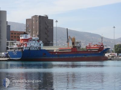
UGURS
General Cargo
Current Trip
| Time Travelled | 23 h, 40 mins |
|---|---|
| Remaining Time | --- |
| Distance Travelled | 177.32 морская миля |
| Remaining Distance | --- |
| AVG Speed | 7.4 Узлы |
| MAX Speed | 9.4 Узлы |
| AVG Wind | 14.5 knots |
| MAX Wind | 21.7 knots |
| MIN Temp | 9.6°C / 49.28°F |
| MAX Temp | 14.9°C / 58.82°F |
| Осадка | 6.3 м |
| Позиция Получена | 36 m тому назад |
Current Position
| Долгота | --- |
|---|---|
| Широта | --- |
| Статус | Under way using engine |
| Скорость | 7.7 Узлы |
| Курс | 209.4° |
| Район | Aegean Sea |
| Станция | T-AIS |
| Позиция Получена | 36 m тому назад |
Info
Information
The current position of UGURS is in Aegean Sea with coordinates 39.10777° / 25.35288° as reported on 2024-12-24 20:01 by AIS to our vessel tracker app. The vessel's current speed is 7.7 Узлы and is heading at the port of KOPER. The estimated time of arrival as calculated by MyShipTracking vessel tracking app is 2024-12-29 08:30 LT
The vessel UGURS (IMO: 9539793, MMSI: 271040150) is a General Cargo that was built in 2010 ( 14 лет ). It's sailing under the flag of [TR] Turkey.
In this page you can find informations about the vessels current position, last detected port calls, and current voyage information. If the vessels is not in coverage by AIS you will find the latest position.
The current position of UGURS is detected by our AIS receivers and we are not responsible for the reliability of the data. The last position was recorded while the vessel was in Coverage by the Ais receivers of our vessel tracking app.
The current draught of UGURS as reported by AIS is 6.3 meters
Weather
| Temperature | 12.7°C / 54.86°F |
|---|---|
| Wind Speed | 14 knots |
| Direction | 117° ESE |
| Pressure | 1005.1 hPa |
| Humidity | 75.8 % |
| Cloud Coverage | 100 % |
Featured Company
Last Port Calls
| Port | Arrival | Departure | Time In Port |
|---|---|---|---|
| 2024-12-21 18:47 | 2024-12-23 23:57 | 2 d | |
| 2024-12-18 08:34 | 2024-12-19 14:04 | 1 d | |
| 2024-12-11 13:40 | 2024-12-12 14:18 | 1 d | |
| 2024-12-07 17:11 | |||
| 2024-11-26 20:26 | 2024-11-27 17:39 | 21 h | |
| 2024-11-22 15:52 | 2024-11-26 12:16 | 3 d | |
| 2024-11-11 15:06 | 2024-11-13 16:42 | 2 d | |
| 2024-11-08 12:24 | 2024-11-08 12:59 | 35 m | |
| 2024-11-05 22:32 | 2024-11-08 12:00 | 2 d | |
| 2024-11-05 03:08 | 2024-11-05 21:15 | 18 h |
Last Trips
| Origin | Departure | Destination | Arrival | Distance | |
|---|---|---|---|---|---|
| 2024-12-19 14:04 | 2024-12-21 18:47 | 418.16 морская миля | |||
| 2024-12-12 14:18 | 2024-12-18 08:34 | 961.80 морская миля | |||
| 2024-12-07 17:11 | 2024-12-11 13:40 | 590.21 морская миля | |||
| 2024-11-26 12:16 | 2024-11-26 20:26 | 73.32 морская миля | |||
| 2024-11-13 16:42 | 2024-11-22 15:52 | 1484.79 морская миля | |||
| 2024-11-08 12:59 | 2024-11-11 15:06 | 682.29 морская миля | |||
| 2024-11-08 12:00 | 2024-11-08 12:24 | 1.90 морская миля | |||
| 2024-11-05 21:15 | 2024-11-05 22:32 | 4.55 морская миля | |||
| 2024-11-05 02:17 | 2024-11-05 03:08 | 4.28 морская миля | |||
| 2024-11-05 01:31 | 2024-11-05 01:55 | 1.94 морская миля |
Events
| Время | Событие | Детали | Позиция / Направление | Информация |
|---|---|---|---|---|
| 2024-12-24 13:41 | Обнаружено в море | Greek part of the Aegean Sea |
39.77121 / 25.80548
Aegean Sea
SI KOP
|
Скорость: 7 kn Курс: 211.6° |
| 2024-12-24 13:41 | Статус изменился | Under way using engine Default |
39.77121 / 25.80548
SI KOP
|
Скорость: 6.8 kn Курс: 208° |
| 2024-12-24 13:23 | В покрытии |
39.77121 / 25.80548
Aegean Sea
SI KOP
|
Скорость: 7 kn Курс: 211.6° |
|
| 2024-12-24 11:20 | Статус изменился | Default Under way using engine |
40.01815 / 26.02903
SI KOP
|
Скорость: 9.3 kn Курс: 265.7° |
| 2024-12-24 11:16 | Статус изменился | Under way using engine Default |
40.01905 / 26.03910
SI KOP
|
Скорость: 9.2 kn Курс: 264° |
| 2024-12-24 11:16 | Вне покрытия |
40.01905 / 26.03910
Aegean Sea
SI KOP
|
Скорость: 9.3 kn Курс: 265.7° |
|
| 2024-12-24 11:06 | Статус изменился | Default Under way using engine |
40.02171 / 26.07665
SI KOP
|
Скорость: 9.3 kn Курс: 264.2° |
| 2024-12-24 11:03 | Статус изменился | Under way using engine Default |
40.02235 / 26.08402
SI KOP
|
Скорость: 9.2 kn Курс: 264° |
| 2024-12-24 10:54 | Статус изменился | Default Under way using engine |
40.02504 / 26.11721
SI KOP
|
Скорость: 9.1 kn Курс: 262.5° |
| 2024-12-24 10:50 | Изменение морского района | Turkish part of the Aegean Sea Turkish part of the Sea of Marmara |
40.02584 / 26.12595
Aegean Sea
SI KOP
|
Скорость: 9.1 kn Курс: 262.5° |