
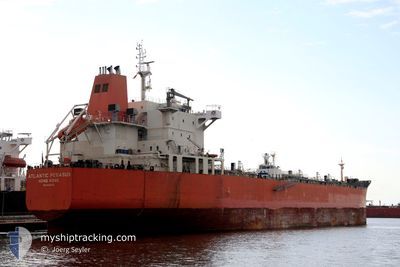
TORM PHILIPPINES
Oil/Chemical Tanker
Current Trip
MXPGO
| Time Travelled | 7 days |
|---|---|
| Remaining Time | --- |
| Distance Travelled | 583.61 морская миля |
| Remaining Distance | --- |
| AVG Speed | 10 Узлы |
| MAX Speed | 14 Узлы |
| AVG Wind | 13 knots |
| MAX Wind | 23 knots |
| MIN Temp | 21.4°C / 70.52°F |
| MAX Temp | 26.6°C / 79.88°F |
| Осадка | 9.1 м |
| Позиция Получена | 26 d тому назад |
Current Position
| Долгота | --- |
|---|---|
| Широта | --- |
| Статус | Under way using engine |
| Скорость | 11.2 Узлы |
| Курс | 82.9° |
| Район | Gulf of Mexico |
| Станция | T-AIS |
| Позиция Получена | 26 d тому назад |
Info
Information
The current position of TORM PHILIPPINES is in Gulf of Mexico with coordinates 29.34425° / -94.73677° as reported on 2025-12-08 01:07 by AIS to our vessel tracker app. The vessel's current speed is 11.2 Узлы
The vessel TORM PHILIPPINES (IMO: 9440136, MMSI: 219028049) is a Oil/Chemical Tanker that was built in 2010 ( 16 лет ). It's sailing under the flag of [DK] Denmark.
In this page you can find informations about the vessels current position, last detected port calls, and current voyage information. If the vessels is not in coverage by AIS you will find the latest position.
The current position of TORM PHILIPPINES is detected by our AIS receivers and we are not responsible for the reliability of the data. The last position was recorded while the vessel was in Coverage by the Ais receivers of our vessel tracking app.
The current draught of TORM PHILIPPINES as reported by AIS is 9.1 meters
Weather
| Temperature | 22.1°C / 71.78°F |
|---|---|
| Wind Speed | 10 knots |
| Direction | 129° SE |
| Pressure | 1014 hPa |
| Humidity | 79.8 % |
| Cloud Coverage | --- |
Featured Company
Last Port Calls
| Port | Arrival | Departure | Time In Port |
|---|---|---|---|
| 2025-12-23 18:20 | 2025-12-26 09:30 | 2 d | |
| 2025-12-16 07:44 | 2025-12-17 00:36 | 16 h | |
| 2025-12-10 01:55 | 2025-12-11 16:55 | 1 d | |
| 2025-12-05 18:55 | 2025-12-07 17:17 | 1 d | |
| 2025-11-17 03:02 | 2025-11-18 12:31 | 1 d | |
| 2025-11-02 00:36 |
Most Visited Ports (Last year)
| Port | Arrivals | |
|---|---|---|
| 5 | ||
| 3 | ||
| 2 | ||
| 2 | ||
| 1 | ||
| 1 |
Last Trips
| Origin | Departure | Destination | Arrival | Distance | |
|---|---|---|---|---|---|
| 2025-12-17 00:36 | 2025-12-23 18:20 | 35.28 морская миля | |||
| 2025-12-11 16:55 | 2025-12-16 07:44 | 42.09 морская миля | |||
| 2025-12-07 17:17 | 2025-12-10 01:55 | 594.11 морская миля | |||
| 2025-11-18 12:31 | 2025-12-05 18:55 | 2111.60 морская миля | |||
| 2025-11-02 00:36 | 2025-11-17 03:02 | 3515.95 морская миля |
Events
| Время | Событие | Детали | Позиция / Направление | Информация |
|---|---|---|---|---|
| 2026-01-01 02:48 | Окончание движения | 18.17 nm, North of DOS BOCAS |
18.74667 / -93.14167
MXPGO
|
Скорость: Курс: -1° |
| 2025-12-31 05:54 | Начало движения |
19.02333 / -93.25667
MXPGO
|
Скорость: 7 kn Курс: 325° |
|
| 2025-12-30 23:48 | Окончание движения |
18.83500 / -93.08833
MXPGO
|
Скорость: Курс: -1° |
|
| 2025-12-30 17:33 | Начало движения | 18.11 nm, North of DOS BOCAS |
18.74500 / -93.13834
MXPGO
|
Скорость: 4 kn Курс: -1° |
| 2025-12-29 19:03 | Окончание движения | 18.26 nm, North of DOS BOCAS |
18.74833 / -93.14333
MXPGO
|
Скорость: Курс: -1° |
| 2025-12-29 17:36 | Начало движения | 9.04 nm, North West of DOS BOCAS |
18.58000 / -93.26667
MXPGO
|
Скорость: 13 kn Курс: 10° |
| 2025-12-29 16:18 | Окончание движения | 7.92 nm, North West of DOS BOCAS |
18.55833 / -93.26667
MXPGO
|
Скорость: Курс: -1° |
| 2025-12-29 14:03 | Начало движения | 17.96 nm, North of DOS BOCAS |
18.74333 / -93.14333
MXPGO
|
Скорость: 7 kn Курс: 236° |
| 2025-12-27 23:12 | Окончание движения | 18.27 nm, North of DOS BOCAS |
18.74833 / -93.14167
MXPGO
|
Скорость: Курс: -1° |
| 2025-12-26 15:30 | ПОРТ ОТПРАВЛЕНИЯ |
|
21.36356 / -89.68858
MXPGO
|
Скорость: 8.4 kn Курс: 355° |