
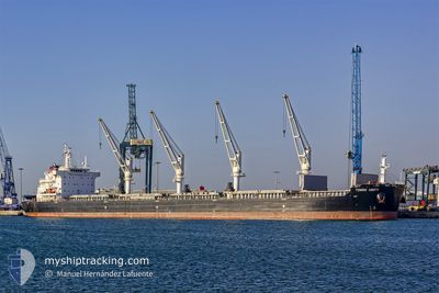
TOMINI UNITY
Cargo
Current Trip
| Time Travelled | 6 days |
|---|---|
| Remaining Time | 1 day |
| Distance Travelled | 1811.95 морская миля |
| Remaining Distance | 428.58 морская миля |
| AVG Speed | 12.1 Узлы |
| MAX Speed | 16.3 Узлы |
| AVG Wind | 13.4 knots |
| MAX Wind | 35 knots |
| MIN Temp | 5.2°C / 41.36°F |
| MAX Temp | 17.2°C / 62.96°F |
| Осадка | 9.3 м |
| Позиция Получена | 1 d тому назад |
Current Position
| Долгота | --- |
|---|---|
| Широта | --- |
| Статус | Under way using engine |
| Скорость | 10.9 Узлы |
| Курс | 85.2° |
| Район | Alboran Sea |
| Станция | T-AIS |
| Позиция Получена | 1 d тому назад |
Info
Information
The current position of TOMINI UNITY is in Alboran Sea with coordinates 36.32908° / -2.41793° as reported on 2025-03-04 04:06 by AIS to our vessel tracker app. The vessel's current speed is 10.9 Узлы and is heading at the port of VALLETTA. The estimated time of arrival as calculated by MyShipTracking vessel tracking app is 2025-03-07 01:25 LT
The vessel TOMINI UNITY (IMO: 9718167, MMSI: 538006521) is a Cargo It's sailing under the flag of [MH] Marshall Is.
In this page you can find informations about the vessels current position, last detected port calls, and current voyage information. If the vessels is not in coverage by AIS you will find the latest position.
The current position of TOMINI UNITY is detected by our AIS receivers and we are not responsible for the reliability of the data. The last position was recorded while the vessel was in Coverage by the Ais receivers of our vessel tracking app.
The current draught of TOMINI UNITY as reported by AIS is 9.3 meters
Weather
| Temperature | 15.8°C / 60.44°F |
|---|---|
| Wind Speed | 19 knots |
| Direction | 84° E |
| Pressure | 1015.9 hPa |
| Humidity | 81.9 % |
| Cloud Coverage | 3 % |
Featured Company
Last Port Calls
| Port | Arrival | Departure | Time In Port |
|---|---|---|---|
| 2025-02-24 06:58 | 2025-02-27 09:03 | 3 d | |
| 2025-02-21 17:16 | 2025-02-21 18:16 | 1 h | |
| 2025-02-14 19:16 | 2025-02-18 04:08 | 3 d | |
| 2025-01-21 19:54 | 2025-01-29 23:53 | 8 d |
Most Visited Ports (Last year)
| Port | Arrivals | |
|---|---|---|
| 2 | ||
| 2 | ||
| 2 | ||
| 2 | ||
| 1 | ||
| 1 |
Last Trips
| Origin | Departure | Destination | Arrival | Distance | |
|---|---|---|---|---|---|
| 2025-02-21 18:16 | 2025-02-24 06:58 | 82.54 морская миля | |||
| 2025-02-18 04:08 | 2025-02-21 17:16 | 909.97 морская миля | |||
| 2025-01-29 18:53 | 2025-02-14 19:16 | 4169.23 морская миля | |||
| 2024-12-28 11:08 | 2025-01-21 14:54 | 5703.69 морская миля |
Events
| Время | Событие | Детали | Позиция / Направление | Информация |
|---|---|---|---|---|
| 2025-03-04 04:07 | Статус изменился | Default Under way using engine |
36.32924 / -2.41554
MALTA
|
Скорость: 10.9 kn Курс: 85.2° |
| 2025-03-04 04:06 | Вне покрытия |
36.32908 / -2.41793
Alboran Sea
MALTA
|
Скорость: 10.9 kn Курс: 85.2° |
|
| 2025-03-04 01:04 | Осадка изменилась | 9.3 9.2 |
36.25831 / -3.09843
MALTA
|
Скорость: 12.1 kn Курс: 82° |
| 2025-03-04 00:49 | Статус изменился | Under way using engine Default |
36.25157 / -3.16019
MALTA
|
Скорость: 12 kn Курс: 82° |
| 2025-03-04 00:40 | Статус изменился | Default Under way using engine |
36.24766 / -3.19578
MALTA
|
Скорость: 12.1 kn Курс: 82.6° |
| 2025-03-04 00:31 | Статус изменился | Under way using engine Default |
36.24315 / -3.23591
MALTA
|
Скорость: 12.1 kn Курс: 83° |
| 2025-03-04 00:17 | Статус изменился | Default Under way using engine |
36.23690 / -3.29280
MALTA
|
Скорость: 12.4 kn Курс: 81.7° |
| 2025-03-04 00:07 | Статус изменился | Under way using engine Default |
36.23185 / -3.33346
MALTA
|
Скорость: 12.2 kn Курс: 78° |
| 2025-03-04 00:02 | Статус изменился | Default Under way using engine |
36.22824 / -3.35575
MALTA
|
Скорость: 12.3 kn Курс: 78.7° |
| 2025-03-03 20:58 | Статус изменился | Under way using engine Default |
36.13948 / -4.13617
MALTA
|
Скорость: 12.7 kn Курс: 82° |