
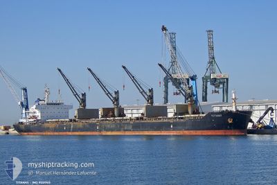
TITANAS
Cargo
Current Trip
| Time Travelled | 4 days |
|---|---|
| Remaining Time | 1 day |
| Distance Travelled | 969.15 морская миля |
| Remaining Distance | 452.55 морская миля |
| AVG Speed | 9.4 Узлы |
| MAX Speed | 11.6 Узлы |
| AVG Wind | 15.5 knots |
| MAX Wind | 29 knots |
| MIN Temp | 11.4°C / 52.52°F |
| MAX Temp | 16.1°C / 60.98°F |
| Осадка | 11.3 м |
| Позиция Получена | 12 h, 0 m тому назад |
Current Position
| Долгота | --- |
|---|---|
| Широта | --- |
| Статус | Under way using engine |
| Скорость | 10.2 Узлы |
| Курс | 356.1° |
| Район | North Atlantic Ocean |
| Станция | T-AIS |
| Позиция Получена | 12 h, 0 m тому назад |
Info
Information
The current position of TITANAS is in North Atlantic Ocean with coordinates 39.24167° / -9.93539° as reported on 2025-03-16 19:13 by AIS to our vessel tracker app. The vessel's current speed is 10.2 Узлы and is heading at the port of BILBAO. The estimated time of arrival as calculated by MyShipTracking vessel tracking app is 2025-03-18 21:58 LT
The vessel TITANAS (IMO: 9551703, MMSI: 538010691) is a Cargo It's sailing under the flag of [MH] Marshall Is.
In this page you can find informations about the vessels current position, last detected port calls, and current voyage information. If the vessels is not in coverage by AIS you will find the latest position.
The current position of TITANAS is detected by our AIS receivers and we are not responsible for the reliability of the data. The last position was recorded while the vessel was in Coverage by the Ais receivers of our vessel tracking app.
The current draught of TITANAS as reported by AIS is 11.3 meters
Weather
| Temperature | 12°C / 53.6°F |
|---|---|
| Wind Speed | 21 knots |
| Direction | 111° ESE |
| Pressure | 1008 hPa |
| Humidity | 86.5 % |
| Cloud Coverage | 100 % |
Featured Company
Last Port Calls
| Port | Arrival | Departure | Time In Port |
|---|---|---|---|
| 2025-03-10 20:29 | 2025-03-13 01:53 | 2 d | |
| 2025-03-05 16:07 | 2025-03-06 00:02 | 7 h | |
| 2025-01-13 10:26 | 2025-01-22 09:41 | 8 d | |
| 2025-01-06 10:45 | 2025-01-11 15:41 | 5 d |
Most Visited Ports (Last year)
| Port | Arrivals | |
|---|---|---|
| 1 | ||
| 1 | ||
| 1 | ||
| 1 | ||
| 1 | ||
| 1 |
Last Trips
| Origin | Departure | Destination | Arrival | Distance | |
|---|---|---|---|---|---|
| 2025-03-06 00:02 | 2025-03-10 21:29 | 1205.85 морская миля | |||
| 2025-01-22 17:41 | 2025-03-05 16:07 | 8056.75 морская миля | |||
| 2025-01-11 22:41 | 2025-01-13 18:26 | 411.13 морская миля | |||
| 2024-12-30 17:29 | 2025-01-06 17:45 | 1016.03 морская миля |
Events
| Время | Событие | Детали | Позиция / Направление | Информация |
|---|---|---|---|---|
| 2025-03-16 19:20 | Статус изменился | Default Under way using engine |
39.26214 / -9.93663
ES BIO
|
Скорость: 10.2 kn Курс: 356.1° |
| 2025-03-16 19:13 | Вне покрытия |
39.24167 / -9.93539
North Atlantic Ocean
ES BIO
|
Скорость: 10.2 kn Курс: 356.1° |
|
| 2025-03-16 18:30 | Статус изменился | Under way using engine Default |
39.11812 / -9.93594
ES BIO
|
Скорость: 10.6 kn Курс: 2° |
| 2025-03-16 18:28 | Статус изменился | Default Under way using engine |
39.11086 / -9.93624
ES BIO
|
Скорость: 10.8 kn Курс: 2.5° |
| 2025-03-16 13:03 | Статус изменился | Under way using engine Default |
38.13947 / -9.78679
ES BIO
|
Скорость: 10.7 kn Курс: 345° |
| 2025-03-16 12:55 | В покрытии |
38.13947 / -9.78679
North Atlantic Ocean
ES BIO
|
Скорость: 10.6 kn Курс: 345.7° |
|
| 2025-03-16 12:08 | Статус изменился | Default Under way using engine |
37.97964 / -9.73094
ES BIO
|
Скорость: 10.7 kn Курс: 343.2° |
| 2025-03-16 12:01 | Вне покрытия |
37.96111 / -9.72415
North Atlantic Ocean
ES BIO
|
Скорость: 10.7 kn Курс: 343.2° |
|
| 2025-03-16 09:20 | ETA изменился | 2025/03/19 03:00 2025/03/18 15:00 |
37.50930 / -9.58215
ES BIO
|
Скорость: 10.2 kn Курс: 345.3° |
| 2025-03-16 08:38 | Статус изменился | Under way using engine Default |
37.38927 / -9.56180
ES BIO
|
Скорость: 10.5 kn Курс: 355° |