
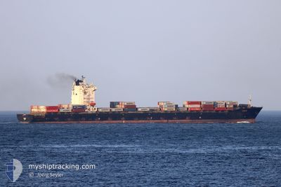
TANJA
Container Ship
Current Trip
| Time Travelled | 14 h, 25 mins |
|---|---|
| Remaining Time | 10 h, 47 mins |
| Distance Travelled | 200.63 морская миля |
| Remaining Distance | 118.63 морская миля |
| AVG Speed | 14.1 Узлы |
| MAX Speed | 15.5 Узлы |
| AVG Wind | 8.9 knots |
| MAX Wind | 12 knots |
| MIN Temp | 25°C / 77°F |
| MAX Temp | 27.5°C / 81.5°F |
| Осадка | 9 м |
| Позиция Получена | 1 h, 44 m тому назад |
Current Position
| Долгота | 53.03402° |
|---|---|
| Широта | 26.31454° |
| Статус | Under way using engine |
| Скорость | 10.6 Узлы |
| Курс | 132.8° |
| Район | Persian Gulf |
| Станция | T-AIS |
| Позиция Получена | 1 h, 44 m тому назад |
Info
Information
The current position of TANJA is in Persian Gulf with coordinates 26.31454° / 53.03402° as reported on 2024-05-05 10:25 by AIS to our vessel tracker app. The vessel's current speed is 10.6 Узлы and is heading at the port of JEBEL ALI. The estimated time of arrival as calculated by MyShipTracking vessel tracking app is 2024-05-05 22:56 LT
The vessel TANJA (IMO: 9431692, MMSI: 538003717) is a Container Ship that was built in 2009 ( 15 лет ). It's sailing under the flag of [MH] Marshall Is.
In this page you can find informations about the vessels current position, last detected port calls, and current voyage information. If the vessels is not in coverage by AIS you will find the latest position.
The current position of TANJA is detected by our AIS receivers and we are not responsible for the reliability of the data. The last position was recorded while the vessel was in Coverage by the Ais receivers of our vessel tracking app.
The current draught of TANJA as reported by AIS is 9 meters
Weather
| Temperature | 27.6°C / 81.68°F |
|---|---|
| Wind Speed | 9 knots |
| Direction | 294° WNW |
| Pressure | 1008.2 hPa |
| Humidity | 70.7 % |
| Cloud Coverage | --- |
Featured Company
Last Port Calls
| Port | Arrival | Departure | Time In Port |
|---|---|---|---|
| 2024-05-03 20:39 | 2024-05-04 21:44 | 1 d | |
| 2024-04-30 14:39 | 2024-05-01 09:53 | 19 h | |
| 2024-04-25 15:11 | 2024-04-26 05:34 | 14 h | |
| 2024-03-25 09:53 | 2024-03-26 01:29 | 15 h | |
| 2024-03-23 05:28 | 2024-03-23 16:35 | 11 h | |
| 2024-03-16 19:02 | 2024-03-17 21:00 | 1 d | |
| 2024-03-08 08:33 | 2024-03-09 02:36 | 18 h | |
| 2024-03-07 12:37 | 2024-03-07 22:57 | 10 h |
Last Trips
| Origin | Departure | Destination | Arrival | Distance | |
|---|---|---|---|---|---|
| 2024-05-01 13:53 | 2024-05-03 23:39 | 347.27 морская миля | |||
| 2024-04-26 09:34 | 2024-04-30 18:39 | 1043.53 морская миля | |||
| 2024-03-26 02:29 | 2024-04-25 19:11 | 9981.51 морская миля | |||
| 2024-03-23 17:35 | 2024-03-25 10:53 | 531.43 морская миля | |||
| 2024-03-09 03:36 | 2024-03-23 06:28 | 3795.10 морская миля | |||
| 2024-03-09 03:36 | 2024-03-16 21:02 | 2166.41 морская миля | |||
| 2024-03-07 23:57 | 2024-03-08 09:33 | 29.63 морская миля | |||
| 2024-02-25 22:13 | 2024-03-07 13:37 | 2740.16 морская миля |
Events
| Время | Событие | Детали | Позиция / Направление | Информация |
|---|---|---|---|---|
| 2024-05-05 10:32 | Статус изменился | Default Under way using engine |
26.29894 / 53.05362
AEJAL
|
Скорость: 10.6 kn Курс: 132.8° |
| 2024-05-05 10:25 | Вне покрытия |
26.31454 / 53.03402
Persian Gulf
AEJAL
|
Скорость: 10.6 kn Курс: 132.8° |
|
| 2024-05-05 09:42 | Статус изменился | Under way using engine Default |
26.40216 / 52.92943
AEJAL
|
Скорость: 10 kn Курс: 133° |
| 2024-05-05 09:33 | Статус изменился | Default Under way using engine |
26.42037 / 52.90761
AEJAL
|
Скорость: 10.9 kn Курс: 131.5° |
| 2024-05-05 08:36 | Статус изменился | Under way using engine Default |
26.57572 / 52.73485
AEJAL
|
Скорость: 14.3 kn Курс: 144° |
| 2024-05-05 08:00 | Статус изменился | Default Under way using engine |
26.69734 / 52.64565
AEJAL
|
Скорость: 14.5 kn Курс: 151.5° |
| 2024-05-05 07:51 | Статус изменился | Under way using engine Default |
26.73097 / 52.62586
AEJAL
|
Скорость: 14.8 kn Курс: 154° |
| 2024-05-05 07:41 | Статус изменился | Default Under way using engine |
26.76719 / 52.60563
AEJAL
|
Скорость: 14.9 kn Курс: 152.2° |
| 2024-05-05 07:31 | Изменение морского района | Iranian part of the Persian Gulf Bahraini part of the Persian Gulf |
26.80491 / 52.58087
Persian Gulf
AEJAL
|
Скорость: 14.9 kn Курс: 147.8° |
| 2024-05-05 07:30 | Статус изменился | Under way using engine Default |
26.80844 / 52.57837
AEJAL
|
Скорость: 15 kn Курс: 148° |