
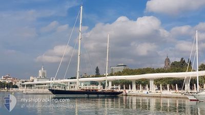
SY THALIA
Sailing
Current Trip
| Trip Time | --- |
|---|---|
| Trip Distance | --- |
| AVG Speed | --- |
| MAX Speed | --- |
| Осадка | --- |
| AVG Wind | --- |
| MAX Wind | --- |
| MIN Temp | --- |
| MAX Temp | --- |
| Позиция Получена | 3 h, 31 m тому назад |
Current Position
| Долгота | -61.76410° |
|---|---|
| Широта | 17.00679° |
| Статус | Moored |
| Скорость | |
| Курс | --- |
| Район | Caribbean Sea |
| Станция | T-AIS |
| Позиция Получена | 3 h, 31 m тому назад |
Info
Information
The current position of SY THALIA is in Caribbean Sea with coordinates 17.00679° / -61.76410° as reported on 2024-05-11 22:47 by AIS to our vessel tracker app. The vessel's current speed is 0 Узлы and is currently inside the port of ENGLISH HARBOUR.
The vessel SY THALIA (MMSI: 319929000) is a Sailing It's sailing under the flag of [KY] Cayman Is.
In this page you can find informations about the vessels current position, last detected port calls, and current voyage information. If the vessels is not in coverage by AIS you will find the latest position.
The current position of SY THALIA is detected by our AIS receivers and we are not responsible for the reliability of the data. The last position was recorded while the vessel was in Coverage by the Ais receivers of our vessel tracking app.
The current draught of SY THALIA as reported by AIS is 4.7 meters
Weather
| Temperature | 28.2°C / 82.76°F |
|---|---|
| Wind Speed | 9 knots |
| Direction | 109° ESE |
| Pressure | 1013 hPa |
| Humidity | 74.6 % |
| Cloud Coverage | --- |
Featured Company
Last Trips
| Origin | Departure | Destination | Arrival | Distance | |
|---|---|---|---|---|---|
| 2024-04-09 10:34 | 2024-04-27 13:34 | 346.91 морская миля | |||
| 2024-04-08 11:45 | 2024-04-09 10:15 | 4.44 морская миля | |||
| 2024-04-03 09:25 | 2024-04-08 11:41 | 116.19 морская миля | |||
| 2024-01-31 12:59 | 2024-04-02 17:58 | 79.86 морская миля |
Events
| Время | Событие | Детали | Позиция / Направление | Информация |
|---|---|---|---|---|
| 2024-05-11 22:47 | Вне покрытия |
17.00679 / -61.76410
Caribbean Sea
[AG] ENGLISH HARBOUR
|
Скорость: Курс: 11.9° |
|
| 2024-05-11 21:14 | В покрытии |
17.00680 / -61.76410
Caribbean Sea
[AG] ENGLISH HARBOUR
|
Скорость: 0.1 kn Курс: 313.3° |
|
| 2024-05-11 20:02 | Вне покрытия |
17.00680 / -61.76411
Caribbean Sea
[AG] ENGLISH HARBOUR
|
Скорость: Курс: 285.8° |
|
| 2024-05-11 18:17 | В покрытии |
17.00680 / -61.76411
Caribbean Sea
[AG] ENGLISH HARBOUR
|
Скорость: 0.1 kn Курс: 148.8° |
|
| 2024-05-10 19:19 | Вне покрытия |
16.99787 / -61.77114
Caribbean Sea
|
Скорость: 9.1 kn Курс: 84.9° |
|
| 2024-05-10 18:50 | Начало движения | 3.68 nm, West of FALMOUTH |
17.00787 / -61.83740
NASSAU
|
Скорость: 7 kn Курс: 212.9° |
| 2024-05-10 18:44 | Статус изменился | Under way using engine At anchor |
17.00989 / -61.83654
NASSAU
|
Скорость: 0.3 kn Курс: 511° |
| 2024-05-10 18:26 | Статус изменился | At anchor Under way using engine |
17.01002 / -61.83640
NASSAU
|
Скорость: 2.3 kn Курс: 511° |
| 2024-05-10 18:26 | Окончание движения | 3.6 nm, West of FALMOUTH |
17.01002 / -61.83640
NASSAU
|
Скорость: 0.3 kn Курс: 511° |
| 2024-05-10 17:15 | В покрытии |
17.00020 / -61.89229
Caribbean Sea
|
Скорость: 9 kn Курс: 87.1° |