

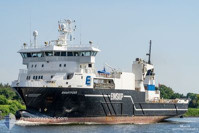
SVARTFOSS
Reefer

Current Trip
| Time Travelled | 22 h, 22 mins |
|---|---|
| Remaining Time | 1 day |
| Distance Travelled | 212.98 морская миля |
| Remaining Distance | 559.93 морская миля |
| AVG Speed | 12.6 Узлы |
| MAX Speed | 14.5 Узлы |
| AVG Wind | 18.8 knots |
| MAX Wind | 33.2 knots |
| MIN Temp | 3.6°C / 38.48°F |
| MAX Temp | 7.1°C / 44.78°F |
| Осадка | 5.2 м |
| Позиция Получена | Сейчас |
Current Position
| Долгота | --- |
|---|---|
| Широта | --- |
| Статус | Under way using engine |
| Скорость | 1 Узлы |
| Курс | 264° |
| Район | Norwegian Sea |
| Станция | T-AIS |
| Позиция Получена | Сейчас |
Information
The current position of SVARTFOSS is in Norwegian Sea with coordinates 62.48237° / 6.18859° as reported on 2025-03-27 15:13 by AIS to our vessel tracker app. The vessel's current speed is 1 Узлы and is heading at the port of TROMSO. The estimated time of arrival as calculated by MyShipTracking vessel tracking app is 2025-03-29 04:32 LT
The vessel SVARTFOSS (IMO: 9323089, MMSI: 257315000) is a Reefer that was built in 2005 ( 20 лет ). It's sailing under the flag of [NO] Norway.
In this page you can find informations about the vessels current position, last detected port calls, and current voyage information. If the vessels is not in coverage by AIS you will find the latest position.
The current position of SVARTFOSS is detected by our AIS receivers and we are not responsible for the reliability of the data. The last position was recorded while the vessel was in Coverage by the Ais receivers of our vessel tracking app.
The current draught of SVARTFOSS as reported by AIS is 5.2 meters
Weather
| Temperature | 4.9°C / 40.82°F |
|---|---|
| Wind Speed | 13 knots |
| Direction | 197° SSW |
| Pressure | 1002.4 hPa |
| Humidity | 91.9 % |
| Cloud Coverage | 100 % |


Featured Company
Last Port Calls
| Port | Arrival | Departure | Time In Port |
|---|---|---|---|
| 2025-03-26 16:23 | 2025-03-26 17:52 | 1 h | |
| 2025-03-25 22:10 | 2025-03-25 23:59 | 1 h | |
| 2025-03-25 19:38 | 2025-03-25 20:07 | 29 m | |
| 2025-03-25 13:26 | 2025-03-25 16:49 | 3 h | |
| 2025-03-25 11:17 | 2025-03-25 11:58 | 41 m | |
| 2025-03-24 19:41 | 2025-03-24 20:02 | 21 m | |
| 2025-03-23 06:35 | 2025-03-23 08:39 | 2 h | |
| 2025-03-23 02:37 | 2025-03-23 03:30 | 52 m | |
| 2025-03-22 22:55 | 2025-03-23 00:34 | 1 h | |
| 2025-03-22 00:57 | 2025-03-22 15:53 | 14 h |
Last Trips
| Origin | Departure | Destination | Arrival | Distance | |
|---|---|---|---|---|---|
| 2025-03-25 23:59 | 2025-03-26 16:23 | 215.43 морская миля | |||
| 2025-03-25 20:07 | 2025-03-25 22:10 | 28.14 морская миля | |||
| 2025-03-25 16:49 | 2025-03-25 19:38 | 35.54 морская миля | |||
| 2025-03-25 11:58 | 2025-03-25 13:26 | 20.08 морская миля | |||
| 2025-03-24 20:02 | 2025-03-25 11:17 | 120.72 морская миля | |||
| 2025-03-23 08:39 | 2025-03-24 19:41 | 124.84 морская миля | |||
| 2025-03-23 03:30 | 2025-03-23 06:35 | 38.56 морская миля | |||
| 2025-03-23 00:34 | 2025-03-23 02:37 | 26.82 морская миля | |||
| 2025-03-22 15:53 | 2025-03-22 22:55 | 93.14 морская миля | |||
| 2025-03-21 18:00 | 2025-03-22 00:57 | 84.69 морская миля |
Events
| Время | Событие | Детали | Позиция / Направление | Информация |
|---|---|---|---|---|
| 2025-03-27 15:09 | Начало движения | 1.57 nm, North East of ALESUND |
62.48166 / 6.19487
TROMSOE
|
Скорость: 5.6 kn Курс: 22.8° |
| 2025-03-27 10:52 | Окончание движения | 1.43 nm, North East of ALESUND |
62.48060 / 6.19058
TROMSOE
|
Скорость: Курс: 268° |
| 2025-03-27 02:23 | Начало движения | 6.73 nm, South East of FILLAN |
63.51263 / 9.11285
TROMSOE
|
Скорость: 4.2 kn Курс: 214° |
| 2025-03-27 01:06 | Окончание движения | 6.59 nm, South East of FILLAN |
63.51518 / 9.11182
TROMSOE
|
Скорость: 0.3 kn Курс: 23° |
| 2025-03-26 16:52 | ПОРТ ОТПРАВЛЕНИЯ |
|
64.85140 / 11.21991
TROMSOE
|
Скорость: 10.8 kn Курс: 227° |
| 2025-03-26 16:50 | Начало движения |
64.85602 / 11.23132
[NO] ROERVIK
|
Скорость: 10.8 kn Курс: 227° |
|
| 2025-03-26 15:23 | Окончание движения |
64.86101 / 11.24185
[NO] ROERVIK
|
Скорость: 0.1 kn Курс: 41° |
|
| 2025-03-26 15:23 | Порт |
|
64.86101 / 11.24185
[NO] ROERVIK
|
Скорость: 0.6 kn Курс: 40° |
| 2025-03-25 22:59 | ПОРТ ОТПРАВЛЕНИЯ |
|
68.12021 / 13.58510
TROMSOE
|
Скорость: 7.4 kn Курс: 163° |
| 2025-03-25 22:57 | Начало движения |
68.12480 / 13.57362
[NO] LEKNES
|
Скорость: 7.4 kn Курс: 163° |