
STRATEGIC SYNERGY
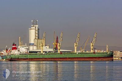
Bulk Carrier
Current Trip
| Time Travelled | 26 days |
|---|---|
| Remaining Time | 22 days |
| Distance Travelled | 7466.73 морская миля |
| Remaining Distance | 5543.51 морская миля |
| AVG Speed | 11.2 Узлы |
| MAX Speed | 11.2 Узлы |
| AVG Wind | 12.1 knots |
| MAX Wind | 35 knots |
| MIN Temp | 12.8°C / 55.04°F |
| MAX Temp | 29.6°C / 85.28°F |
| Осадка | 10.9 м |
| Позиция Получена | 6 d тому назад |
Current Position
| Долгота | -1.79847° |
|---|---|
| Широта | -12.79915° |
| Статус | Under way using engine |
| Скорость | 12.3 Узлы |
| Курс | 145.2° |
| Район | South Atlantic Ocean |
| Станция | T-AIS |
| Позиция Получена | 6 d тому назад |
Info
Information
The current position of STRATEGIC SYNERGY is in South Atlantic Ocean with coordinates -12.79915° / -1.79847° as reported on 2024-04-20 11:07 by AIS to our vessel tracker app. The vessel's current speed is 12.3 Узлы and is heading at the port of SINGAPORE. The estimated time of arrival as calculated by MyShipTracking vessel tracking app is 2024-05-19 16:14 LT
The vessel STRATEGIC SYNERGY (IMO: 9648087, MMSI: 563935000) is a Bulk Carrier that was built in 2014 ( 10 лет ). It's sailing under the flag of [SG] Singapore.
In this page you can find informations about the vessels current position, last detected port calls, and current voyage information. If the vessels is not in coverage by AIS you will find the latest position.
The current position of STRATEGIC SYNERGY is detected by our AIS receivers and we are not responsible for the reliability of the data. The last position was recorded while the vessel was in Coverage by the Ais receivers of our vessel tracking app.
The current draught of STRATEGIC SYNERGY as reported by AIS is 10.9 meters
Weather
| Temperature | 18.1°C / 64.58°F |
|---|---|
| Wind Speed | 27 knots |
| Direction | 87° E |
| Pressure | 1022.5 hPa |
| Humidity | 78.3 % |
| Cloud Coverage | --- |
Featured Company
Most Visited Ports (Last year)
| Port | Arrivals | |
|---|---|---|
| 5 | ||
| 4 | ||
| 2 | ||
| 2 | ||
| 1 | ||
| 1 |
Last Trips
| Origin | Departure | Destination | Arrival | Distance | |
|---|---|---|---|---|---|
| 2024-03-23 05:53 | 2024-03-26 15:43 | 710.91 морская миля | |||
| 2024-02-27 18:17 | 2024-03-13 20:48 | 3123.03 морская миля | |||
| 2024-02-21 07:23 | 2024-02-21 20:58 | 120.57 морская миля | |||
| 2024-01-30 02:04 | 2024-02-11 06:41 | 3286.42 морская миля |
Events
| Время | Событие | Детали | Позиция / Направление | Информация |
|---|---|---|---|---|
| 2024-04-20 11:14 | Статус изменился | Default Under way using engine |
-12.81833 / -1.78333
SG SIN
|
Скорость: 12.3 kn Курс: 145.2° |
| 2024-04-20 11:07 | Вне покрытия |
-12.79915 / -1.79847
South Atlantic Ocean
SG SIN
|
Скорость: 12.3 kn Курс: 145.2° |
|
| 2024-04-20 10:31 | Обнаружено в море | High seas of the South Atlantic Ocean |
-12.69937 / -1.87564
South Atlantic Ocean
SG SIN
|
Скорость: 12.6 kn Курс: 145.1° |
| 2024-04-20 10:29 | Статус изменился | Under way using engine Default |
-12.69335 / -1.88030
SG SIN
|
Скорость: 12.4 kn Курс: 140° |
| 2024-04-20 10:29 | В покрытии |
-12.69937 / -1.87564
South Atlantic Ocean
SG SIN
|
Скорость: 12.6 kn Курс: 145.1° |