
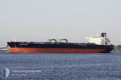
STI SOLIDARITY
Tanker
Current Trip
| Time Travelled | 10 days |
|---|---|
| Remaining Time | --- |
| Distance Travelled | 1953.17 морская миля |
| Remaining Distance | --- |
| AVG Speed | 10.6 Узлы |
| MAX Speed | 13.8 Узлы |
| AVG Wind | 6.8 knots |
| MAX Wind | 23.7 knots |
| MIN Temp | 23.6°C / 74.48°F |
| MAX Temp | 31°C / 87.8°F |
| Осадка | 8.9 м |
| Позиция Получена | 2 m тому назад |
Current Position
| Долгота | 56.53357° |
|---|---|
| Широта | 25.33776° |
| Статус | At anchor |
| Скорость | 0.1 Узлы |
| Курс | 69° |
| Район | Gulf of Oman |
| Станция | T-AIS |
| Позиция Получена | 2 m тому назад |
Info
Information
The current position of STI SOLIDARITY is in Gulf of Oman with coordinates 25.33776° / 56.53357° as reported on 2024-05-03 13:19 by AIS to our vessel tracker app. The vessel's current speed is 0.1 Узлы
The vessel STI SOLIDARITY (IMO: 9708576, MMSI: 538006076) is a Tanker It's sailing under the flag of [MH] Marshall Is.
In this page you can find informations about the vessels current position, last detected port calls, and current voyage information. If the vessels is not in coverage by AIS you will find the latest position.
The current position of STI SOLIDARITY is detected by our AIS receivers and we are not responsible for the reliability of the data. The last position was recorded while the vessel was in Coverage by the Ais receivers of our vessel tracking app.
The current draught of STI SOLIDARITY as reported by AIS is 8.9 meters
Weather
| Temperature | 30.6°C / 87.08°F |
|---|---|
| Wind Speed | 17 knots |
| Direction | 285° WNW |
| Pressure | 1005.9 hPa |
| Humidity | 48.8 % |
| Cloud Coverage | --- |
Featured Company
Last Port Calls
| Port | Arrival | Departure | Time In Port |
|---|---|---|---|
| 2024-04-20 10:29 | 2024-04-23 12:54 | 3 d | |
| 2024-03-30 01:19 | 2024-04-03 03:53 | 4 d | |
| 2024-03-27 20:49 | 2024-03-29 00:23 | 1 d |
Most Visited Ports (Last year)
| Port | Arrivals | |
|---|---|---|
| 3 | ||
| 2 | ||
| 1 | ||
| 1 | ||
| 1 | ||
| 1 |
Events
| Время | Событие | Детали | Позиция / Направление | Информация |
|---|---|---|---|---|
| 2024-05-03 08:58 | Статус изменился | At anchor Default |
25.33760 / 56.53746
KHOR FAKKAN
|
Скорость: 0.1 kn Курс: 326° |
| 2024-05-03 08:55 | Статус изменился | Default At anchor |
25.33760 / 56.53742
KHOR FAKKAN
|
Скорость: 0.1 kn Курс: 329° |
| 2024-05-03 01:01 | Статус изменился | At anchor Default |
25.34066 / 56.53740
KHOR FAKKAN
|
Скорость: 0.1 kn Курс: 221° |
| 2024-05-03 00:55 | Статус изменился | Default At anchor |
25.34083 / 56.53716
KHOR FAKKAN
|
Скорость: 0.1 kn Курс: 221° |
| 2024-05-01 11:58 | Статус изменился | At anchor Default |
25.34112 / 56.53548
KHOR FAKKAN
|
Скорость: Курс: 215° |
| 2024-05-01 11:52 | Статус изменился | Default At anchor |
25.34131 / 56.53537
KHOR FAKKAN
|
Скорость: Курс: 219° |
| 2024-05-01 01:07 | Статус изменился | At anchor Default |
25.34145 / 56.53420
KHOR FAKKAN
|
Скорость: Курс: 178° |
| 2024-05-01 01:04 | Статус изменился | Default At anchor |
25.34152 / 56.53432
KHOR FAKKAN
|
Скорость: Курс: 185° |
| 2024-05-01 00:31 | Статус изменился | At anchor Default |
25.34143 / 56.53534
KHOR FAKKAN
|
Скорость: Курс: 202° |
| 2024-05-01 00:28 | Статус изменился | Default At anchor |
25.34145 / 56.53529
KHOR FAKKAN
|
Скорость: Курс: 201° |