
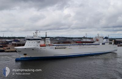
STELLAR MARI
Ro-Ro Cargo
Current Trip
LAVAN ANCHOREG
| Time Travelled | 1 day |
|---|---|
| Remaining Time | --- |
| Distance Travelled | 72.34 морская миля |
| Remaining Distance | --- |
| AVG Speed | 4.7 Узлы |
| MAX Speed | 6 Узлы |
| AVG Wind | 9.9 knots |
| MAX Wind | 12.8 knots |
| MIN Temp | 24.3°C / 75.74°F |
| MAX Temp | 26.2°C / 79.16°F |
| Осадка | 0 м |
| Позиция Получена | 1 d тому назад |
Current Position
| Долгота | --- |
|---|---|
| Широта | --- |
| Статус | Default |
| Скорость | 5.3 Узлы |
| Курс | 275.5° |
| Район | Persian Gulf |
| Станция | T-AIS |
| Позиция Получена | 1 d тому назад |
Info
Information
The current position of STELLAR MARI is in Persian Gulf with coordinates 26.63642° / 53.34047° as reported on 2025-12-10 04:44 by AIS to our vessel tracker app. The vessel's current speed is 5.3 Узлы
The vessel STELLAR MARI (IMO: 9132002, MMSI: 257653000) is a Ro-Ro Cargo that was built in 1998 ( 27 лет ). It's sailing under the flag of [NO] Norway.
In this page you can find informations about the vessels current position, last detected port calls, and current voyage information. If the vessels is not in coverage by AIS you will find the latest position.
The current position of STELLAR MARI is detected by our AIS receivers and we are not responsible for the reliability of the data. The last position was recorded while the vessel was in Coverage by the Ais receivers of our vessel tracking app.
Weather
| Temperature | 26.2°C / 79.16°F |
|---|---|
| Wind Speed | 7 knots |
| Direction | 133° SE |
| Pressure | 1016.5 hPa |
| Humidity | 58.2 % |
| Cloud Coverage | 100 % |
Featured Company
Most Visited Ports (Last year)
| Port | Arrivals | |
|---|---|---|
| 4 |
Events
| Время | Событие | Детали | Позиция / Направление | Информация |
|---|---|---|---|---|
| 2025-12-10 04:44 | Вне покрытия |
26.63642 / 53.34047
Persian Gulf
|
Скорость: 5.3 kn Курс: 275.5° |
|
| 2025-12-10 04:44 | В покрытии |
26.63642 / 53.34047
Persian Gulf
|
Скорость: 5.3 kn Курс: 275.5° |
|
| 2025-12-09 21:26 | Начало движения | 0.53 nm, North of KISH |
26.57954 / 54.00880
LAVAN ANCHOREG
|
Скорость: 3.4 kn Курс: -1° |
| 2025-12-09 21:12 | ПОРТ ОТПРАВЛЕНИЯ |
|
26.57954 / 54.00880
LAVAN ANCHOREG
|
Скорость: 0.2 kn Курс: -1° |
| 2025-12-05 10:04 | Порт |
|
26.56822 / 54.00259
[IR] KISH
|
Скорость: 5.6 kn Курс: 185° |
| 2025-12-04 19:44 | Окончание движения | 2.02 nm, North West of KISH |
26.59166 / 53.97666
LAVAN ANCHOREG
|
Скорость: Курс: -1° |
| 2025-12-03 22:39 | Начало движения |
26.66167 / 52.14667
LAVAN ANCHOREG
|
Скорость: 5 kn Курс: 96° |
|
| 2025-12-01 16:54 | Окончание движения |
26.65667 / 52.13667
LAVAN ANCHOREG
|
Скорость: Курс: -1° |
|
| 2025-12-01 13:12 | Начало движения |
26.55676 / 52.40752
LAVAN ANCHOREG
|
Скорость: 4.2 kn Курс: -1° |
|
| 2025-12-01 13:05 | Окончание движения |
26.55673 / 52.41196
LAVAN ANCHOREG
|
Скорость: 0.2 kn Курс: -1° |