
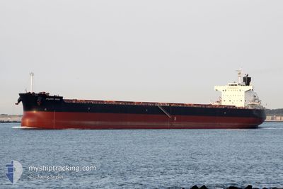
STAR MONA
Cargo
Current Trip
| Time Travelled | 8 days |
|---|---|
| Remaining Time | --- |
| Distance Travelled | 2034.06 морская миля |
| Remaining Distance | --- |
| AVG Speed | 10.6 Узлы |
| MAX Speed | 10.6 Узлы |
| AVG Wind | 6.9 knots |
| MAX Wind | 34.6 knots |
| MIN Temp | 25.3°C / 77.54°F |
| MAX Temp | 29.8°C / 85.64°F |
| Осадка | 10 м |
| Позиция Получена | 5 d тому назад |
Current Position
| Долгота | 56.99706° |
|---|---|
| Широта | 24.67753° |
| Статус | Under way using engine |
| Скорость | 11.5 Узлы |
| Курс | 135.5° |
| Район | Gulf of Oman |
| Станция | T-AIS |
| Позиция Получена | 5 d тому назад |
Info
Information
The current position of STAR MONA is in Gulf of Oman with coordinates 24.67753° / 56.99706° as reported on 2024-05-02 00:27 by AIS to our vessel tracker app. The vessel's current speed is 11.5 Узлы and is heading at the port of NEW ORLEANS. The estimated time of arrival as calculated by MyShipTracking vessel tracking app is 2024-06-14 13:00 LT
The vessel STAR MONA (IMO: 9518062, MMSI: 319125100) is a Cargo It's sailing under the flag of [KY] Cayman Is.
In this page you can find informations about the vessels current position, last detected port calls, and current voyage information. If the vessels is not in coverage by AIS you will find the latest position.
The current position of STAR MONA is detected by our AIS receivers and we are not responsible for the reliability of the data. The last position was recorded while the vessel was in Coverage by the Ais receivers of our vessel tracking app.
The current draught of STAR MONA as reported by AIS is 10 meters
Weather
| Temperature | 29°C / 84.2°F |
|---|---|
| Wind Speed | 3 knots |
| Direction | 3° N |
| Pressure | 1009.2 hPa |
| Humidity | 72.1 % |
| Cloud Coverage | 100 % |
Featured Company
Last Port Calls
| Port | Arrival | Departure | Time In Port |
|---|---|---|---|
| 2024-04-23 13:22 | 2024-04-28 01:59 | 4 d | |
| 2024-04-06 09:08 | 2024-04-17 12:10 | 11 d | |
| 2024-03-29 13:38 | 2024-04-06 09:05 | 7 d |
Most Visited Ports (Last year)
| Port | Arrivals | |
|---|---|---|
| 2 | ||
| 1 | ||
| 1 | ||
| 1 | ||
| 1 | ||
| 1 |
Last Trips
| Origin | Departure | Destination | Arrival | Distance | |
|---|---|---|---|---|---|
| 2024-04-17 16:40 | 2024-04-23 16:22 | 744.42 морская миля | |||
| 2024-04-06 13:35 | 2024-04-06 13:38 | 0.68 морская миля |
Events
| Время | Событие | Детали | Позиция / Направление | Информация |
|---|---|---|---|---|
| 2024-05-02 00:32 | Статус изменился | Default Under way using engine |
24.66443 / 57.01098
US MSY
|
Скорость: 11.5 kn Курс: 135.5° |
| 2024-05-02 00:27 | Вне покрытия |
24.67753 / 56.99706
Gulf of Oman
|
Скорость: 11.5 kn Курс: 135.5° |
|
| 2024-05-01 22:06 | ETA изменился | 2024/06/14 13:00 2024/06/14 12:00 |
25.01784 / 56.67797
US MSY
|
Скорость: 11.7 kn Курс: 149.8° |
| 2024-05-01 22:02 | Обнаружено в море | Omani part of the Gulf of Oman |
25.02916 / 56.67076
Gulf of Oman
|
Скорость: 11.6 kn Курс: 149.8° |
| 2024-05-01 20:41 | Начало движения | 9.71 nm, East of FUJAIRAH |
25.17938 / 56.53941
US MSY
|
Скорость: 5.3 kn Курс: 119.6° |
| 2024-05-01 20:37 | Статус изменился | Under way using engine At anchor |
25.18164 / 56.53520
US MSY
|
Скорость: 0.9 kn Курс: 145° |
| 2024-05-01 20:33 | ETA изменился | 2024/06/14 12:00 2024/06/14 10:00 |
25.18245 / 56.53544
US MSY
|
Скорость: 0.1 kn Курс: 167° |
| 2024-05-01 20:27 | ETA изменился | 2024/06/14 10:00 2025/04/30 10:00 |
25.18260 / 56.53582
US MSY
|
Скорость: 0.3 kn Курс: 176° |
| 2024-05-01 20:25 | Пункт назначения изменился | US MSY NOLA USA |
25.18280 / 56.53613
US MSY
|
Скорость: 0.4 kn Курс: 181° |
| 2024-05-01 19:14 | Пункт назначения изменился | NOLA USA N |
25.18335 / 56.53605
NOLA USA
|
Скорость: Курс: 159° |