
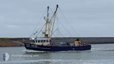
ST22 PEKE SENIOR
Not available
Current Trip
Unknown
| Time Travelled | 1 day |
|---|---|
| Remaining Time | --- |
| Distance Travelled | 65.59 морская миля |
| Remaining Distance | --- |
| AVG Speed | 5.7 Узлы |
| MAX Speed | 11.3 Узлы |
| AVG Wind | 16.7 knots |
| MAX Wind | 20 knots |
| MIN Temp | 3.4°C / 38.12°F |
| MAX Temp | 6°C / 42.8°F |
| Осадка | 1.5 м |
| Позиция Получена | Сейчас |
Current Position
| Долгота | --- |
|---|---|
| Широта | --- |
| Статус | Engaged in Fishing |
| Скорость | |
| Курс | --- |
| Район | North Sea |
| Станция | T-AIS |
| Позиция Получена | Сейчас |
Info
Information
The current position of ST22 PEKE SENIOR is in North Sea with coordinates 53.23486° / 5.28314° as reported on 2025-03-18 01:58 by AIS to our vessel tracker app. The vessel's current speed is 0 Узлы
The vessel ST22 PEKE SENIOR (MMSI: 245408000) is a Not available It's sailing under the flag of [NL] Netherlands.
In this page you can find informations about the vessels current position, last detected port calls, and current voyage information. If the vessels is not in coverage by AIS you will find the latest position.
The current position of ST22 PEKE SENIOR is detected by our AIS receivers and we are not responsible for the reliability of the data. The last position was recorded while the vessel was in Coverage by the Ais receivers of our vessel tracking app.
The current draught of ST22 PEKE SENIOR as reported by AIS is 1.5 meters
Weather
| Temperature | 3°C / 37.4°F |
|---|---|
| Wind Speed | 12 knots |
| Direction | 105° ESE |
| Pressure | 1031.6 hPa |
| Humidity | 59.3 % |
| Cloud Coverage | --- |
Featured Company
Last Port Calls
| Port | Arrival | Departure | Time In Port |
|---|---|---|---|
| 2025-03-17 00:04 | |||
| 2025-02-26 08:01 | 2025-02-26 08:35 | 33 m | |
| 2025-02-24 05:13 | 2025-02-24 05:46 | 32 m | |
| 2025-02-05 14:36 | 2025-02-05 15:13 | 36 m | |
| 2025-01-28 09:34 | 2025-01-28 09:53 | 18 m | |
| 2025-01-21 11:19 | 2025-01-22 09:40 | 22 h | |
| 2025-01-17 11:37 | 2025-01-19 20:02 | 2 d | |
| 2025-01-15 09:57 | 2025-01-15 10:22 | 25 m | |
| 2025-01-12 22:04 |
Last Trips
| Origin | Departure | Destination | Arrival | Distance | |
|---|---|---|---|---|---|
| 2025-02-24 05:46 | 2025-02-26 08:01 | 82.07 морская миля | |||
| 2025-02-05 15:13 | 2025-02-24 05:13 | 14.82 морская миля | |||
| 2025-01-28 09:53 | 2025-02-05 14:36 | 133.45 морская миля | |||
| 2025-01-22 09:40 | 2025-01-28 09:34 | 126.59 морская миля | |||
| 2025-01-19 20:02 | 2025-01-21 11:19 | 96.85 морская миля | |||
| 2025-01-15 10:22 | 2025-01-17 11:37 | 17.54 морская миля | |||
| 2025-01-12 22:04 | 2025-01-15 09:57 | 177.13 морская миля |
Events
| Время | Событие | Детали | Позиция / Направление | Информация |
|---|---|---|---|---|
| 2025-03-17 23:41 | Окончание движения | 6.12 nm, North West of HARLINGEN |
53.23484 / 5.28422
|
Скорость: 0.2 kn Курс: 511° |
| 2025-03-17 23:18 | В покрытии |
53.19655 / 5.30764
North Sea
|
Скорость: 6.7 kn Курс: 311° |
|
| 2025-03-17 21:23 | Вне покрытия |
53.19292 / 5.31328
North Sea
|
Скорость: 7.3 kn Курс: 127.7° |
|
| 2025-03-17 18:30 | Начало движения | 5.12 nm, South East of VLIELAND |
53.24240 / 5.19413
|
Скорость: 4.5 kn Курс: 248.6° |
| 2025-03-17 14:07 | Окончание движения | 5.18 nm, South East of VLIELAND |
53.24313 / 5.19697
|
Скорость: 0.2 kn Курс: 511° |
| 2025-03-17 07:21 | Начало движения | 7.07 nm, North West of HARLINGEN |
53.23269 / 5.25136
|
Скорость: 5.6 kn Курс: 259° |
| 2025-03-17 07:11 | Окончание движения | 6.4 nm, North West of HARLINGEN |
53.23183 / 5.27208
|
Скорость: 0.1 kn Курс: 511° |
| 2025-03-17 00:11 | В покрытии |
53.04812 / 5.34607
North Sea
|
Скорость: 8.4 kn Курс: 352.3° |
|
| 2025-03-16 23:04 | ПОРТ ОТПРАВЛЕНИЯ |
|
53.04620 / 5.34609
|
Скорость: Курс: 511° |
| 2025-03-14 13:43 | Вне покрытия |
52.88697 / 5.35908
North Sea
[NL] STAVOREN
|
Скорость: Курс: 64.1° |