
ST GEORGE
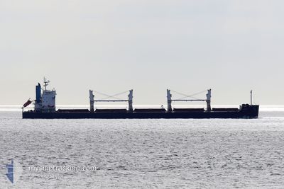
Bulk Carrier
Current Trip
| Time Travelled | 14 days |
|---|---|
| Remaining Time | 1 day |
| Distance Travelled | 3772.41 морская миля |
| Remaining Distance | 350.49 морская миля |
| AVG Speed | 11.4 Узлы |
| MAX Speed | 14.5 Узлы |
| AVG Wind | 11.6 knots |
| MAX Wind | 24.3 knots |
| MIN Temp | 16.5°C / 61.7°F |
| MAX Temp | 30.9°C / 87.62°F |
| Осадка | 6.5 м |
| Позиция Получена | 2 d тому назад |
Current Position
| Долгота | 118.78767° |
|---|---|
| Широта | -35.40398° |
| Статус | Under way using engine |
| Скорость | 10.9 Узлы |
| Курс | 93.8° |
| Район | Great Australian Bight |
| Станция | T-AIS |
| Позиция Получена | 2 d тому назад |
Info
Information
The current position of ST GEORGE is in Great Australian Bight with coordinates -35.40398° / 118.78767° as reported on 2024-05-02 06:10 by AIS to our vessel tracker app. The vessel's current speed is 10.9 Узлы and is heading at the port of WHYALLA. The estimated time of arrival as calculated by MyShipTracking vessel tracking app is 2024-05-06 01:24 LT
The vessel ST GEORGE (IMO: 9500663, MMSI: 538006811) is a Bulk Carrier that was built in 2012 ( 12 лет ). It's sailing under the flag of [MH] Marshall Is.
In this page you can find informations about the vessels current position, last detected port calls, and current voyage information. If the vessels is not in coverage by AIS you will find the latest position.
The current position of ST GEORGE is detected by our AIS receivers and we are not responsible for the reliability of the data. The last position was recorded while the vessel was in Coverage by the Ais receivers of our vessel tracking app.
The current draught of ST GEORGE as reported by AIS is 6.5 meters
Weather
| Temperature | 17°C / 62.6°F |
|---|---|
| Wind Speed | 12 knots |
| Direction | 59° ENE |
| Pressure | 1024.4 hPa |
| Humidity | 66.6 % |
| Cloud Coverage | 31 % |
Featured Company
Events
| Время | Событие | Детали | Позиция / Направление | Информация |
|---|---|---|---|---|
| 2024-05-02 06:15 | Статус изменился | Default Under way using engine |
-35.40333 / 118.80500
WHYALLA,AUSTRALIA
|
Скорость: 10.9 kn Курс: 93.8° |
| 2024-05-02 06:10 | Вне покрытия |
-35.40398 / 118.78767
Great Australian Bight
WHYALLA,AUSTRALIA
|
Скорость: 10.9 kn Курс: 93.8° |
|
| 2024-05-02 04:53 | Изменение морского района | Australian part of the Great Australian Bight Australian part of the Indian Ocean |
-35.39732 / 118.49139
Great Australian Bight
WHYALLA,AUSTRALIA
|
Скорость: 11 kn Курс: 87.1° |
| 2024-05-01 22:08 | ETA изменился | 2024/05/05 11:30 2024/05/04 08:30 |
-35.52566 / 116.88417
WHYALLA,AUSTRALIA
|
Скорость: 12.4 kn Курс: 83.4° |
| 2024-05-01 21:54 | Статус изменился | Under way using engine Default |
-35.53173 / 116.82622
WHYALLA,AUSTRALIA
|
Скорость: 12.3 kn Курс: 84° |
| 2024-05-01 21:54 | В покрытии |
-35.53173 / 116.82622
Indian Ocean
WHYALLA,AUSTRALIA
|
Скорость: 12.5 kn Курс: 82° |
|
| 2024-04-28 12:59 | Статус изменился | Default Under way using engine |
-20.94014 / 113.53899
WHYALLA,AUSTRALIA
|
Скорость: 11.9 kn Курс: 188.6° |
| 2024-04-28 12:52 | Статус изменился | Under way using engine Default |
-20.91631 / 113.54296
WHYALLA,AUSTRALIA
|
Скорость: 12 kn Курс: 188° |
| 2024-04-28 12:52 | Вне покрытия |
-20.91631 / 113.54296
Indian Ocean
WHYALLA,AUSTRALIA
|
Скорость: 11.9 kn Курс: 188.6° |
|
| 2024-04-28 12:39 | Статус изменился | Default Under way using engine |
-20.87380 / 113.54999
WHYALLA,AUSTRALIA
|
Скорость: 11.9 kn Курс: 189.3° |