
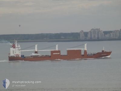
SNOEKGRACHT
General Cargo
Current Trip
| Time Travelled | 1 day |
|---|---|
| Remaining Time | 1 day |
| Distance Travelled | 656.17 морская миля |
| Remaining Distance | 330.00 морская миля |
| AVG Speed | 15.6 Узлы |
| MAX Speed | 18 Узлы |
| AVG Wind | 9.9 knots |
| MAX Wind | 24 knots |
| MIN Temp | 15.4°C / 59.72°F |
| MAX Temp | 18.9°C / 66.02°F |
| Осадка | 7.1 м |
| Позиция Получена | 58 m тому назад |
Current Position
| Долгота | 17.33924° |
|---|---|
| Широта | 41.52137° |
| Статус | Under way using engine |
| Скорость | 13.1 Узлы |
| Курс | 312.2° |
| Район | Adriatic Sea |
| Станция | T-AIS |
| Позиция Получена | 58 m тому назад |
Info
Information
The current position of SNOEKGRACHT is in Adriatic Sea with coordinates 41.52137° / 17.33924° as reported on 2024-05-10 01:47 by AIS to our vessel tracker app. The vessel's current speed is 13.1 Узлы and is heading at the port of VENEZIA. The estimated time of arrival as calculated by MyShipTracking vessel tracking app is 2024-05-11 03:12 LT
The vessel SNOEKGRACHT (IMO: 9202546, MMSI: 245816000) is a General Cargo that was built in 2000 ( 24 лет ). It's sailing under the flag of [NL] Netherlands.
In this page you can find informations about the vessels current position, last detected port calls, and current voyage information. If the vessels is not in coverage by AIS you will find the latest position.
The current position of SNOEKGRACHT is detected by our AIS receivers and we are not responsible for the reliability of the data. The last position was recorded while the vessel was in Coverage by the Ais receivers of our vessel tracking app.
The current draught of SNOEKGRACHT as reported by AIS is 7.1 meters
Weather
| Temperature | 18.8°C / 65.84°F |
|---|---|
| Wind Speed | 4 knots |
| Direction | 54° NE |
| Pressure | 1012.6 hPa |
| Humidity | 74.3 % |
| Cloud Coverage | 100 % |
Featured Company
Last Port Calls
| Port | Arrival | Departure | Time In Port |
|---|---|---|---|
| 2024-05-05 13:40 | 2024-05-08 07:01 | 2 d | |
| 2024-04-30 03:05 | 2024-04-30 21:18 | 18 h | |
| 2024-04-16 04:21 | 2024-04-17 02:48 | 22 h | |
| 2024-04-13 01:56 | 2024-04-14 13:22 | 1 d | |
| 2024-04-07 22:08 | 2024-04-09 18:35 | 1 d | |
| 2024-04-04 22:39 | 2024-04-05 22:51 | 1 d | |
| 2024-03-30 12:59 | 2024-04-02 05:09 | 2 d | |
| 2024-03-27 17:20 | 2024-03-28 18:49 | 1 d | |
| 2024-03-07 22:19 | 2024-03-09 10:34 | 1 d | |
| 2024-03-03 15:23 | 2024-03-06 19:40 | 3 d |
Most Visited Ports (Last year)
| Port | Arrivals | |
|---|---|---|
| 5 | ||
| 3 | ||
| 3 | ||
| 3 | ||
| 3 | ||
| 3 |
Last Trips
| Origin | Departure | Destination | Arrival | Distance | |
|---|---|---|---|---|---|
| 2024-04-30 22:18 | 2024-05-05 14:40 | 1579.58 морская миля | |||
| 2024-04-16 21:48 | 2024-04-30 04:05 | 4706.56 морская миля | |||
| 2024-04-14 08:22 | 2024-04-15 23:21 | 577.64 морская миля | |||
| 2024-04-09 13:35 | 2024-04-12 20:56 | 810.60 морская миля | |||
| 2024-04-05 16:51 | 2024-04-07 17:08 | 808.35 морская миля | |||
| 2024-04-02 00:09 | 2024-04-04 16:39 | 512.85 морская миля | |||
| 2024-03-28 12:49 | 2024-03-30 07:59 | 653.10 морская миля | |||
| 2024-03-09 11:34 | 2024-03-27 11:20 | 6307.29 морская миля | |||
| 2024-03-06 20:40 | 2024-03-07 23:19 | 388.26 морская миля | |||
| 2024-03-02 17:33 | 2024-03-03 16:23 | 189.46 морская миля |
Events
| Время | Событие | Детали | Позиция / Направление | Информация |
|---|---|---|---|---|
| 2024-05-10 01:53 | Статус изменился | Default Under way using engine |
41.51893 / 17.34280
ITPMA
|
Скорость: 13.1 kn Курс: 312.2° |
| 2024-05-10 01:01 | Статус изменился | Under way using engine Default |
41.40726 / 17.50709
ITPMA
|
Скорость: 13.2 kn Курс: 312° |
| 2024-05-10 01:01 | В покрытии |
41.40893 / 17.50466
Adriatic Sea
ITPMA
|
Скорость: 13.1 kn Курс: 312.4° |
|
| 2024-05-10 00:08 | Статус изменился | Default Under way using engine |
41.27626 / 17.69518
ITPMA
|
Скорость: 13.2 kn Курс: 311.3° |
| 2024-05-09 23:29 | Вне покрытия |
41.18072 / 17.83844
Adriatic Sea
ITPMA
|
Скорость: 13.2 kn Курс: 311.3° |
|
| 2024-05-09 17:19 | Изменение морского района | Italian part of the Adriatic Sea Italian part of the Ionian Sea |
39.97228 / 18.61611
Adriatic Sea
ITPMA
|
Скорость: 16.7 kn Курс: 9.9° |
| 2024-05-09 17:18 | Статус изменился | Under way using engine Default |
39.96950 / 18.61548
ITPMA
|
Скорость: 16.7 kn Курс: 9° |
| 2024-05-09 17:18 | В покрытии |
39.97228 / 18.61611
Adriatic Sea
ITPMA
|
Скорость: 16.7 kn Курс: 9.9° |
|
| 2024-05-09 12:21 | Вне покрытия |
38.78514 / 17.61530
Ionian Sea
ITPMA
|
Скорость: 17.2 kn Курс: 35.8° |
|
| 2024-05-09 12:21 | В покрытии |
38.78514 / 17.61530
Ionian Sea
ITPMA
|
Скорость: 17.2 kn Курс: 35.8° |