
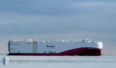
SIEM CONFUCIUS
Cargo
Current Trip
MXVER
| Time Travelled | 10 days |
|---|---|
| Remaining Time | --- |
| Distance Travelled | 3097.71 морская миля |
| Remaining Distance | --- |
| AVG Speed | 14.3 Узлы |
| MAX Speed | 18.4 Узлы |
| AVG Wind | 10.5 knots |
| MAX Wind | 21 knots |
| MIN Temp | 16.3°C / 61.34°F |
| MAX Temp | 26.7°C / 80.06°F |
| Осадка | 7.9 м |
| Позиция Получена | 6 d тому назад |
Current Position
| Долгота | --- |
|---|---|
| Широта | --- |
| Статус | Under way using engine |
| Скорость | 6.5 Узлы |
| Курс | 218.1° |
| Район | North Atlantic Ocean |
| Станция | T-AIS |
| Позиция Получена | 6 d тому назад |
Info
Information
The current position of SIEM CONFUCIUS is in North Atlantic Ocean with coordinates 30.39890° / -81.43055° as reported on 2025-02-10 15:03 by AIS to our vessel tracker app. The vessel's current speed is 6.5 Узлы
The vessel SIEM CONFUCIUS (IMO: 9841017, MMSI: 636017540) is a Cargo It's sailing under the flag of [LR] Liberia.
In this page you can find informations about the vessels current position, last detected port calls, and current voyage information. If the vessels is not in coverage by AIS you will find the latest position.
The current position of SIEM CONFUCIUS is detected by our AIS receivers and we are not responsible for the reliability of the data. The last position was recorded while the vessel was in Coverage by the Ais receivers of our vessel tracking app.
The current draught of SIEM CONFUCIUS as reported by AIS is 7.9 meters
Weather
| Temperature | 18.4°C / 65.12°F |
|---|---|
| Wind Speed | 12 knots |
| Direction | 313° NW |
| Pressure | 1023 hPa |
| Humidity | 62 % |
| Cloud Coverage | 19 % |
Featured Company
Last Port Calls
| Port | Arrival | Departure | Time In Port |
|---|---|---|---|
| 2025-02-05 16:36 | 2025-02-06 17:03 | 1 d | |
| 2025-01-29 09:21 | 2025-01-30 03:30 | 18 h | |
| 2025-01-25 20:07 | 2025-01-26 03:02 | 6 h | |
| 2024-12-17 09:59 | 2024-12-17 19:41 | 9 h | |
| 2024-12-09 15:46 | 2024-12-11 04:32 | 1 d | |
| 2024-12-03 13:35 | 2024-12-05 00:54 | 1 d |
Most Visited Ports (Last year)
| Port | Arrivals | |
|---|---|---|
| 8 | ||
| 7 | ||
| 5 | ||
| 5 | ||
| 3 | ||
| 2 |
Last Trips
| Origin | Departure | Destination | Arrival | Distance | |
|---|---|---|---|---|---|
| 2025-01-29 22:30 | 2025-02-05 10:36 | 2007.55 морская миля | |||
| 2025-01-25 23:02 | 2025-01-29 04:21 | 979.68 морская миля | |||
| 2024-12-17 14:41 | 2025-01-25 16:07 | 8789.11 морская миля | |||
| 2024-12-10 22:32 | 2024-12-17 04:59 | 1993.10 морская миля | |||
| 2024-12-04 18:54 | 2024-12-09 09:46 | 624.56 морская миля | |||
| 2024-11-28 21:49 | 2024-12-03 07:35 | 559.52 морская миля |
Events
| Время | Событие | Детали | Позиция / Направление | Информация |
|---|---|---|---|---|
| 2025-02-14 05:52 | Окончание движения |
30.36786 / -63.60515
MXVER
|
Скорость: 0.3 kn Курс: 89° |
|
| 2025-02-11 03:39 | Начало движения | 5.27 nm, North East of JACKSONVILLE |
30.39743 / -81.55004
MXVER
|
Скорость: 3.6 kn Курс: 14° |
| 2025-02-10 16:39 | Окончание движения | 5.77 nm, North East of JACKSONVILLE |
30.40585 / -81.54619
MXVER
|
Скорость: Курс: 17° |
| 2025-02-10 15:03 | Статус изменился | Default Under way using engine |
30.39818 / -81.43119
MXVER
|
Скорость: 6.5 kn Курс: 218.1° |
| 2025-02-10 15:03 | Статус изменился | Under way using engine Default |
30.39890 / -81.43055
MXVER
|
Скорость: 6.4 kn Курс: 254° |
| 2025-02-10 15:03 | Вне покрытия |
30.39890 / -81.43055
North Atlantic Ocean
|
Скорость: 6.5 kn Курс: 218.1° |
|
| 2025-02-10 14:59 | Статус изменился | Default Under way using engine |
30.40291 / -81.42471
MXVER
|
Скорость: 6.8 kn Курс: 276.3° |
| 2025-02-10 14:54 | Статус изменился | Under way using engine Default |
30.40278 / -81.41362
MXVER
|
Скорость: 6.9 kn Курс: 276° |
| 2025-02-10 14:31 | Статус изменился | Default Under way using engine |
30.39564 / -81.34521
MXVER
|
Скорость: 10.1 kn Курс: 225.3° |
| 2025-02-10 14:17 | Статус изменился | Under way using engine Default |
30.41306 / -81.31755
MXVER
|
Скорость: 2 kn Курс: 251° |