

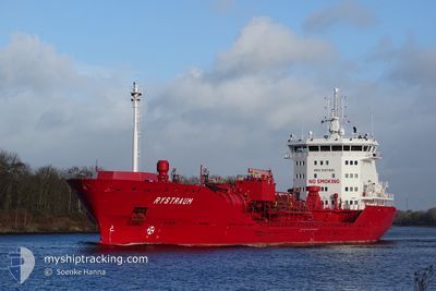
RYSTRAUM
Oil/Chemical Tanker

Current Trip
NOTBO
| Time Travelled | 3 days |
|---|---|
| Remaining Time | --- |
| Distance Travelled | 1010.47 морская миля |
| Remaining Distance | --- |
| AVG Speed | 14 Узлы |
| MAX Speed | 16.7 Узлы |
| AVG Wind | 12.1 knots |
| MAX Wind | 21.8 knots |
| MIN Temp | 2.3°C / 36.14°F |
| MAX Temp | 8.7°C / 47.66°F |
| Осадка | 6 м |
| Позиция Получена | 1 m тому назад |
Current Position
| Долгота | --- |
|---|---|
| Широта | --- |
| Статус | Under way using engine |
| Скорость | 16 Узлы |
| Курс | 0.1° |
| Район | North Sea |
| Станция | T-AIS |
| Позиция Получена | 1 m тому назад |
Information
The current position of RYSTRAUM is in North Sea with coordinates 59.81733° / 4.19508° as reported on 2025-03-27 19:29 by AIS to our vessel tracker app. The vessel's current speed is 16 Узлы
The vessel RYSTRAUM (IMO: 9391000, MMSI: 258858000) is a Oil/Chemical Tanker that was built in 2009 ( 16 лет ). It's sailing under the flag of [NO] Norway.
In this page you can find informations about the vessels current position, last detected port calls, and current voyage information. If the vessels is not in coverage by AIS you will find the latest position.
The current position of RYSTRAUM is detected by our AIS receivers and we are not responsible for the reliability of the data. The last position was recorded while the vessel was in Coverage by the Ais receivers of our vessel tracking app.
The current draught of RYSTRAUM as reported by AIS is 6 meters
Weather
| Temperature | 6.4°C / 43.52°F |
|---|---|
| Wind Speed | 21 knots |
| Direction | 166° SSE |
| Pressure | 1002.2 hPa |
| Humidity | 98.2 % |
| Cloud Coverage | 100 % |


Featured Company
Last Port Calls
| Port | Arrival | Departure | Time In Port |
|---|---|---|---|
| 2025-03-16 12:55 | 2025-03-24 15:23 | 8 d | |
| 2025-02-14 12:08 | 2025-03-16 12:32 | ||
| 2025-02-13 07:17 | |||
| 2025-02-08 18:18 | 2025-02-09 16:54 | 22 h | |
| 2025-02-07 03:17 | 2025-02-08 02:52 | 23 h | |
| 2025-02-02 07:21 | 2025-02-03 04:53 | 21 h | |
| 2025-01-30 15:27 | 2025-01-31 08:37 | 17 h | |
| 2025-01-25 20:59 | 2025-01-26 19:31 | 22 h | |
| 2025-01-23 13:43 | 2025-01-24 08:24 | 18 h | |
| 2025-01-19 23:23 | 2025-01-23 13:37 | 3 d |
Last Trips
| Origin | Departure | Destination | Arrival | Distance | |
|---|---|---|---|---|---|
| 2025-03-16 14:32 | 2025-03-16 14:55 | 0.74 морская миля | |||
| 2025-02-13 09:17 | 2025-02-14 14:08 | 342.14 морская миля | |||
| 2025-02-08 03:52 | 2025-02-08 19:18 | 131.34 морская миля | |||
| 2025-02-03 05:53 | 2025-02-07 04:17 | 1122.44 морская миля | |||
| 2025-01-31 10:37 | 2025-02-02 08:21 | 206.85 морская миля | |||
| 2025-01-26 20:31 | 2025-01-30 17:27 | 1124.08 морская миля | |||
| 2025-01-24 09:24 | 2025-01-25 21:59 | 185.02 морская миля | |||
| 2025-01-23 14:37 | 2025-01-23 14:43 | 0.41 морская миля | |||
| 2025-01-16 08:53 | 2025-01-20 00:23 | 1131.01 морская миля | |||
| 2025-01-14 11:30 | 2025-01-15 12:21 | 310.37 морская миля |
Events
| Время | Событие | Детали | Позиция / Направление | Информация |
|---|---|---|---|---|
| 2025-03-27 11:23 | Статус изменился | Under way using engine Default |
58.12711 / 5.91832
NOTBO
|
Скорость: 14.7 kn Курс: 308° |
| 2025-03-27 11:22 | Статус изменился | Default Under way using engine |
58.12397 / 5.92532
NOTBO
|
Скорость: 14.7 kn Курс: 309.6° |
| 2025-03-27 11:03 | ETA изменился | 2025/03/28 17:00 2025/03/28 19:00 |
58.07391 / 6.03815
NOTBO
|
Скорость: 15.1 kn Курс: 307.6° |
| 2025-03-27 07:51 | Изменение морского района | Norwegian part of the North Sea Norwegian part of the Skaggerak |
57.78000 / 7.36333
North Sea
NOTBO
|
Скорость: 15 kn Курс: 271.3° |
| 2025-03-27 04:02 | Изменение морского района | Norwegian part of the Skaggerak Danish part of the Skaggerak |
57.81478 / 9.07570
Skaggerak
NOTBO
|
Скорость: 14.6 kn Курс: 264.6° |
| 2025-03-26 23:41 | Изменение морского района | Danish part of the Skaggerak Danish part of the Kattegat |
57.80500 / 10.93983
Skaggerak
NOTBO
|
Скорость: 14.1 kn Курс: 318.7° |
| 2025-03-26 23:14 | Изменение морского района | Danish part of the Kattegat Swedish part of the Kattegat |
57.74726 / 11.10479
Kattegat
NOTBO
|
Скорость: 14.4 kn Курс: 300.4° |
| 2025-03-26 21:44 | Начало движения | 3.51 nm, South West of SANDVIK |
57.59652 / 11.67115
NOTBO
|
Скорость: 5.9 kn Курс: 241.2° |
| 2025-03-26 21:39 | Осадка изменилась | 6 5.9 |
57.59716 / 11.67648
NOTBO
|
Скорость: 0.5 kn Курс: 280° |
| 2025-03-26 21:38 | Статус изменился | Under way using engine At anchor |
57.59717 / 11.67650
NOTBO
|
Скорость: 0.5 kn Курс: 285° |