
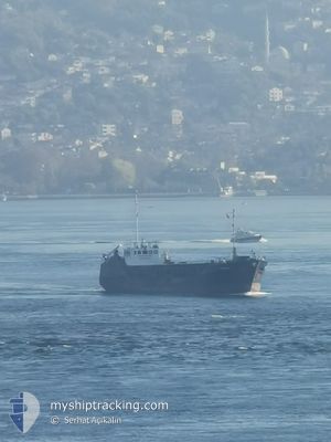
RUSTEM
General Cargo
Current Trip
Unknown
| Time Travelled | --- |
|---|---|
| Remaining Time | --- |
| Distance Travelled | 46.49 морская миля |
| Remaining Distance | --- |
| AVG Speed | 5.5 Узлы |
| MAX Speed | 7 Узлы |
| AVG Wind | 8.8 knots |
| MAX Wind | 14.3 knots |
| MIN Temp | 12.2°C / 53.96°F |
| MAX Temp | 17.6°C / 63.68°F |
| Осадка | 0 м |
| Позиция Получена | 9 d тому назад |
Current Position
| Долгота | --- |
|---|---|
| Широта | --- |
| Статус | Default |
| Скорость | 0.2 Узлы |
| Курс | --- |
| Район | Black Sea |
| Станция | T-AIS |
| Позиция Получена | 9 d тому назад |
Info
Information
The current position of RUSTEM is in Black Sea with coordinates 41.67898° / 32.19498° as reported on 2025-03-07 21:12 by AIS to our vessel tracker app. The vessel's current speed is 0.2 Узлы
The vessel RUSTEM (IMO: 8519954, MMSI: 341654001) is a General Cargo that was built in 1986 ( 39 лет ). It's sailing under the flag of [KN] St Kitts Nevis.
In this page you can find informations about the vessels current position, last detected port calls, and current voyage information. If the vessels is not in coverage by AIS you will find the latest position.
The current position of RUSTEM is detected by our AIS receivers and we are not responsible for the reliability of the data. The last position was recorded while the vessel was in Coverage by the Ais receivers of our vessel tracking app.
Weather
| Temperature | 8.5°C / 47.3°F |
|---|---|
| Wind Speed | 3 knots |
| Direction | 86° E |
| Pressure | 1019.1 hPa |
| Humidity | 80.5 % |
| Cloud Coverage | --- |
Featured Company
Last Port Calls
Last Trips
| Origin | Departure | Destination | Arrival | Distance |
|---|
Events
| Время | Событие | Детали | Позиция / Направление | Информация |
|---|---|---|---|---|
| 2025-03-07 21:12 | Вне покрытия |
41.67898 / 32.19498
Black Sea
|
Скорость: 0.2 kn Курс: 302.5° |