
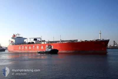
REGGANE
Lpg Tanker
Current Trip
| Time Travelled | 33 days |
|---|---|
| Remaining Time | 13 days |
| Distance Travelled | 10534.27 морская миля |
| Remaining Distance | 4515.86 морская миля |
| AVG Speed | 13.1 Узлы |
| MAX Speed | 13.1 Узлы |
| AVG Wind | 13.2 knots |
| MAX Wind | 29 knots |
| MIN Temp | 12.3°C / 54.14°F |
| MAX Temp | 30.2°C / 86.36°F |
| Осадка | 7.5 м |
| Позиция Получена | 9 d тому назад |
Current Position
| Долгота | 17.97214° |
|---|---|
| Широта | -34.55407° |
| Статус | Under way using engine |
| Скорость | 13.9 Узлы |
| Курс | 286.7° |
| Район | South Atlantic Ocean |
| Станция | T-AIS |
| Позиция Получена | 9 d тому назад |
Info
Information
The current position of REGGANE is in South Atlantic Ocean with coordinates -34.55407° / 17.97214° as reported on 2024-09-06 21:23 by AIS to our vessel tracker app. The vessel's current speed is 13.9 Узлы and is heading at the port of HOUSTON. The estimated time of arrival as calculated by MyShipTracking vessel tracking app is 2024-09-29 14:14 LT
The vessel REGGANE (IMO: 9176357, MMSI: 636011212) is a Lpg Tanker that was built in 1999 ( 25 лет ). It's sailing under the flag of [LR] Liberia.
In this page you can find informations about the vessels current position, last detected port calls, and current voyage information. If the vessels is not in coverage by AIS you will find the latest position.
The current position of REGGANE is detected by our AIS receivers and we are not responsible for the reliability of the data. The last position was recorded while the vessel was in Coverage by the Ais receivers of our vessel tracking app.
The current draught of REGGANE as reported by AIS is 7.5 meters
Weather
| Temperature | 24.9°C / 76.82°F |
|---|---|
| Wind Speed | 16 knots |
| Direction | 117° ESE |
| Pressure | 1017.5 hPa |
| Humidity | 73.6 % |
| Cloud Coverage | 38 % |
Featured Company
Events
| Время | Событие | Детали | Позиция / Направление | Информация |
|---|---|---|---|---|
| 2024-09-06 21:27 | Статус изменился | Default Under way using engine |
-34.54929 / 17.95423
USHOU
|
Скорость: 13.9 kn Курс: 286.7° |
| 2024-09-06 21:23 | Вне покрытия |
-34.55407 / 17.97214
South Atlantic Ocean
USHOU
|
Скорость: 13.9 kn Курс: 286.7° |
|
| 2024-09-06 21:02 | Статус изменился | Under way using engine Default |
-34.58006 / 18.06798
USHOU
|
Скорость: 14.2 kn Курс: 290° |
| 2024-09-06 20:55 | Статус изменился | Default Under way using engine |
-34.58872 / 18.10026
USHOU
|
Скорость: 14.5 kn Курс: 289.6° |
| 2024-09-06 20:49 | Статус изменился | Under way using engine Default |
-34.59637 / 18.12861
USHOU
|
Скорость: 14.3 kn Курс: 288° |
| 2024-09-06 20:47 | Статус изменился | Default Under way using engine |
-34.59868 / 18.13728
USHOU
|
Скорость: 14.3 kn Курс: 286.4° |
| 2024-09-06 19:15 | ETA изменился | 2024/09/29 23:00 2024/09/29 21:00 |
-34.70752 / 18.55303
USHOU
|
Скорость: 13.9 kn Курс: 284.9° |
| 2024-09-06 19:04 | Статус изменился | Under way using engine Default |
-34.71909 / 18.60182
USHOU
|
Скорость: 14 kn Курс: 287° |
| 2024-09-06 18:47 | В покрытии |
-34.71909 / 18.60182
South Atlantic Ocean
USHOU
|
Скорость: 13.9 kn Курс: 284.5° |
|
| 2024-09-06 17:49 | Вне покрытия |
-34.82066 / 18.93483
South Atlantic Ocean
USHOU
|
Скорость: 14.3 kn Курс: 290.1° |