
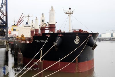
PORT ORIENT
Not available
Current Trip
| Time Travelled | 10 days |
|---|---|
| Remaining Time | --- |
| Distance Travelled | 2796.56 морская миля |
| Remaining Distance | --- |
| AVG Speed | 13.7 Узлы |
| MAX Speed | 16.4 Узлы |
| AVG Wind | 7 knots |
| MAX Wind | 17.9 knots |
| MIN Temp | 24.4°C / 75.92°F |
| MAX Temp | 29.6°C / 85.28°F |
| Осадка | 6.3 м |
| Позиция Получена | 22 h, 53 m тому назад |
Current Position
| Долгота | -44.19091° |
|---|---|
| Широта | -2.23642° |
| Статус | At anchor |
| Скорость | 0.1 Узлы |
| Курс | 39° |
| Район | South Atlantic Ocean |
| Станция | T-AIS |
| Позиция Получена | 22 h, 53 m тому назад |
Info
Information
The current position of PORT ORIENT is in South Atlantic Ocean with coordinates -2.23642° / -44.19091° as reported on 2024-05-01 15:17 by AIS to our vessel tracker app. The vessel's current speed is 0.1 Узлы
The vessel PORT ORIENT (IMO: 9735103, MMSI: 636017519) is a Not available It's sailing under the flag of [LR] Liberia.
In this page you can find informations about the vessels current position, last detected port calls, and current voyage information. If the vessels is not in coverage by AIS you will find the latest position.
The current position of PORT ORIENT is detected by our AIS receivers and we are not responsible for the reliability of the data. The last position was recorded while the vessel was in Coverage by the Ais receivers of our vessel tracking app.
The current draught of PORT ORIENT as reported by AIS is 6.3 meters
Weather
| Temperature | 27.9°C / 82.22°F |
|---|---|
| Wind Speed | 11 knots |
| Direction | 96° E |
| Pressure | 1010.6 hPa |
| Humidity | 79.9 % |
| Cloud Coverage | 100 % |
Featured Company
Most Visited Ports (Last year)
| Port | Arrivals | |
|---|---|---|
| 3 | ||
| 2 | ||
| 1 | ||
| 1 | ||
| 1 | ||
| 1 |
Events
| Время | Событие | Детали | Позиция / Направление | Информация |
|---|---|---|---|---|
| 2024-05-01 15:32 | Статус изменился | Default At anchor |
-2.23610 / -44.19108
BR ALU
|
Скорость: 0.1 kn Курс: 39° |
| 2024-05-01 15:17 | Вне покрытия |
-2.23642 / -44.19091
South Atlantic Ocean
|
Скорость: 0.1 kn Курс: 141° |
|
| 2024-05-01 14:46 | Осадка изменилась | 6.3 11.9 |
-2.23654 / -44.19060
BR ALU
|
Скорость: Курс: 38° |
| 2024-05-01 14:46 | Пункт назначения изменился | BR ALU GH TKD |
-2.23654 / -44.19060
BR ALU
|
Скорость: Курс: 38° |
| 2024-05-01 14:46 | ETA изменился | 2025/04/30 21:00 2024/04/12 20:00 |
-2.23654 / -44.19060
BR ALU
|
Скорость: Курс: 38° |
| 2024-05-01 14:41 | Обнаружено в море | Brazilian part of the South Atlantic Ocean |
-2.23655 / -44.19060
South Atlantic Ocean
|
Скорость: Курс: 141° |
| 2024-05-01 14:41 | Статус изменился | At anchor Default |
-2.23655 / -44.19060
GH TKD
|
Скорость: Курс: 34° |
| 2024-05-01 14:29 | В покрытии |
-2.23655 / -44.19060
South Atlantic Ocean
|
Скорость: Курс: 141° |
|
| 2024-04-30 17:57 | Окончание движения | 18.75 nm, North East of SAO LUIS |
-2.23167 / -44.18833
GH TKD
|
Скорость: Курс: -1° |