
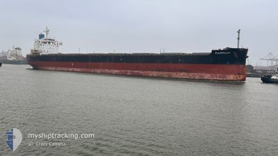
PLAINPALAIS
Cargo
Current Trip
| Time Travelled | 1 day |
|---|---|
| Remaining Time | 1 day |
| Distance Travelled | 240.02 морская миля |
| Remaining Distance | 428.20 морская миля |
| AVG Speed | 11 Узлы |
| MAX Speed | 12.4 Узлы |
| AVG Wind | 9.6 knots |
| MAX Wind | 18 knots |
| MIN Temp | -1.8°C / 28.76°F |
| MAX Temp | 8.8°C / 47.84°F |
| Осадка | 13.5 м |
| Позиция Получена | 4 h, 55 m тому назад |
Current Position
| Долгота | --- |
|---|---|
| Широта | --- |
| Статус | Under way using engine |
| Скорость | 10.2 Узлы |
| Курс | 183.3° |
| Район | North Sea |
| Станция | T-AIS |
| Позиция Получена | 4 h, 55 m тому назад |
Info
Information
The current position of PLAINPALAIS is in North Sea with coordinates 58.84165° / 3.98691° as reported on 2025-12-08 12:37 by AIS to our vessel tracker app. The vessel's current speed is 10.2 Узлы and is heading at the port of ROTTERDAM. The estimated time of arrival as calculated by MyShipTracking vessel tracking app is 2025-12-10 04:26 LT
The vessel PLAINPALAIS (IMO: 9739032, MMSI: 538010759) is a Cargo It's sailing under the flag of [MH] Marshall Is.
In this page you can find informations about the vessels current position, last detected port calls, and current voyage information. If the vessels is not in coverage by AIS you will find the latest position.
The current position of PLAINPALAIS is detected by our AIS receivers and we are not responsible for the reliability of the data. The last position was recorded while the vessel was in Coverage by the Ais receivers of our vessel tracking app.
The current draught of PLAINPALAIS as reported by AIS is 13.5 meters
Weather
| Temperature | 8.9°C / 48.02°F |
|---|---|
| Wind Speed | 13 knots |
| Direction | 237° WSW |
| Pressure | 995.7 hPa |
| Humidity | 84.3 % |
| Cloud Coverage | 100 % |
Featured Company
Last Trips
| Origin | Departure | Destination | Arrival | Distance | |
|---|---|---|---|---|---|
| 2025-12-02 00:31 | 2025-12-05 13:21 | 648.91 морская миля | |||
| 2025-11-21 13:30 | 2025-11-30 00:05 | 1548.93 морская миля | |||
| 2025-11-09 10:11 | 2025-11-20 09:49 | 63.28 морская миля | |||
| 2025-08-31 23:08 | 2025-11-05 08:46 | 8420.55 морская миля |
Events
| Время | Событие | Детали | Позиция / Направление | Информация |
|---|---|---|---|---|
| 2025-12-08 12:51 | Статус изменился | Default Under way using engine |
58.80230 / 3.98242
NL EUR
|
Скорость: 10.2 kn Курс: 183.3° |
| 2025-12-08 12:37 | Вне покрытия |
58.84165 / 3.98691
North Sea
NL EUR
|
Скорость: 10.2 kn Курс: 183.3° |
|
| 2025-12-08 01:25 | Изменение морского района | Norwegian part of the North Sea Norwegian part of the Norwegian Sea |
60.98926 / 4.01527
North Sea
NL EUR
|
Скорость: 11.7 kn Курс: 179.2° |
| 2025-12-07 15:20 | Пункт назначения изменился | NL EUR NL RTM |
62.08566 / 5.46262
NL EUR
|
Скорость: 10.5 kn Курс: 304° |
| 2025-12-07 15:13 | Осадка изменилась | 13.5 6.4 |
62.07163 / 5.48717
NL RTM
|
Скорость: 9.6 kn Курс: 325.9° |
| 2025-12-07 15:13 | Пункт назначения изменился | NL RTM NO AHM |
62.07163 / 5.48717
NL RTM
|
Скорость: 9.6 kn Курс: 325.9° |
| 2025-12-07 15:13 | ETA изменился | 2025/12/10 03:00 2025/12/10 01:00 |
62.07163 / 5.48717
NL RTM
|
Скорость: 9.6 kn Курс: 325.9° |
| 2025-12-07 15:02 | Начало движения | 0.8 nm, North of AAHEIM |
62.05583 / 5.51077
NO AHM
|
Скорость: 3.5 kn Курс: 323° |
| 2025-12-07 14:57 | ПОРТ ОТПРАВЛЕНИЯ |
|
62.05297 / 5.51525
NO AHM
|
Скорость: 1.3 kn Курс: 147° |
| 2025-12-07 14:18 | Статус изменился | Under way using engine Moored |
62.04467 / 5.52134
[NO] AAHEIM
|
Скорость: Курс: 234° |