
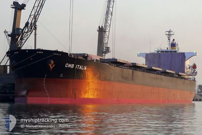
PANAMAX NOSTOS
Bulk Carrier
Current Trip
| Trip Time | 28 days |
|---|---|
| Trip Distance | 6483.45 морская миля |
| AVG Speed | 11.8 Узлы |
| MAX Speed | 17.5 Узлы |
| Осадка | 13.9 м |
| AVG Wind | 9.8 knots |
| MAX Wind | 25.2 knots |
| MIN Temp | 22.3°C / 72.14°F |
| MAX Temp | 31.4°C / 88.52°F |
| Позиция Получена | 8 d тому назад |
Current Position
| Долгота | 39.52567° |
|---|---|
| Широта | 18.78245° |
| Статус | Under way using engine |
| Скорость | 10.9 Узлы |
| Курс | 156° |
| Район | Red Sea |
| Станция | T-AIS |
| Позиция Получена | 8 d тому назад |
Info
Information
The current position of PANAMAX NOSTOS is in Red Sea with coordinates 18.78245° / 39.52567° as reported on 2024-04-30 04:39 by AIS to our vessel tracker app. The vessel's current speed is 10.9 Узлы and is currently inside the port of DAHEJ.
The vessel PANAMAX NOSTOS (IMO: 9325051, MMSI: 212619000) is a Bulk Carrier that was built in 2005 ( 19 лет ). It's sailing under the flag of [CY] Cyprus.
In this page you can find informations about the vessels current position, last detected port calls, and current voyage information. If the vessels is not in coverage by AIS you will find the latest position.
The current position of PANAMAX NOSTOS is detected by our AIS receivers and we are not responsible for the reliability of the data. The last position was recorded while the vessel was in Coverage by the Ais receivers of our vessel tracking app.
The current draught of PANAMAX NOSTOS as reported by AIS is 13.9 meters
Weather
| Temperature | 29.4°C / 84.92°F |
|---|---|
| Wind Speed | 6 knots |
| Direction | 200° SSW |
| Pressure | 1004.6 hPa |
| Humidity | 70.7 % |
| Cloud Coverage | --- |
Featured Company
Most Visited Ports (Last year)
| Port | Arrivals | |
|---|---|---|
| 3 | ||
| 3 | ||
| 2 | ||
| 1 | ||
| 1 | ||
| 1 |
Last Trips
| Origin | Departure | Destination | Arrival | Distance | |
|---|---|---|---|---|---|
| 2024-04-10 08:39 | 2024-05-09 03:38 | 6483.45 морская миля | |||
| 2024-04-02 00:31 | 2024-04-07 08:35 | 1276.84 морская миля | |||
| 2024-03-28 00:25 | 2024-04-01 10:41 | 23.71 морская миля | |||
| 2024-03-22 16:01 | 2024-03-26 13:58 | 1030.17 морская миля |
Events
| Время | Событие | Детали | Позиция / Направление | Информация |
|---|---|---|---|---|
| 2024-05-08 22:08 | Порт |
|
21.68202 / 72.50803
[IN] DAHEJ
|
Скорость: 0.6 kn Курс: 163° |
| 2024-04-30 04:49 | Статус изменился | Default Under way using engine |
18.75508 / 39.53833
AQABA-HAZIRA
|
Скорость: 10.9 kn Курс: 156° |
| 2024-04-30 04:39 | Вне покрытия |
18.78245 / 39.52567
Red Sea
AQABA-HAZIRA
|
Скорость: 10.9 kn Курс: 156° |
|
| 2024-04-30 03:28 | Обнаружено в море | Sudanese part of the Red Sea |
18.98600 / 39.43667
Red Sea
AQABA-HAZIRA
|
Скорость: 11.4 kn Курс: 158° |
| 2024-04-30 03:28 | Статус изменился | Under way using engine Default |
18.98600 / 39.43667
AQABA-HAZIRA
|
Скорость: 11.2 kn Курс: 158° |
| 2024-04-30 03:28 | В покрытии |
18.98600 / 39.43667
Red Sea
AQABA-HAZIRA
|
Скорость: 11.4 kn Курс: 158° |
|
| 2024-04-30 00:18 | Статус изменился | Default Under way using engine |
19.53672 / 39.20683
AQABA-HAZIRA
|
Скорость: 11.3 kn Курс: 158° |
| 2024-04-30 00:13 | Вне покрытия |
19.55233 / 39.20033
Red Sea
AQABA-HAZIRA
|
Скорость: 11.3 kn Курс: 158° |
|
| 2024-04-29 23:15 | Статус изменился | Under way using engine Default |
19.72800 / 39.12570
AQABA-HAZIRA
|
Скорость: 12.1 kn Курс: 159° |
| 2024-04-29 22:59 | В покрытии |
19.72650 / 39.12635
Red Sea
AQABA-HAZIRA
|
Скорость: 12.1 kn Курс: 158° |