

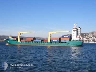
OYSTER
Container Ship

Current Trip
| Time Travelled | 3 days |
|---|---|
| Remaining Time | 1 day |
| Distance Travelled | 243.12 морская миля |
| Remaining Distance | 338.88 морская миля |
| AVG Speed | 9.8 Узлы |
| MAX Speed | 14.5 Узлы |
| AVG Wind | 7.6 knots |
| MAX Wind | 15 knots |
| MIN Temp | 4.2°C / 39.56°F |
| MAX Temp | 9.9°C / 49.82°F |
| Осадка | 7.2 м |
| Позиция Получена | 6 h, 55 m тому назад |
Current Position
| Долгота | --- |
|---|---|
| Широта | --- |
| Статус | Under way using engine |
| Скорость | 12.1 Узлы |
| Курс | 87.1° |
| Район | Black Sea |
| Станция | T-AIS |
| Позиция Получена | 6 h, 55 m тому назад |
Information
The current position of OYSTER is in Black Sea with coordinates 41.26354° / 29.82636° as reported on 2025-03-23 01:58 by AIS to our vessel tracker app. The vessel's current speed is 12.1 Узлы and is heading at the port of NOVOROSSIYSK. The estimated time of arrival as calculated by MyShipTracking vessel tracking app is 2025-03-24 15:13 LT
The vessel OYSTER (IMO: 9418884, MMSI: 372797000) is a Container Ship that was built in 2008 ( 17 лет ). It's sailing under the flag of [PA] Panama.
In this page you can find informations about the vessels current position, last detected port calls, and current voyage information. If the vessels is not in coverage by AIS you will find the latest position.
The current position of OYSTER is detected by our AIS receivers and we are not responsible for the reliability of the data. The last position was recorded while the vessel was in Coverage by the Ais receivers of our vessel tracking app.
The current draught of OYSTER as reported by AIS is 7.2 meters
Weather
| Temperature | 9.3°C / 48.74°F |
|---|---|
| Wind Speed | 4 knots |
| Direction | 41° NE |
| Pressure | 1024.8 hPa |
| Humidity | 63.8 % |
| Cloud Coverage | 97 % |


Featured Company
Most Visited Ports (Last year)
| Port | Arrivals | |
|---|---|---|
| 5 | ||
| 2 | ||
| 1 | ||
| 1 | ||
| 1 |
Last Trips
| Origin | Departure | Destination | Arrival | Distance | |
|---|---|---|---|---|---|
| 2025-03-13 02:11 | 2025-03-19 11:01 | 919.98 морская миля | |||
| 2025-02-25 23:38 | 2025-02-27 04:18 | 64.28 морская миля | |||
| 2025-02-25 06:08 | 2025-02-25 11:51 | 44.93 морская миля | |||
| 2025-02-22 18:48 | 2025-02-24 12:58 | 38.92 морская миля |
Events
| Время | Событие | Детали | Позиция / Направление | Информация |
|---|---|---|---|---|
| 2025-03-23 02:08 | Статус изменился | Default Under way using engine |
41.26516 / 29.87585
RUNVS
|
Скорость: 12.1 kn Курс: 87.1° |
| 2025-03-23 01:58 | Вне покрытия |
41.26354 / 29.82636
Black Sea
RUNVS
|
Скорость: 12.1 kn Курс: 87.1° |
|
| 2025-03-23 01:43 | Статус изменился | Under way using engine Default |
41.26174 / 29.76242
RUNVS
|
Скорость: 12.2 kn Курс: 87° |
| 2025-03-23 01:34 | Статус изменился | Default Under way using engine |
41.26095 / 29.72197
RUNVS
|
Скорость: 12.2 kn Курс: 88° |
| 2025-03-22 23:59 | ETA изменился | 2025/03/24 15:00 2025/03/23 11:00 |
41.25640 / 29.28296
RUNVS
|
Скорость: 12.6 kn Курс: 89.8° |
| 2025-03-22 23:31 | Изменение морского района | Turkish part of the Black Sea Turkish part of the Sea of Marmara |
41.23435 / 29.15802
Black Sea
RUNVS
|
Скорость: 12.8 kn Курс: 58.5° |
| 2025-03-22 20:09 | Начало движения | 11.17 nm, South of MALTEPE |
40.74278 / 29.03706
RUNVS
|
Скорость: 3.2 kn Курс: 348° |
| 2025-03-22 20:03 | Статус изменился | Under way using engine Not under command |
40.74142 / 29.03919
RUNVS
|
Скорость: 0.5 kn Курс: 339° |
| 2025-03-22 14:37 | Окончание движения | 11.09 nm, South West of KARTAL |
40.74081 / 29.04624
RUNVS
|
Скорость: 0.3 kn Курс: 280° |
| 2025-03-22 13:31 | Начало движения | 6 nm, North West of YALOVA |
40.72863 / 29.17685
RUNVS
|
Скорость: 3.2 kn Курс: 359° |