
OSIRIS
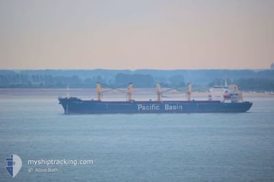
Bulk Carrier
Current Trip
| Time Travelled | 7 days |
|---|---|
| Remaining Time | --- |
| Distance Travelled | 1604.33 морская миля |
| Remaining Distance | --- |
| AVG Speed | 9 Узлы |
| MAX Speed | 12.3 Узлы |
| AVG Wind | 7.2 knots |
| MAX Wind | 18.6 knots |
| MIN Temp | 27.2°C / 80.96°F |
| MAX Temp | 30.7°C / 87.26°F |
| Осадка | 12.8 м |
| Позиция Получена | 2 h, 12 m тому назад |
Current Position
| Долгота | 104.14707° |
|---|---|
| Широта | 1.25514° |
| Статус | Under way using engine |
| Скорость | 6.6 Узлы |
| Курс | 94.3° |
| Район | Singapore Strait |
| Станция | T-AIS |
| Позиция Получена | 2 h, 12 m тому назад |
Info
Information
The current position of OSIRIS is in Singapore Strait with coordinates 1.25514° / 104.14707° as reported on 2024-04-27 21:00 by AIS to our vessel tracker app. The vessel's current speed is 6.6 Узлы and is heading at the port of BAYUQUAN. The estimated time of arrival as calculated by MyShipTracking vessel tracking app is 2024-05-07 03:00 LT
The vessel OSIRIS (IMO: 9293674, MMSI: 248048000) is a Bulk Carrier that was built in 2004 ( 20 лет ). It's sailing under the flag of [MT] Malta.
In this page you can find informations about the vessels current position, last detected port calls, and current voyage information. If the vessels is not in coverage by AIS you will find the latest position.
The current position of OSIRIS is detected by our AIS receivers and we are not responsible for the reliability of the data. The last position was recorded while the vessel was in Coverage by the Ais receivers of our vessel tracking app.
The current draught of OSIRIS as reported by AIS is 12.8 meters
Weather
| Temperature | 29.1°C / 84.38°F |
|---|---|
| Wind Speed | 3 knots |
| Direction | 159° SSE |
| Pressure | 1008.1 hPa |
| Humidity | 74.8 % |
| Cloud Coverage | 92 % |
Featured Company
Last Port Calls
| Port | Arrival | Departure | Time In Port |
|---|---|---|---|
| 2024-04-18 06:48 | 2024-04-20 21:50 | 2 d | |
| 2024-04-11 17:36 | 2024-04-15 02:12 | 3 d |
Most Visited Ports (Last year)
| Port | Arrivals | |
|---|---|---|
| 2 | ||
| 2 | ||
| 1 | ||
| 1 | ||
| 1 | ||
| 1 |
Last Trips
| Origin | Departure | Destination | Arrival | Distance | |
|---|---|---|---|---|---|
| 2024-04-15 07:42 | 2024-04-18 12:18 | 353.40 морская миля |
Events
| Время | Событие | Детали | Позиция / Направление | Информация |
|---|---|---|---|---|
| 2024-04-27 22:23 | Окончание движения | 6.63 nm, South of TELOK RAMUNIA |
1.25123 / 104.26509
BAYUQUAN
|
Скорость: Курс: 270° |
| 2024-04-27 21:02 | Статус изменился | Default Under way using engine |
1.25482 / 104.15076
BAYUQUAN
|
Скорость: 6.6 kn Курс: 94.3° |
| 2024-04-27 21:00 | Вне покрытия |
1.25514 / 104.14707
Singapore Strait
BAYUQUAN
|
Скорость: 6.6 kn Курс: 94.3° |
|
| 2024-04-27 20:05 | Изменение морского района | Indonesian part of the Singapore Strait Singaporean part of the Singapore Strait |
1.25369 / 104.01149
Singapore Strait
BAYUQUAN
|
Скорость: 9.7 kn Курс: 113.9° |
| 2024-04-27 19:41 | Пункт назначения изменился | BAYUQUAN SINGAPORE PEBGB |
1.29330 / 104.00003
BAYUQUAN
|
Скорость: 4.1 kn Курс: 228° |
| 2024-04-27 19:41 | ETA изменился | 2024/05/07 03:00 2024/04/27 02:00 |
1.29330 / 104.00003
BAYUQUAN
|
Скорость: 4.1 kn Курс: 228° |
| 2024-04-27 19:40 | Начало движения | 1.48 nm, South West of TANAH MERAH |
1.29395 / 104.00121
SINGAPORE PEBGB
|
Скорость: 3.7 kn Курс: 245° |
| 2024-04-27 19:29 | Статус изменился | Under way using engine Default |
1.29554 / 104.00515
SINGAPORE PEBGB
|
Скорость: 0.3 kn Курс: 256° |
| 2024-04-27 19:22 | Статус изменился | Default At anchor |
1.29553 / 104.00527
SINGAPORE PEBGB
|
Скорость: 0.2 kn Курс: 255° |
| 2024-04-27 19:19 | Статус изменился | At anchor Default |
1.29573 / 104.00516
SINGAPORE PEBGB
|
Скорость: Курс: 267° |