
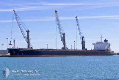
OCEAN PEACE
Bulk Carrier
Current Trip
| Time Travelled | 39 days |
|---|---|
| Remaining Time | 4 days |
| Distance Travelled | 6126.71 морская миля |
| Remaining Distance | 1540.25 морская миля |
| AVG Speed | 10.4 Узлы |
| MAX Speed | 15.6 Узлы |
| AVG Wind | 11.6 knots |
| MAX Wind | 33.9 knots |
| MIN Temp | 12.9°C / 55.22°F |
| MAX Temp | 30.8°C / 87.44°F |
| Осадка | 7 м |
| Позиция Получена | 13 h, 56 m тому назад |
Current Position
| Долгота | 76.75790° |
|---|---|
| Широта | 7.92052° |
| Статус | Under way using engine |
| Скорость | 12.2 Узлы |
| Курс | 314.8° |
| Район | Laccadive Sea |
| Станция | T-AIS |
| Позиция Получена | 13 h, 56 m тому назад |
Info
Information
The current position of OCEAN PEACE is in Laccadive Sea with coordinates 7.92052° / 76.75790° as reported on 2024-06-16 21:02 by AIS to our vessel tracker app. The vessel's current speed is 12.2 Узлы and is heading at the port of SOHAR. The estimated time of arrival as calculated by MyShipTracking vessel tracking app is 2024-06-22 02:45 LT
The vessel OCEAN PEACE (IMO: 9050395, MMSI: 371155000) is a Bulk Carrier that was built in 1994 ( 30 лет ). It's sailing under the flag of [PA] Panama.
In this page you can find informations about the vessels current position, last detected port calls, and current voyage information. If the vessels is not in coverage by AIS you will find the latest position.
The current position of OCEAN PEACE is detected by our AIS receivers and we are not responsible for the reliability of the data. The last position was recorded while the vessel was in Coverage by the Ais receivers of our vessel tracking app.
The current draught of OCEAN PEACE as reported by AIS is 7 meters
Weather
| Temperature | 29.1°C / 84.38°F |
|---|---|
| Wind Speed | 9 knots |
| Direction | 254° WSW |
| Pressure | 1007.1 hPa |
| Humidity | 73.7 % |
| Cloud Coverage | 81 % |
Featured Company
Last Trips
| Origin | Departure | Destination | Arrival | Distance | |
|---|---|---|---|---|---|
| 2024-05-04 12:32 | 2024-05-06 19:36 | 503.48 морская миля | |||
| 2024-02-23 08:03 | 2024-05-03 11:44 | 5806.22 морская миля |
Events
| Время | Событие | Детали | Позиция / Направление | Информация |
|---|---|---|---|---|
| 2024-06-16 21:06 | Статус изменился | Default Under way using engine |
7.92910 / 76.74939
SOHAR OMAN
|
Скорость: 12.2 kn Курс: 314.8° |
| 2024-06-16 21:02 | Вне покрытия |
7.92052 / 76.75790
Laccadive Sea
SOHAR OMAN
|
Скорость: 12.2 kn Курс: 314.8° |
|
| 2024-06-16 19:25 | Осадка изменилась | 7 11.5 |
7.67205 / 76.99242
SOHAR OMAN
|
Скорость: 12.8 kn Курс: 314.6° |
| 2024-06-16 19:25 | Пункт назначения изменился | SOHAR OMAN CHITTAGONG |
7.67205 / 76.99242
SOHAR OMAN
|
Скорость: 12.8 kn Курс: 314.6° |
| 2024-06-16 19:25 | ETA изменился | 2024/06/22 22:00 2025/05/27 23:00 |
7.67205 / 76.99242
SOHAR OMAN
|
Скорость: 12.8 kn Курс: 314.6° |
| 2024-06-16 18:10 | Обнаружено в море | Indian part of the Laccadive Sea |
7.52252 / 77.21164
Laccadive Sea
|
Скорость: 12.6 kn Курс: 301.4° |
| 2024-06-16 18:10 | В покрытии |
7.52252 / 77.21164
Laccadive Sea
|
Скорость: 12.6 kn Курс: 301.4° |
|
| 2024-06-16 18:08 | Статус изменился | Under way using engine Default |
7.51892 / 77.21746
CHITTAGONG
|
Скорость: 12.6 kn Курс: 302° |
| 2024-06-11 09:45 | Статус изменился | Default Under way using engine |
22.19868 / 91.70475
CHITTAGONG
|
Скорость: 11.1 kn Курс: 178.2° |
| 2024-06-11 09:41 | Вне покрытия |
22.21368 / 91.70417
Bay of Bengal
|
Скорость: 11.1 kn Курс: 178.2° |