
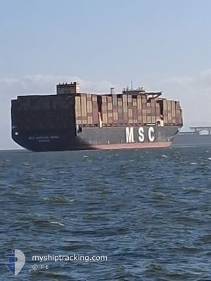
MSC MARTINA MARIA
Cargo D
Current Trip
| Time Travelled | 1 day |
|---|---|
| Remaining Time | --- |
| Distance Travelled | 265.56 морская миля |
| Remaining Distance | --- |
| AVG Speed | 17.8 Узлы |
| MAX Speed | 20 Узлы |
| AVG Wind | 14.5 knots |
| MAX Wind | 21 knots |
| MIN Temp | 14.5°C / 58.1°F |
| MAX Temp | 20.3°C / 68.54°F |
| Осадка | 13 м |
| Позиция Получена | 29 d тому назад |
Current Position
| Долгота | --- |
|---|---|
| Широта | --- |
| Статус | Under way using engine |
| Скорость | 18.3 Узлы |
| Курс | 230.8° |
| Район | North Pacific Ocean |
| Станция | T-AIS |
| Позиция Получена | 29 d тому назад |
Info
Information
The current position of MSC MARTINA MARIA is in North Pacific Ocean with coordinates 33.02943° / -129.95158° as reported on 2025-02-16 11:10 by AIS to our vessel tracker app. The vessel's current speed is 18.3 Узлы and is heading at the port of BUSAN.
The vessel MSC MARTINA MARIA (IMO: 9540077, MMSI: 636022451) is a Cargo D It's sailing under the flag of [LR] Liberia.
In this page you can find informations about the vessels current position, last detected port calls, and current voyage information. If the vessels is not in coverage by AIS you will find the latest position.
The current position of MSC MARTINA MARIA is detected by our AIS receivers and we are not responsible for the reliability of the data. The last position was recorded while the vessel was in Coverage by the Ais receivers of our vessel tracking app.
The current draught of MSC MARTINA MARIA as reported by AIS is 13 meters
Weather
| Temperature | 24.8°C / 76.64°F |
|---|---|
| Wind Speed | 19 knots |
| Direction | 40° NE |
| Pressure | 1018.5 hPa |
| Humidity | 78.1 % |
| Cloud Coverage | 98 % |
Featured Company
Last Port Calls
| Port | Arrival | Departure | Time In Port |
|---|---|---|---|
| 2025-03-16 06:06 | 2025-03-17 09:06 | 1 d | |
| 2025-03-10 10:53 | 2025-03-11 13:23 | 1 d | |
| 2025-02-12 06:49 | 2025-02-14 06:51 | 2 d | |
| 2025-01-30 05:40 | 2025-02-06 07:23 | 7 d | |
| 2025-01-14 14:04 | 2025-01-15 20:08 | 1 d | |
| 2025-01-02 13:16 | 2025-01-04 07:57 | 1 d |
Most Visited Ports (Last year)
| Port | Arrivals | |
|---|---|---|
| 4 | ||
| 3 | ||
| 3 | ||
| 3 | ||
| 2 | ||
| 2 |
Last Trips
| Origin | Departure | Destination | Arrival | Distance | |
|---|---|---|---|---|---|
| 2025-03-11 13:23 | 2025-03-16 06:06 | 977.95 морская миля | |||
| 2025-02-14 06:51 | 2025-03-10 10:53 | 8109.33 морская миля | |||
| 2025-02-06 07:23 | 2025-02-12 06:49 | 781.29 морская миля | |||
| 2025-01-15 20:08 | 2025-01-30 05:40 | 6281.72 морская миля | |||
| 2025-01-04 07:57 | 2025-01-14 14:04 | 2781.91 морская миля | |||
| 2024-12-31 04:50 | 2025-01-02 13:16 | 862.62 морская миля |
Events
| Время | Событие | Детали | Позиция / Направление | Информация |
|---|---|---|---|---|
| 2025-03-17 01:06 | Начало движения | 1.6 nm, East of YANTIAN |
22.56491 / 114.29426
KRPUS
|
Скорость: 5.8 kn Курс: 95° |
| 2025-03-17 01:06 | ПОРТ ОТПРАВЛЕНИЯ |
|
22.56491 / 114.29426
KRPUS
|
Скорость: 2.6 kn Курс: 91° |
| 2025-03-15 22:06 | Окончание движения |
22.56637 / 114.28556
[CN] YANTIAN
|
Скорость: Курс: 89° |
|
| 2025-03-15 22:06 | Порт |
|
22.56637 / 114.28556
[CN] YANTIAN
|
Скорость: 0.9 kn Курс: 38° |
| 2025-03-15 13:50 | Начало движения |
22.10634 / 114.91236
KRPUS
|
Скорость: 3.2 kn Курс: 230° |
|
| 2025-03-15 05:09 | Окончание движения |
22.15392 / 114.93430
KRPUS
|
Скорость: 0.3 kn Курс: 24° |
|
| 2025-03-15 03:46 | Начало движения |
22.12185 / 114.91911
KRPUS
|
Скорость: 3.1 kn Курс: 72° |
|
| 2025-03-15 00:18 | Окончание движения |
22.11793 / 114.94210
KRPUS
|
Скорость: 0.3 kn Курс: 36° |
|
| 2025-03-14 22:34 | Начало движения |
22.10835 / 114.86221
KRPUS
|
Скорость: 4.5 kn Курс: 80° |
|
| 2025-03-14 19:14 | Окончание движения |
22.10531 / 114.90018
KRPUS
|
Скорость: 0.3 kn Курс: 156° |