
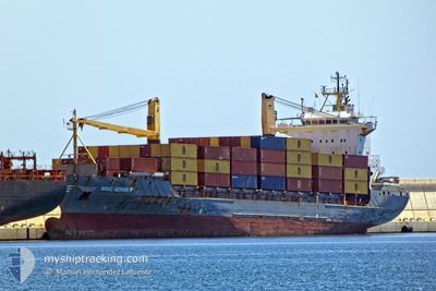
MSC IZMIR F
Container Ship
Current Trip
| Time Travelled | 11 h, 3 mins |
|---|---|
| Remaining Time | 1 h, 28 mins |
| Distance Travelled | 147.85 морская миля |
| Remaining Distance | 46.69 морская миля |
| AVG Speed | 12 Узлы |
| MAX Speed | 15.5 Узлы |
| AVG Wind | 15.9 knots |
| MAX Wind | 17 knots |
| MIN Temp | 25.4°C / 77.72°F |
| MAX Temp | 27.2°C / 80.96°F |
| Осадка | 6.4 м |
| Позиция Получена | 8 h, 37 m тому назад |
Current Position
| Долгота | -79.52957° |
|---|---|
| Широта | 26.14253° |
| Статус | Under way using engine |
| Скорость | 14.2 Узлы |
| Курс | 90.5° |
| Район | North Atlantic Ocean |
| Станция | T-AIS |
| Позиция Получена | 8 h, 37 m тому назад |
Info
Information
The current position of MSC IZMIR F is in North Atlantic Ocean with coordinates 26.14253° / -79.52957° as reported on 2024-05-11 01:44 by AIS to our vessel tracker app. The vessel's current speed is 14.2 Узлы and is heading at the port of NASSAU. The estimated time of arrival as calculated by MyShipTracking vessel tracking app is 2024-05-11 11:50 LT
The vessel MSC IZMIR F (IMO: 9127021, MMSI: 636017878) is a Container Ship that was built in 1996 ( 28 лет ). It's sailing under the flag of [LR] Liberia.
In this page you can find informations about the vessels current position, last detected port calls, and current voyage information. If the vessels is not in coverage by AIS you will find the latest position.
The current position of MSC IZMIR F is detected by our AIS receivers and we are not responsible for the reliability of the data. The last position was recorded while the vessel was in Coverage by the Ais receivers of our vessel tracking app.
The current draught of MSC IZMIR F as reported by AIS is 6.4 meters
Weather
| Temperature | 25.4°C / 77.72°F |
|---|---|
| Wind Speed | 12 knots |
| Direction | 213° SSW |
| Pressure | 1011.5 hPa |
| Humidity | 82.9 % |
| Cloud Coverage | --- |
Featured Company
Last Port Calls
| Port | Arrival | Departure | Time In Port |
|---|---|---|---|
| 2024-05-10 14:33 | 2024-05-10 23:19 | 8 h | |
| 2024-05-10 14:22 | 2024-05-10 14:29 | 7 m | |
| 2024-05-09 13:05 | 2024-05-09 18:22 | 5 h | |
| 2024-05-08 14:39 | 2024-05-08 23:23 | 8 h | |
| 2024-05-08 14:18 | 2024-05-08 14:26 | 8 m | |
| 2024-05-07 13:46 | 2024-05-07 18:08 | 4 h | |
| 2024-05-06 14:55 | 2024-05-07 01:09 | 10 h | |
| 2024-05-06 14:34 | 2024-05-06 14:44 | 9 m | |
| 2024-05-04 13:42 | 2024-05-04 19:36 | 5 h | |
| 2024-05-03 14:35 | 2024-05-03 22:49 | 8 h |
Most Visited Ports (Last year)
| Port | Arrivals | |
|---|---|---|
| 90 | ||
| 88 | ||
| 85 | ||
| 5 | ||
| 4 | ||
| 4 |
Last Trips
| Origin | Departure | Destination | Arrival | Distance | |
|---|---|---|---|---|---|
| 2024-05-10 10:29 | 2024-05-10 10:33 | 0.47 морская миля | |||
| 2024-05-09 14:22 | 2024-05-10 10:22 | 205.82 морская миля | |||
| 2024-05-08 19:23 | 2024-05-09 09:05 | 183.90 морская миля | |||
| 2024-05-08 10:26 | 2024-05-08 10:39 | 0.73 морская миля | |||
| 2024-05-07 14:08 | 2024-05-08 10:18 | 200.32 морская миля | |||
| 2024-05-06 21:09 | 2024-05-07 09:46 | 183.81 морская миля | |||
| 2024-05-06 10:44 | 2024-05-06 10:55 | 0.11 морская миля | |||
| 2024-05-04 15:36 | 2024-05-06 10:34 | 222.32 морская миля | |||
| 2024-05-03 18:49 | 2024-05-04 09:42 | 183.37 морская миля | |||
| 2024-05-03 10:33 | 2024-05-03 10:35 | 0.43 морская миля |
Events
| Время | Событие | Детали | Позиция / Направление | Информация |
|---|---|---|---|---|
| 2024-05-11 01:47 | Статус изменился | Default Under way using engine |
26.14243 / -79.51724
BSNAS
|
Скорость: 14.2 kn Курс: 90.5° |
| 2024-05-11 01:44 | Вне покрытия |
26.14253 / -79.52957
North Atlantic Ocean
BSNAS
|
Скорость: 14.2 kn Курс: 90.5° |
|
| 2024-05-11 01:32 | Изменение морского района | Bahamas part of the North Atlantic Ocean United States part of the North Atlantic Ocean |
26.14275 / -79.58456
North Atlantic Ocean
BSNAS
|
Скорость: 14.3 kn Курс: 89.6° |
| 2024-05-10 23:19 | ПОРТ ОТПРАВЛЕНИЯ |
|
26.08713 / -80.11374
BSNAS
|
Скорость: 5.8 kn Курс: 345° |
| 2024-05-10 23:12 | Начало движения |
26.07437 / -80.11458
[US] FORT LAUDERDALE
|
Скорость: 3.2 kn Курс: 3° |
|
| 2024-05-10 22:59 | Статус изменился | Under way using engine Moored |
26.07139 / -80.11535
[US] FORT LAUDERDALE
|
Скорость: Курс: 181° |
| 2024-05-10 21:11 | Осадка изменилась | 6.4 6.2 |
26.07131 / -80.11536
[US] FORT LAUDERDALE
|
Скорость: Курс: 182° |
| 2024-05-10 15:43 | Статус изменился | Moored Default |
26.07125 / -80.11537
[US] FORT LAUDERDALE
|
Скорость: Курс: 182° |
| 2024-05-10 15:40 | Статус изменился | Default Moored |
26.07120 / -80.11531
[US] FORT LAUDERDALE
|
Скорость: Курс: 182° |
| 2024-05-10 15:18 | Пункт назначения изменился | BSNAS USPEF |
26.07117 / -80.11531
[US] FORT LAUDERDALE
|
Скорость: Курс: 182° |