

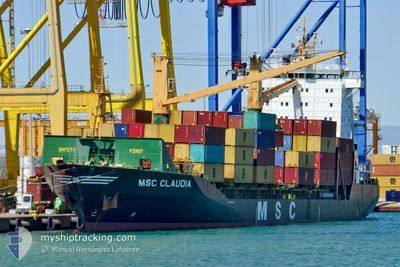
MSC CLAUDIA
Container Ship

Current Trip
| Time Travelled | 1 day |
|---|---|
| Remaining Time | 16 h, 7 mins |
| Distance Travelled | 191.76 морская миля |
| Remaining Distance | 332.14 морская миля |
| AVG Speed | 11.2 Узлы |
| MAX Speed | 12.1 Узлы |
| AVG Wind | 13.5 knots |
| MAX Wind | 22 knots |
| MIN Temp | 12°C / 53.6°F |
| MAX Temp | 15.2°C / 59.36°F |
| Осадка | 8.1 м |
| Позиция Получена | 18 h, 52 m тому назад |
Current Position
| Долгота | --- |
|---|---|
| Широта | --- |
| Статус | Under way using engine |
| Скорость | 11 Узлы |
| Курс | 248.5° |
| Район | Mediterranean Sea - Eastern Basin |
| Станция | T-AIS |
| Позиция Получена | 18 h, 52 m тому назад |
Information
The current position of MSC CLAUDIA is in Mediterranean Sea - Eastern Basin with coordinates 36.38539° / 22.61303° as reported on 2025-02-16 10:58 by AIS to our vessel tracker app. The vessel's current speed is 11 Узлы and is heading at the port of GIOIA TAURO. The estimated time of arrival as calculated by MyShipTracking vessel tracking app is 2025-02-17 21:58 LT
The vessel MSC CLAUDIA (IMO: 9113446, MMSI: 636018573) is a Container Ship that was built in 1996 ( 29 лет ). It's sailing under the flag of [LR] Liberia.
In this page you can find informations about the vessels current position, last detected port calls, and current voyage information. If the vessels is not in coverage by AIS you will find the latest position.
The current position of MSC CLAUDIA is detected by our AIS receivers and we are not responsible for the reliability of the data. The last position was recorded while the vessel was in Coverage by the Ais receivers of our vessel tracking app.
The current draught of MSC CLAUDIA as reported by AIS is 8.1 meters
Weather
| Temperature | 14.7°C / 58.46°F |
|---|---|
| Wind Speed | 11 knots |
| Direction | 56° NE |
| Pressure | 1011.7 hPa |
| Humidity | 70.4 % |
| Cloud Coverage | 8 % |


Featured Company
Last Port Calls
| Port | Arrival | Departure | Time In Port |
|---|---|---|---|
| 2025-02-15 10:18 | 2025-02-15 23:20 | 13 h | |
| 2025-02-12 11:49 | 2025-02-12 22:00 | 10 h | |
| 2025-02-10 12:43 | 2025-02-11 08:55 | 20 h | |
| 2025-02-07 11:38 | 2025-02-07 19:29 | 7 h | |
| 2025-02-04 08:09 | 2025-02-05 03:48 | 19 h | |
| 2025-02-02 17:49 | 2025-02-03 08:09 | 14 h | |
| 2025-01-31 05:21 | 2025-01-31 14:29 | 9 h | |
| 2025-01-28 10:05 | 2025-01-28 18:24 | 8 h | |
| 2025-01-27 02:56 | 2025-01-27 06:56 | 3 h | |
| 2025-01-26 15:56 | 2025-01-26 19:35 | 3 h |
Last Trips
| Origin | Departure | Destination | Arrival | Distance | |
|---|---|---|---|---|---|
| 2025-02-13 00:00 | 2025-02-15 12:18 | 572.10 морская миля | |||
| 2025-02-11 10:55 | 2025-02-12 13:49 | 261.03 морская миля | |||
| 2025-02-07 21:29 | 2025-02-10 14:43 | 377.09 морская миля | |||
| 2025-02-05 05:48 | 2025-02-07 13:38 | 380.52 морская миля | |||
| 2025-02-03 10:09 | 2025-02-04 10:09 | 275.46 морская миля | |||
| 2025-01-31 17:29 | 2025-02-02 19:49 | 487.24 морская миля | |||
| 2025-01-28 21:24 | 2025-01-31 08:21 | 700.11 морская миля | |||
| 2025-01-27 09:56 | 2025-01-28 13:05 | 300.94 морская миля | |||
| 2025-01-26 22:35 | 2025-01-27 05:56 | 67.11 морская миля | |||
| 2025-01-26 09:35 | 2025-01-26 18:56 | 98.61 морская миля |
Events
| Время | Событие | Детали | Позиция / Направление | Информация |
|---|---|---|---|---|
| 2025-02-16 11:07 | Статус изменился | Default Under way using engine |
36.37633 / 22.58367
ITGIT
|
Скорость: 11 kn Курс: 248.5° |
| 2025-02-16 10:58 | Обнаружено в море | Greek part of the Mediterranean Sea - Eastern Basin |
36.38539 / 22.61303
Mediterranean Sea - Eastern Basin
ITGIT
|
Скорость: 11 kn Курс: 248.5° |
| 2025-02-16 10:58 | Вне покрытия |
36.38539 / 22.61303
Mediterranean Sea - Eastern Basin
ITGIT
|
Скорость: 11 kn Курс: 248.5° |
|
| 2025-02-16 10:58 | Статус изменился | Under way using engine Default |
36.38609 / 22.61539
ITGIT
|
Скорость: 11.2 kn Курс: 249° |
| 2025-02-16 10:51 | В покрытии |
36.38539 / 22.61303
Mediterranean Sea - Eastern Basin
ITGIT
|
Скорость: 11 kn Курс: 248.5° |
|
| 2025-02-16 07:07 | Статус изменился | Default Under way using engine |
36.57075 / 23.35653
ITGIT
|
Скорость: 11.1 kn Курс: 213.5° |
| 2025-02-16 06:59 | Вне покрытия |
36.59082 / 23.37279
Aegean Sea
ITGIT
|
Скорость: 11.1 kn Курс: 213.5° |
|
| 2025-02-16 06:39 | Статус изменился | Under way using engine Default |
36.64587 / 23.41155
ITGIT
|
Скорость: 11.5 kn Курс: 212° |
| 2025-02-16 06:31 | В покрытии |
36.64587 / 23.41155
Aegean Sea
ITGIT
|
Скорость: 11.4 kn Курс: 210.7° |
|
| 2025-02-16 05:38 | Вне покрытия |
36.81593 / 23.53882
Aegean Sea
ITGIT
|
Скорость: 12.1 kn Курс: 211.1° |